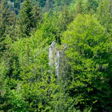
Sommet du Pinet, Mountain summit in Savoie, France
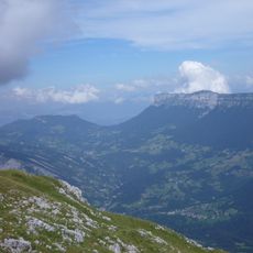
Sommet du Pinet is a mountain peak in the Chartreuse range that rises to approximately 1,870 meters and marks the border between the Isère and Savoie departments. It sits within a larger massif with several hiking routes accessible from nearby villages.
The peak served as a natural boundary marker that later became formalized in the region's administrative divisions. Its role as a dividing line remains visible in how the landscape and local geography are still understood today.
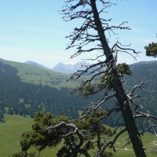
The peak draws hikers from nearby villages who return regularly, making it a familiar landmark in local walking culture. The trails are maintained and shared by residents, showing how central this mountain is to the region's outdoor traditions.
Several hiking trails lead from Saint-Pierre-d'Entremont to the summit, with the main route classified as T2 difficulty for moderate hikers. The best season for walking is May through October, when the mountain is typically free of snow.
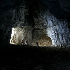
Beneath the summit lies the Pinet-Brouillard cave system, an underground network that has fascinated speleologists for decades. This hidden subterranean world extends far below the surface, making the mountain more than just a surface hiking destination.
The community of curious travelers
AroundUs brings together thousands of curated places, local tips, and hidden gems, enriched daily by 60,000 contributors worldwide.