Réserve naturelle nationale des Hauts de Chartreuse
Réserve naturelle nationale des Hauts de Chartreuse, National nature reserve in Chartreuse Mountains, France.
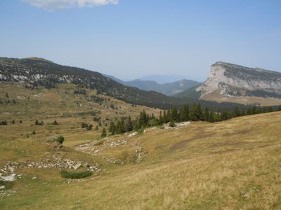
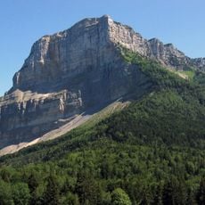
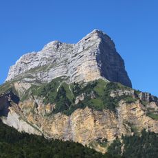
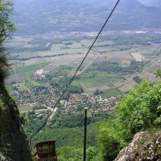
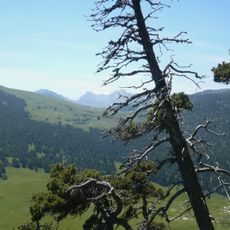
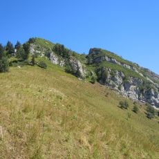
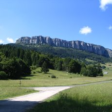
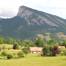
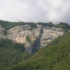
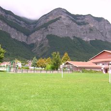
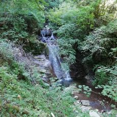
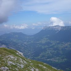
The Réserve naturelle nationale des Hauts de Chartreuse is a protected area spread across roughly 4,450 hectares in the Chartreuse Mountains. Limestone cliffs, dense forests, and mountain grasslands form the main features of this terrain, which rises from 900 meters to over 2,000 meters elevation.
France established this protected area in 1997 to prevent construction and preserve the Chartreuse mountain environment. Since then, the reserve has been managed to keep the natural environment largely untouched by development.
The seven alpine pastures within the reserve show how traditional farming still shapes the landscape today, with herds grazing across open meadows. Visitors walking through these areas can see how rural life and nature conservation work together here.
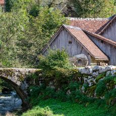
Visitors explore the reserve by following marked trails while respecting strict rules designed to protect the natural habitat. Dogs are not permitted, and plant collection or open fires are forbidden to safeguard the environment.
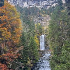
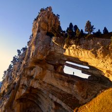
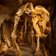
The reserve contains one of Europe's longest cave systems, carved out by water flowing through limestone over millions of years. These hidden passages beneath the mountains reveal the powerful geological forces that shaped the Chartreuse range.
Location: Chapareillan
Location: Sainte-Marie-du-Mont
Location: Saint-Pierre-de-Chartreuse
Location: Saint-Pierre-d'Entremont
Location: Apremont
Location: Entremont-le-Vieux
Location: Plateau-des-Petites-Roches
Inception: October 1, 1997
Website: http://parc-chartreuse.net/nature/reserve-naturelle-hauts-chartreuse.asp
GPS coordinates: 45.39140,5.90056
Latest update: December 14, 2025 12:26
Mont Granier
8.4 km
Dent de Crolles
9.9 km
Cirque de Saint-Même
752 m
Funiculaire de Saint-Hilaire du Touvet
9.8 km
Château du Touvet
4.8 km
Tour Isabelle
2.5 km
Château d'Entremont
4.6 km
Réseau de l'Alpe
3.8 km
Sommet du Pinet
4.6 km
La Scia
6.1 km
Mont Outheran
9.3 km
Roc de Gleisin
7 km
Roche Veyrand
6.1 km
Torrent de Bresson
1.5 km
Ruisseau de Montfort
9.8 km
Ruisseau de Crolles
10.2 km
Ruisseau de la Terrasse
4.1 km
Tournerie de Saint-Même
2.3 km
Musée de l'Ours des Cavernes
6.9 km
Reseau de la Dent de Crolles
9.9 km
Vallée des Entremonts
3.7 km
Chapelle des Dix-Mille Martyrs
4.6 km
Bench
771 m
Église Notre-Dame-d'Épernay d'Entremont-le-Vieux
6.9 km
Église Saint-Pierre de Saint-Pierre-d'Entremont
4.5 km
Église Sainte-Mairie-Madelaine
9.5 km
Église de Sainte-Marie-du-Mont
3.8 kmVisited this place? Tap the stars to rate it and share your experience / photos with the community! Try now! You can cancel it anytime.
Discover hidden gems everywhere you go!
From secret cafés to breathtaking viewpoints, skip the crowded tourist spots and find places that match your style. Our app makes it easy with voice search, smart filtering, route optimization, and insider tips from travelers worldwide. Download now for the complete mobile experience.
A unique approach to discovering new places❞
— Le Figaro
All the places worth exploring❞
— France Info
A tailor-made excursion in just a few clicks❞
— 20 Minutes