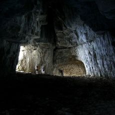
Mont Outheran, Summit in Savoie, France.
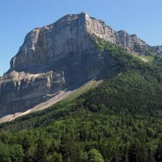
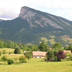
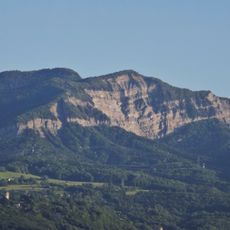
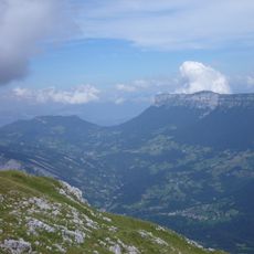
Mont Outheran is a 1,676-metre mountain in the Chartreuse massif, in Savoie. It takes the form of a narrow plateau running north to south for several kilometres between the Col du Grapillon and the Col du Planet, edged on every side by cliffs. The rock is Urgonian limestone overlying Hauterivian marls, and the western cliffs mark the boundary of Saint-Thibaud-de-Couz.
Mont Outheran is formed from Urgonian limestone resting on Hauterivian marls, and its western cliffs mark the boundary of Saint-Thibaud-de-Couz, which owns much of the mountain. About fifty natural limestone shafts have been found on the plateau, including the Gouffre Mollard (117 m deep, 119 m long) and the Gouffre du Mont Outheran (112 m deep, 120 m long), though no large cave system is known. Since 1985 the site has been listed as a type I ZNIEFF (no. 38150032) covering 685 hectares, extended north to include the Rocher du Corbeley (1,419 m).
The name Outheran appears on French maps of the Chartreuse massif, and the mountain lies between Saint-Thibaud-de-Couz and Entremont-le-Vieux. The western cliffs mark the boundary of Saint-Thibaud-de-Couz, which owns much of the plateau. The protected ZNIEFF area of 685 hectares also takes in the Rocher du Corbeley to the north.
The hiking trail covers 11.3 kilometers with 600 meters elevation gain, taking approximately four hours round trip from Foyer de Fond car park, accessible from May to November depending on weather conditions.
About fifty natural limestone shafts have been found on the plateau, yet no large cave system has been identified. Two exceed 100 metres in depth: Gouffre Mollard, 117 m deep and 119 m long, and Gouffre du Mont Outheran, 112 m deep and 120 m long.
The community of curious travelers
AroundUs brings together thousands of curated places, local tips, and hidden gems, enriched daily by 94,313 contributors worldwide.