Étang de Cazaux et de Sanguinet

Log in to your account

AroundUs is a community-driven map of interesting places, built by curious explorers like you. It grows with every review, story, and photo you share.
Connect to save your favorite spots, contribute locations, and create personalized routes.
By continuing, you accept our Terms and Conditions and our Privacy Policy
Add to collection
Map
Suggest a change
Share

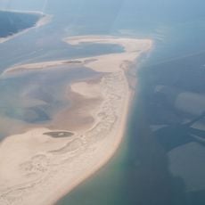
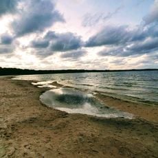
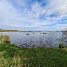
Étang de Cazaux et de Sanguinet, Artificial pond in Gironde, France.

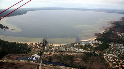
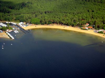
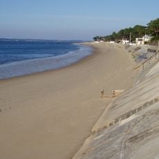
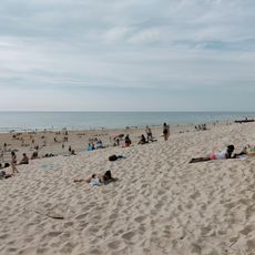
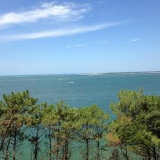
The Étang de Cazaux et de Sanguinet is an artificial lake in southwestern France's Gironde region that covers a vast area. The body of water has deep sections and is bordered by shallow shores where recreation and water activities take place.

The lake formed when sand dunes blocked the Gorgue river, causing water to rise and flood the Roman settlement of Losa. Over time, additional villages became submerged as the water level continued to climb.

The museum in Sanguinet displays objects found during underwater explorations of the drowned settlements below the lake. These artifacts show how people lived in the villages before the water rose.

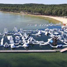
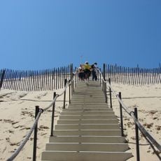
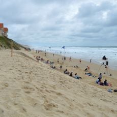
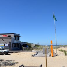
The lake has multiple access points along its shore where visitors can swim, sail, kayak, paddleboard, and fish. These activities are generally available year-round, with water temperature determining the most comfortable times.

Three complete ancient villages rest beneath the water's surface, representing different periods of human settlement. Diving expeditions have explored these submerged communities and recovered many artifacts now displayed in local museums.

Location: Gironde

Elevation above the sea: 12 m

Address: Étang de Cazaux et de Sanguinet, 40460 Sanguinet, France

GPS coordinates: 44.48333,-1.16667

Latest update: December 6, 2025 16:02

Photography around Bassin d'Arcachon: beaches, oyster villages, Dune du Pilat

The Bassin d'Arcachon covers 155 square kilometers along the French Atlantic coast and offers numerous subjects for photography. The Dune du Pilat rises 110 meters above sea level and forms the tallest sand dune in Europe. Oyster farming villages such as Gujan-Mestras, L'Herbe, and Le Canon display wooden huts on stilts distributed along the shores. The Cap Ferret peninsula separates the basin from the Atlantic and presents long sandy beaches on both sides. The Cap Ferret lighthouse from 1947 reaches a height of 53 meters. The Île aux Oiseaux sits in the center of the basin and hosts two traditional stilt cabins, the Cabanes Tchanquées, which are surrounded by water at high tide. The town of Arcachon displays 19th-century villas in the Ville d'Hiver, a district with over 300 buildings in Belle Époque style. The Domaine de Certes et Graveyron nature reserve includes former salt marshes and fish ponds now inhabited by herons, spoonbills, and other water birds. The beaches of Pereire and Pyla-sur-Mer provide direct views of the basin and nearby pine forests.

Reviews

Visited this place? Tap the stars to rate it and share your experience / photos with the community! Try now! You can cancel it anytime.

« Étang de Cazaux et de Sanguinet - Artificial pond in Gironde, France » is provided by Around Us (aroundus.com). Images and texts are derived from Wikimedia project under a Creative Commons license. You are allowed to copy, distribute, and modify copies of this page, under the conditions set by the license, as long as this note is clearly visible.

Discover hidden gems everywhere you go!

From secret cafés to breathtaking viewpoints, skip the crowded tourist spots and find places that match your style. Our app makes it easy with voice search, smart filtering, route optimization, and insider tips from travelers worldwide. Download now for the complete mobile experience.

Around Us App Screenshot

A unique approach to discovering new places

Le Figaro

All the places worth exploring

France Info

A tailor-made excursion in just a few clicks

20 Minutes