Chest opened
+${chestReward.xp} XP
Explorer
NOUVEAU ×${chestReward.collectible.quantity}
tapez pour fermer

See the monuments around you in AR Open chests in the app

Around Us is built for your phone — point your camera at the streets and discover the monuments and places around you in augmented reality. Around Us is built for your phone — chests unlock when you walk, explore and capture nearby places.

•

Enable Location

We need your location to show you interesting places around you

Discover nearby places

Find interesting locations and hidden gems around you

Precise directions

Get accurate directions and distances to places

Your location is never shared with other users. It's only used when you tap the location button.

Signal du Petit Mont-Cenis

Log in to your account

Start exploring — it's free

Trusted by 94,595 travelers worldwide

Continue with Google
Continue with Apple
or

We will send you a code to connect

By continuing, you accept our Terms and Conditions and our Privacy Policy

Check your inbox

We've sent a pincode in your inbox. Please enter the code below.

Signal du Petit Mont-Cenis

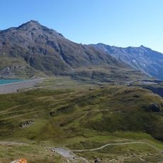
Signal du Petit Mont-Cenis, Mountain summit in Savoie, France

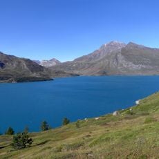
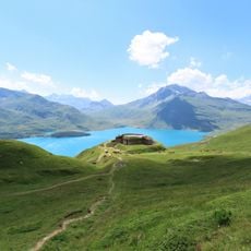
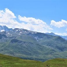
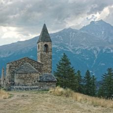
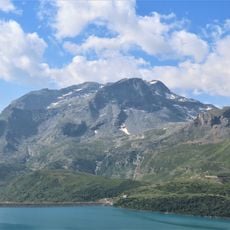
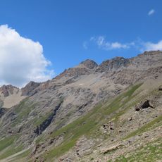
Signal du Petit Mont-Cenis, also called Punta Clairy, is a 3,162 m summit of the Cottian Alps entirely in French territory, in Savoie. It rises between the Mont Cenis pass and the Col du Petit Mont-Cenis, above the west shore of the Mont Cenis lake, on the water divide between the Arc and Dora Riparia watersheds. Its summit rests on the Ambin crystalline basement, capped by lustrous schists, with quartzite and gypsum outcrops on the south-east flank toward the Pointe de Bellecombe and serpentinite on the north flank.

The territory became part of France following the 1947 Treaty of Paris, which redrew boundaries between France and Italy after World War II. This boundary settlement reflected the political changes that shaped the Alpine region in the postwar period.

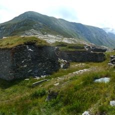
The mountain's name comes from the signal, a lookout point, above the Mont Cenis pass; in Italian it is Punta Clairy. In April 1945 French chasseurs alpins, mountain infantry rather than hunters, fought German mountain troops here in extreme conditions, and these clashes became a symbol of the liberation of the Alps, this part of the Maurienne being among the last French territory freed.

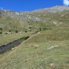
The hike to the summit takes about three hours from the refuge and follows marked paths across alpine terrain. Visitors should be prepared for mountainous conditions and changeable weather at this elevation.

The summit sits on the water divide between the Dora Riparia, draining to the Po, and the Arc, draining to the Rhone. Since 1862 it marked the Franco-Italian border, until the 1947 Treaty of Paris moved the line and made the whole peak French.

The community of curious travelers

AroundUs brings together thousands of curated places, local tips, and hidden gems, enriched daily by 94,595 contributors worldwide.

Start exploring
Location
Elevation above the sea
3,162 m
GPS coordinates
45.24428,6.87277
Latest update
October 26, 2026 12:27
Reviews
Share your experience

No review yet

Discussions
Start a discussion...

No discussion yet

« Signal du Petit Mont-Cenis - Mountain summit in Savoie, France » is provided by Around Us (aroundus.com). Images and texts are derived from Wikimedia project under a Creative Commons license. You are allowed to copy, distribute, and modify copies of this page, under the conditions set by the license, as long as this note is clearly visible.

Discover hidden gems everywhere you go!

From secret cafés to breathtaking viewpoints, skip the crowded tourist spots and find places that match your style. Our app makes it easy with voice search, smart filtering, route optimization, and insider tips from travelers worldwide. Download now for the complete mobile experience.
Around Us App Screenshot
❝

A unique approach to discovering new places❞

— Le Figaro

❝

All the places worth exploring❞

— France Info

❝

A tailor-made excursion in just a few clicks❞

— 20 Minutes

Around Us
Travel Guide & Maps
Download

Send to your phone

QR Code
1

Open the camera app on your mobile.

2

Point at the QR code with your camera. A notification will appear.

3

Tap the notification to open the link.