Peric, Mountain summit at Angoustrine-Villeneuve-des-Escaldes, France.
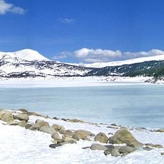
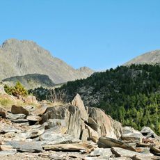
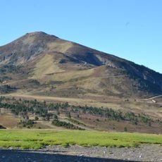
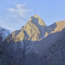
Peric is a 2,810 m mountain in the Carlit massif, on the border between Alta Cerdanya and Capcir, near the Donasà limit. Its summit is a sharp ridge with two peaks, the left higher and broader; below, slopes fall in grey rock faces and shadowed gullies, with pale stone bands across the mid-slopes. It overlooks the Bollosa lake and the Lladura valley.
Puig Peric, 2,810 m high, lies on the border between Alta Cerdanya and Capcir, close to the Donasà limit. It appears in the FEEC's list of the 100 Cims, a selection of peaks the federation considers worth climbing. The summit belongs to the communes of Angostrina i Vilanova de les Escaldes, Les Angles and Formiguera.
The summit marks the edge of the Catalan Countries, near where the Alta Cerdanya and Capcir meet the Donasà of the País de Foix. The name Peric distinguishes two tops: the Peric Gran, between the communes of Angostrina i Vilanova de les Escaldes and els Angles, and the Peric Petit, further east, between els Angles and Formiguera. The peak appears on the FEEC's list of 100 cims, a Catalan hiking challenge.
The summit rises to 2,810 m on the border between Alta Cerdanya and Capcir, close to the Donasà limit. Approach routes come from the communal terms of Angostrina i Vilanova de les Escaldes, els Angles and Formiguera. The peak overlooks the Bollosa lake and the Lladura valley, and the final slopes are bare rock with no marked structure.
Puig Peric reaches 2,810 m on the Carlit massif, on the border between Alta Cerdanya and Capcir, close to the Donasà limit. It is listed among the FEEC's 100 cims, a Catalan hiking challenge. The Peric Gran lies between the communes of Angostrina i Vilanova de les Escaldes and Els Angles, while the Peric Petit, further east, sits between Els Angles and Formiguera.
The community of curious travelers
AroundUs brings together thousands of curated places, local tips, and hidden gems, enriched daily by 94,498 contributors worldwide.