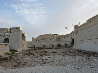
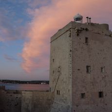
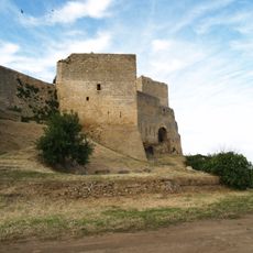
Fort de Bouc, fort à Martigues (Bouches-du-Rhône)
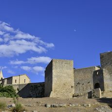
Fort de Bouc is a historic fortress built on a small rocky island at the entrance to the Canal de Caronte, which connects to the Gulf of Fos. The main square tower dates from the 15th century and stands within thick stone walls that rise from the water and create a commanding position over the waterway.
Built in the 13th century to protect the entrance to the Canal de Caronte, the fort was strengthened in the 1600s by French engineers who added thick walls and angled bastions. It served as an active military post monitoring the coast until the late 1800s, when its military role ended and it was decommissioned in 1889.
The name 'Bouc' comes from Provençal and means 'river mouth', reflecting the fort's location at this important waterway crossing. For centuries, local sailors and soldiers used this place to watch the sea and understand the rhythm of maritime life in the region.
The fort sits on an island and can be reached by walking paths or boat depending on conditions and access policies. Walking the perimeter on the old ramparts gives excellent views of the water, though the ground is uneven and often windy, so sturdy shoes are recommended.
During World War II, the Germans occupied the fort and the Allies later damaged parts of it to prevent further military use, leaving visible scars that tell of this conflict. The Bonnefons family, a line of French engineers, directed the major reinforcement work in the early 1600s and shaped much of the fort's current appearance.
The community of curious travelers
AroundUs brings together thousands of curated places, local tips, and hidden gems, enriched daily by 60,000 contributors worldwide.