Baie de Somme

Log in to your account

AroundUs is a community-driven map of interesting places, built by curious explorers like you. It grows with every review, story, and photo you share.
Connect to save your favorite spots, contribute locations, and create personalized routes.
Continue with Google
Continue with Apple
Continue with X
Continue with Facebook
Continue with email
By continuing, you accept our Terms and Conditions and our Privacy Policy
Create an account
Add to collection
Map
Suggest a change
Share

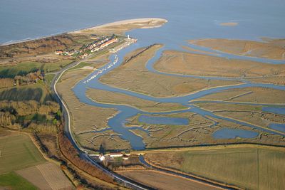
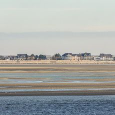
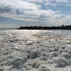
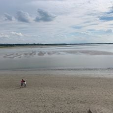
Baie de Somme, Protected wetland in northern France.

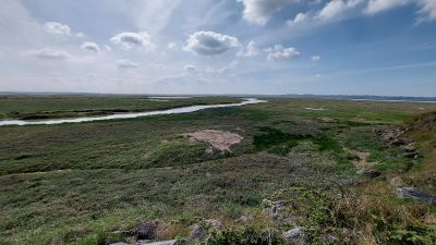
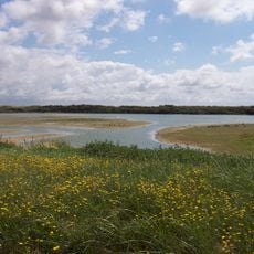
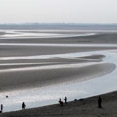
The Bay of Somme is a wetland on France's northern coast with salt marshes, mudflats, lagoons, and sand dunes. These habitats support over 300 bird species that migrate through the area seasonally.

The site gained Ramsar protected status in 1998, marking official recognition of its importance for migratory birds and aquatic ecosystems. This designation represented a major commitment to safeguarding the region's wetlands.

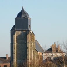
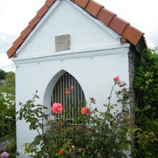
The villages surrounding the bay maintain fishing traditions passed down through generations. Visitors can experience this living connection to the sea through local restaurants and encounters with fishermen in their daily work.

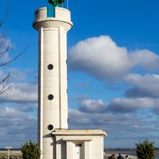
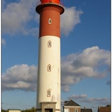
Visitors can explore the area on marked walking trails, cycling routes, or guided boat tours with experienced nature guides. The best seasons for visiting are autumn and spring when bird populations are at their peak.

The peat bogs in this area are preserved in exceptional condition, a rarity in this part of Atlantic Europe. These ancient peat layers hold records of thousands of years of environmental changes.

Location: Colline-Beaumont

Location: Groffliers

Location: Nempont-Saint-Firmin

Location: Tigny-Noyelle

Location: Waben

Location: Arry

Location: Bernay-en-Ponthieu

Location: Boismont

Location: Brutelles

Location: Cahon

Location: Cambron

Location: Cayeux-sur-Mer

Location: Le Crotoy

Location: Favières

Location: Forest-Montiers

Location: Fort-Mahon-Plage

Location: Grand-Laviers

Location: Lanchères

Location: Nampont

Location: Noyelles-sur-Mer

Location: Pendé

Location: Ponthoile

Location: Port-le-Grand

Location: Quend

Location: Regnière-Écluse

Location: Rue

Location: Saigneville

Location: Saint-Quentin-en-Tourmont

Location: Saint-Valery-sur-Somme

Location: Vercourt

Location: Villers-sur-Authie

Location: Vron

Location: Woignarue

Inception: January 23, 1998

Elevation above the sea: 5 m

Address: Baie de Somme, France

GPS coordinates: 50.23330,1.55000

Latest update: December 14, 2025 20:27

Photos
Reviews

Visited this place? Tap the stars to rate it and share your experience / photos with the community! Try now! You can cancel it anytime.

« Baie de Somme - Protected wetland in northern France » is provided by Around Us (aroundus.com). Images and texts are derived from Wikimedia project under a Creative Commons license. You are allowed to copy, distribute, and modify copies of this page, under the conditions set by the license, as long as this note is clearly visible.

Discover hidden gems everywhere you go!

From secret cafés to breathtaking viewpoints, skip the crowded tourist spots and find places that match your style. Our app makes it easy with voice search, smart filtering, route optimization, and insider tips from travelers worldwide. Download now for the complete mobile experience.

Around Us App Screenshot

A unique approach to discovering new places

Le Figaro

All the places worth exploring

France Info

A tailor-made excursion in just a few clicks

20 Minutes