Gorges de l'Infernet, Canyon in Les Deux Alpes, France.
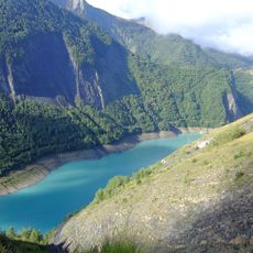
The Gorges de l'Infernet are a steep-sided canyon cut by the Romanche in Isère, between the Grandes Rousses and Écrins massifs. Over about five kilometres the river drops from 900 to 750 metres through a narrow, winding ravine of grey and tan rock, its walls covered with trees and green slopes. A tunnel opening and a pale road ledge run along the right wall.
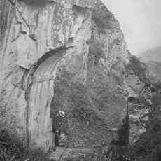
The Romanche has cut the gorges between Le Freney-d'Oisans and the Bourg-d'Oisans plain, dropping from 900 to 750 metres over about five kilometres. A road through them dates back to the Romans, of whom the porte romaine de Bons remains. It was widened and rerouted closer to the river in the early 19th century, abandoning the old route via Mont-de-Lans. In the 1930s the Clapier dam and the first Saint-Guillerme power station were built at the downstream end; a second, underground station replaced the surface one in the 1980s.
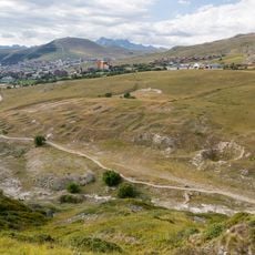
The gorges carry the D213, D220 and D1091 on the left bank and the D211 on the right bank, the historic route to the Lautaret pass. The Roman gate of Bons, a vestige of the Roman road, still stands above the gorge. Villages such as Les Châtains, Les Certs, Les Cours and Mont-de-Lans sit on the slopes overlooking the ravine.
The main access is via a marked trail starting about 400 meters from the Gillardes parking area, which crosses a bridge on the way. Sturdy footwear and reasonable fitness are needed because of the mountain terrain and elevation.
The only structures in the gorge are the Saint-Guillerme hydroelectric plant and the Clapier dam at its downstream exit, built in the 1930s. In the 1980s a second, underground plant replaced the surface one. The right bank and part of the left bank are a type I ZNIEFF nature zone.
The community of curious travelers
AroundUs brings together thousands of curated places, local tips, and hidden gems, enriched daily by 94,652 contributors worldwide.