Enable Location

We need your location to show you interesting places around you

Discover nearby places

Find interesting locations and hidden gems around you

Precise directions

Get accurate directions and distances to places

Your location is never shared with other users. It's only used when you tap the location button.

Lac du Chambon

Log in to your account

Start exploring — it's free

Trusted by 63,015 travelers worldwide

Continue with Google
Continue with Apple
or

We will send you a code to connect

By continuing, you accept our Terms and Conditions and our Privacy Policy

Check your inbox

We've sent a pincode in your inbox. Please enter the code below.

Lac du Chambon
Discussion Reviews 2 Photos 1 Collections
8.3k Popularity

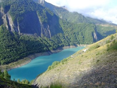
Lac du Chambon, Reservoir in Isère, France

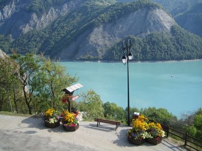
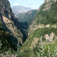
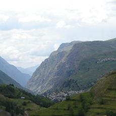
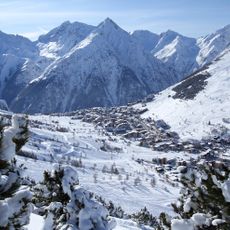
Lac du Chambon is an artificial lake in the French Alps situated at 1,040 meters (3,410 feet) elevation in Isère, created by a dam across the Romanche River. The water is surrounded by mountain slopes and offers a calm setting for swimming, boating, and other water-based activities.

Construction of the Chambon dam began in 1929 and was completed in 1935, creating this major water storage facility in the Alps. The dam transformed the valley and established an important recreational area for the surrounding region.

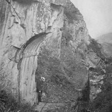
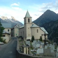
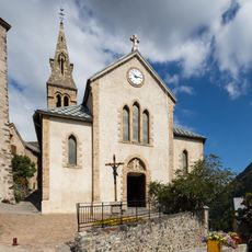
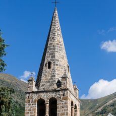
The water covers remnants of three former villages—Chambon, Dauphin, and Parizet—whose foundations occasionally become visible to visitors. When water levels drop for maintenance, traces of old stone structures and pathways emerge from the lakebed, connecting people to the communities that once stood there.

The shoreline provides access to water sports with equipment rentals available for canoes, kayaks, and pedal boats. Visiting works best from June through September when weather is dry and water temperatures are comfortable for swimming.

Beneath the water lies an old road that once connected the sunken villages. This pathway becomes visible during maintenance operations and offers a window into the landscape that existed before the dam.

The community of curious travelers

AroundUs brings together thousands of curated places, local tips, and hidden gems, enriched daily by 60,000 contributors worldwide.

Start exploring
Location
Inception
April 24, 1935
Elevation above the sea
1,040 m
Address
Lac du Chambon, France
GPS coordinates
45.04200,6.14800
Latest update
December 6, 2025 16:04
Lakes of Auvergne-Rhône-Alpes: volcanic craters, glacier waters, mountain dams

The Auvergne-Rhône-Alpes area has lakes from very different beginnings. Large lakes that formed from glaciers, like Lake Bourget or Lake Annecy, appeared after the glaciers in the Alps melted. They have deep water surrounded by mountains. In the Massif Central, volcanic lakes sit in old craters,...

Reviews
Share your experience

No review yet

Discussions
Start a discussion...

No discussion yet

« Lac du Chambon - Reservoir in Isère, France » is provided by Around Us (aroundus.com). Images and texts are derived from Wikimedia project under a Creative Commons license. You are allowed to copy, distribute, and modify copies of this page, under the conditions set by the license, as long as this note is clearly visible.

Discover hidden gems everywhere you go!

From secret cafés to breathtaking viewpoints, skip the crowded tourist spots and find places that match your style. Our app makes it easy with voice search, smart filtering, route optimization, and insider tips from travelers worldwide. Download now for the complete mobile experience.

Around Us App Screenshot

A unique approach to discovering new places

Le Figaro

All the places worth exploring

France Info

A tailor-made excursion in just a few clicks

20 Minutes

Around Us
Travel Guide & Maps
Download

Send to your phone

QR Code
1

Open the camera app on your mobile.

2

Point at the QR code with your camera. A notification will appear.

3

Tap the notification to open the link.