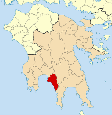
West Mani Municipality, Municipality of Greece
Location: Messenia Regional Unit
Shares border with: Municipality of East Mani, Sparta Municipality, Municipality of Kalamata
Website: http://dimosdytikismanis.gr
GPS coordinates: 36.85000,22.26667
Latest update: March 15, 2025 09:38
Taygetus
17 km
Monastery of Panayia Yiatrissa
10.8 km
Agia Sofia church
26.4 km
Peribleptos Monastery
26.3 km
Kalamata Castle
25.6 km
Mystras Castle
26.3 km
Archaeological Museum of Messenia
25.5 km
Vyros Gorge
8.8 km
Drakos-Selinitsa system
5.9 km
Kalamata Dance Megaron
25.4 km
Transfiguration of the Savior, Lankadas
9.9 km
Saint George church (Mystras)
26.5 km
Cathedral of Ypapanti, Kalamata
25.5 km
Agios Nikolaos church (Mystras)
26.5 km
French Institute of Kalamata - Oikia Efesiou
25.3 km
City hall of Kalamata
25.4 km
Taygetos Mountain Peak, Prophet Elias
13.7 km
Agios Charalambos Kalamata
25.2 km
Church of Agioi Anargyroi, Nomitsi
8.7 km
Church of Ag. Metamorphosis, Nomitsis
8.8 km
Small Taxiarchs, Kalamata
25.3 km
Agioi Theodoroi church, Kambos
11.3 km
Church of Agioi Apostoloi
25.5 km
Folklore museum, Kalamata - Archontiko Kyriakou
25.6 km
Benakeio Archaeological Museum, Kalamata
25.5 km
Pantazopouleios People's School
25.2 kmVisited this place? Tap the stars to rate it and share your experience / photos with the community! Try now! You can cancel it anytime.
Discover hidden gems everywhere you go!
From secret cafés to breathtaking viewpoints, skip the crowded tourist spots and find places that match your style. Our app makes it easy with voice search, smart filtering, route optimization, and insider tips from travelers worldwide. Download now for the complete mobile experience.
A unique approach to discovering new places❞
— Le Figaro
All the places worth exploring❞
— France Info
A tailor-made excursion in just a few clicks❞
— 20 Minutes