YSR district, Administrative district in Rayalaseema region, Andhra Pradesh, India.
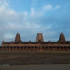
YSR district spreads across the Rayalaseema region in Andhra Pradesh and is named after a former chief minister. Forests cover the hills in the west, while flatter stretches and river basins shape the central and northern parts, with Kadapa forming the administrative center.
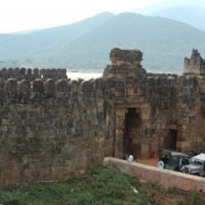
Under British rule the area formed part of the Madras Presidency, with Kadapa serving as a regional garrison. After independence it was merged into the newly formed state of Andhra Pradesh in 1956, then renamed in 2010 to honor a late leader.
The name honors Y. S. Rajasekhara Reddy, who came from this area and served as chief minister in the 2000s. Visitors see street names and memorials in Kadapa that recall his tenure and the political turning points that began here.
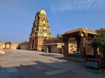
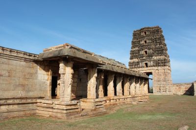
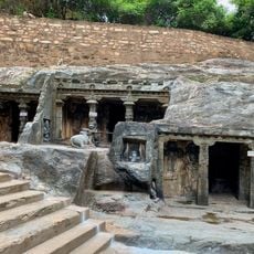
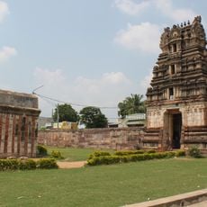
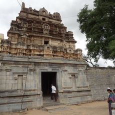
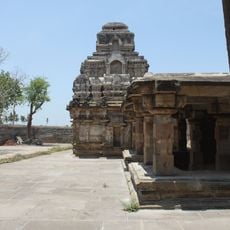
Travelers reach the area by bus routes and train lines that converge on Kadapa and offer connections to neighboring states. Those exploring the surroundings find access roads to temple sites and small towns spread across the 36 administrative blocks.
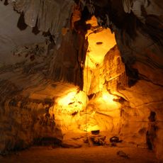
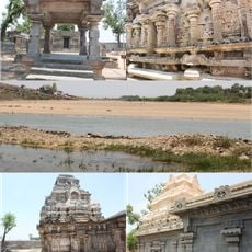
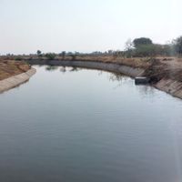
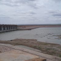
Geologists visit to study formations from the Cuddapah Basin that expose rock layers spanning billions of years. Quarries around Kadapa supply barite and asbestos deposited in the sediments over long periods.
Location: Andhra Pradesh
Capital city: Kadapa
Shares border with: Kurnool district, Anantapuramu district, Prakasam district, Chittoor district, Sri Potti Sri Ramulu Nellore district
Website: http://kadapa.nic.in
GPS coordinates: 14.48000,78.81000
Latest update: December 4, 2025 23:44
Belum Caves
102.2 km
Yaganti Temple
120.8 km
Thimmamma Marrimanu
72.6 km
Sri Kodandrama Swamy Temple, Vontimitta
25.3 km
Ameenpur Dargah
1.6 km
Penchalakona
66.8 km
Bugga Ramalingeswara temple
99 km
Pushpagiri Group of Temples
13.8 km
Sri Ranganathaswamy Temple
68.8 km
Galeru Nagari Sujala Sravanthi Project
70.5 km
Chintala Venkataramana Temple, Tadipatri
98.5 km
Anantapur clock tower
132.7 km
Gurramkonda Fort
81.9 km
Bhairavakonda Caves
79.8 km
Laxminarsimha Swamy temple, Kadiri
81.7 km
Athirala parasurama temple
46.3 km
Annamacharya statue in Tallapaka
49 km
Sri Lakshmi Narasimha Swamy Temple, Ahobilam
74.2 km
Gurramkonda Mahal
81.9 km
Yaganti Caves
120.9 km
Siddavatam Fort
16.9 km
Saumyanatha temple
40.8 km
Gandikota Fort
67.4 km
Chennakeswaraswami Temple
90.4 km
Bhimeshwara swamy temple
14.1 km
Udayagiri Fort
65.9 km
Vaidhyanadha swamy temple
14.1 km
Indranadheshwara swamy temple
14.7 kmReviews
Visited this place? Tap the stars to rate it and share your experience / photos with the community! Try now! You can cancel it anytime.
Duvvur mandal
Thondur mandal
Chennur mandal
Chinthakommadinne mandal
Chapad mandal
Chakrayapet mandal
Gopavaram mandal
Khajipet mandal
Kondapuram mandal
Kalasapadu mandal
Kamalapuram mandal
Vontimitta mandal
Atlur mandal
Simhadripuram mandal
Sidhout mandal
Vemula mandal
Vempalle mandal
Vallur mandal
Lingala mandal
Rajupalem mandal
Mylavaram mandal
S.Mydukur mandal
B.Kodur mandal
Porumamilla mandal
Peddamudium mandal
Pendlimarri mandal
Badvel mandal
Yerraguntla mandal
Muddanur mandal
Proddatur mandal
Pulivendla mandal
Jammalamadugu mandal
Kadapa mandal
Veerapunayunipalle mandal
Sri Avadhutha Kasinayana mandal
Brahmamgarimattam mandal
Discover hidden gems everywhere you go!
From secret cafés to breathtaking viewpoints, skip the crowded tourist spots and find places that match your style. Our app makes it easy with voice search, smart filtering, route optimization, and insider tips from travelers worldwide. Download now for the complete mobile experience.
A unique approach to discovering new places❞
— Le Figaro
All the places worth exploring❞
— France Info
A tailor-made excursion in just a few clicks❞
— 20 Minutes