Enable Location

We need your location to show you interesting places around you

Discover nearby places

Find interesting locations and hidden gems around you

Precise directions

Get accurate directions and distances to places

Your location is never shared with other users. It's only used when you tap the location button.

Log in to your account

Start exploring — it's free

Trusted by 61,555 travelers worldwide

Continue with Google
Continue with Apple
or

We will send you a code to connect

By continuing, you accept our Terms and Conditions and our Privacy Policy

Check your inbox

We've sent a pincode in your inbox. Please enter the code below.

Chittorgarh district

Chittorgarh district, Administrative district in southeastern Rajasthan, India

Description

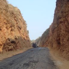
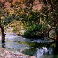
Chittorgarh district spans southeastern Rajasthan with varied topography including hills, river valleys, and farmland distributed across thousands of square kilometers. The landscape transitions from irrigated agricultural areas to drier upland regions with different vegetation patterns.

History

The district was formed in 1948 when several princely territories merged under Indian administration following independence. This consolidation of Mewar, Pratabgarh, Tonk, and Jhalawar regions created the present-day administrative boundaries.

Culture

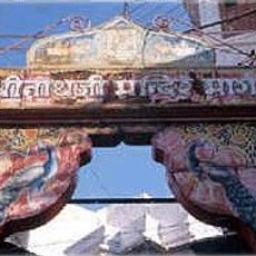
Local artisans throughout the district practice traditional handloom weaving and pottery, skills that have been passed down through families for generations. You can see these crafts in village markets and homes as daily work rather than tourist attractions.

Practical

Two national highways and a major railway junction connect the district to other regions, making travel relatively straightforward. Base yourself near transportation hubs if you plan to explore different areas within the district.

Did you know?

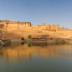
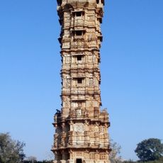
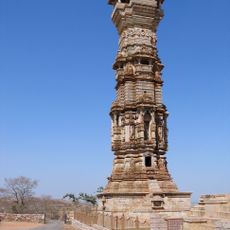
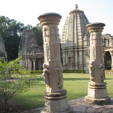
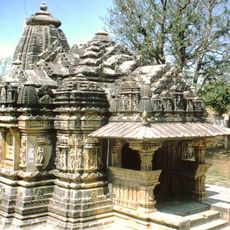
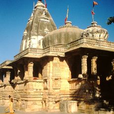
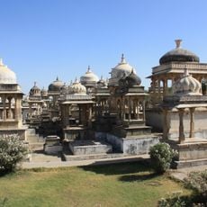
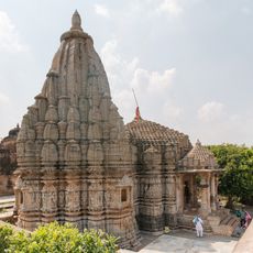
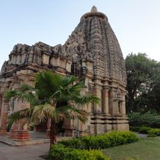
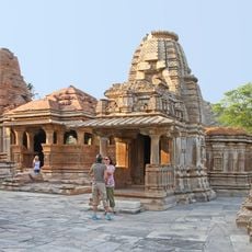
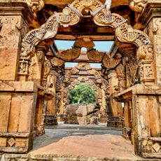
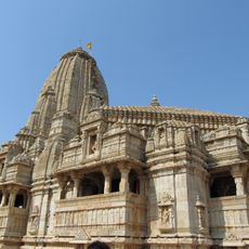
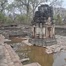
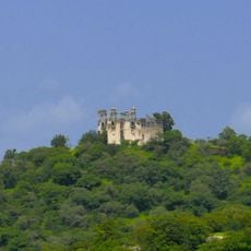
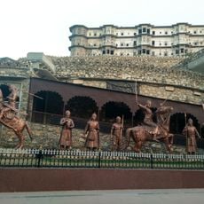
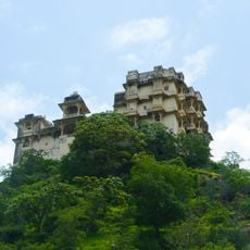
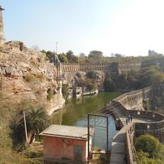
The district contains one of India's largest fort complexes perched atop a hill, featuring numerous palaces, temples, and ancient water management systems built into the structure. This site represents a remarkable engineering achievement of its time.

Location
Capital city
Chittorgarh
Shares border with
Rajsamand district
GPS coordinates
24.88000,74.62000
Latest update
December 7, 2025 19:28

AroundUs brings together thousands of curated places, local tips, and hidden gems, enriched daily by 60,000 contributors worldwide. Discover all places nearby (Udaipur division).

« Chittorgarh district - Administrative district in southeastern Rajasthan, India » is provided by Around Us (aroundus.com). Images and texts are derived from Wikimedia project under a Creative Commons license. You are allowed to copy, distribute, and modify copies of this page, under the conditions set by the license, as long as this note is clearly visible.

Discover hidden gems everywhere you go!

From secret cafés to breathtaking viewpoints, skip the crowded tourist spots and find places that match your style. Our app makes it easy with voice search, smart filtering, route optimization, and insider tips from travelers worldwide. Download now for the complete mobile experience.

Around Us App Screenshot

A unique approach to discovering new places

Le Figaro

All the places worth exploring

France Info

A tailor-made excursion in just a few clicks

20 Minutes

Around Us
Travel Guide & Maps
Download

Send to your phone

QR Code
1

Open the camera app on your mobile.

2

Point at the QR code with your camera. A notification will appear.

3

Tap the notification to open the link.