Enable Location

We need your location to show you interesting places around you

Discover nearby places

Find interesting locations and hidden gems around you

Precise directions

Get accurate directions and distances to places

Your location is never shared with other users. It's only used when you tap the location button.

Log in to your account

Start exploring — it's free

Trusted by 62,564 travelers worldwide

Continue with Google
Continue with Apple
or

We will send you a code to connect

By continuing, you accept our Terms and Conditions and our Privacy Policy

Check your inbox

We've sent a pincode in your inbox. Please enter the code below.

Jabalpur district

Jabalpur district, Administrative district in central Madhya Pradesh, India

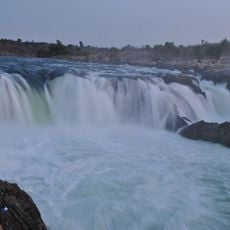
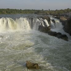
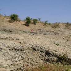
Jabalpur is an administrative district in central India covering approximately 5,200 square kilometers situated between two major rivers. The terrain is marked by limestone formations and numerous waterfalls scattered throughout the landscape.

The area served as an administrative center during British colonial rule for operations in the Narmada region. This past shaped its infrastructure and status as an important governmental location.

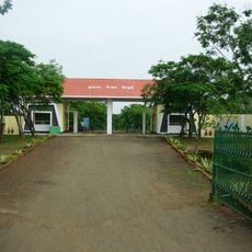
The district has long served as an educational hub, drawing students and scholars from across the region to its institutions. This role shapes daily life and gives the place a distinctive character centered on learning and exchange.

The area contains around 1,500 villages and benefits from good railway connections to major cities. Its central location makes it accessible from several directions.

The main city houses the High Court of Madhya Pradesh and serves as the command center for army operations spanning five different states. This dual role makes it an unusually important administrative and military hub.

The community of curious travelers

AroundUs brings together thousands of curated places, local tips, and hidden gems, enriched daily by 60,000 contributors worldwide.

Start exploring
Capital city
Jabalpur
Shares border with
Katni district, Dindori district
GPS coordinates
23.16000,79.94000
Latest update
December 22, 2025 13:11
« Jabalpur district - Administrative district in central Madhya Pradesh, India » is provided by Around Us (aroundus.com). Images and texts are derived from Wikimedia project under a Creative Commons license. You are allowed to copy, distribute, and modify copies of this page, under the conditions set by the license, as long as this note is clearly visible.

Discover hidden gems everywhere you go!

From secret cafés to breathtaking viewpoints, skip the crowded tourist spots and find places that match your style. Our app makes it easy with voice search, smart filtering, route optimization, and insider tips from travelers worldwide. Download now for the complete mobile experience.

Around Us App Screenshot

A unique approach to discovering new places

Le Figaro

All the places worth exploring

France Info

A tailor-made excursion in just a few clicks

20 Minutes

Around Us
Travel Guide & Maps
Download

Send to your phone

QR Code
1

Open the camera app on your mobile.

2

Point at the QR code with your camera. A notification will appear.

3

Tap the notification to open the link.