Magrahat I community development block, Community development block in Diamond Harbour subdivision, India
Magrahat I is an administrative block near the Diamond Harbour subdivision, spanning a region with mixed settlement patterns. The block comprises several village councils where urban and rural areas exist side by side.
The region got its name from Mog pirates who established trading posts and later migrated away with Portuguese assistance from what is now Myanmar. This maritime past shaped the region's economic development for generations.
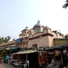
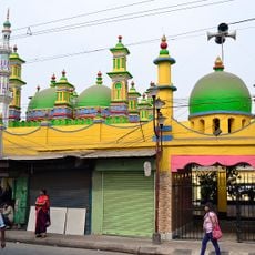
The name comes from Mog pirates who once established trading posts in the area, a heritage that echoes through local stories. Today, residents of different faiths coexist and shape the everyday character of the region.
The area is well served by schools at different levels, with educational facilities spread across local communities. Village councils can help visitors get information about local services and facilities.
The area is known for its rice cultivation tradition, visible in the local economy and fields that shape the landscape. This agricultural activity has connected the community to the rhythm of seasons for centuries.
Location: Diamond Harbour subdivision
Elevation above the sea: 6 m
Shares border with: Bishnupur I community development block
GPS coordinates: 22.24200,88.37840
Latest update: December 11, 2025 18:04
Kalighat Kali Temple
31.2 km
Asutosh College
31.7 km
Birla Mandir
32.2 km
Urbana
30.2 km
Chintamoni Kar Bird Sanctuary
21 km
Rabindra Sarobar Stadium
30.1 km
Ramakrishna Mission Institute of Culture
30.6 km
Benubana Chhaya
26.1 km
Agri Horticultural Society of India
32.2 km
Jatar Deul
29.9 km
Sabarna Sangrahashala
27.4 km
State Archaeological Museum
29.3 km
BAPS Shri Swaminarayan Mandir Kolkata
21.5 km
Matla Setu
31.7 km
Pathrakaliamman Temple
31.2 km
Gurusaday Museum
25 km
Experimenter Gallery
31.8 km
Jagajjivanpur copper-plate inscription of Mahendrapala
29.3 km
Dhanwantari Temple
9 km
Durga Exhibition Museum
29.8 km
Aayakar Bhawan Poorva
30.6 km
The Behala Town Library
29.6 km
Maddox Square
31.7 km
Zohra Begum Mosque
29.4 km
Kamarghat Dwadash Shiva temple
28.8 km
Kuthi of Port Canning Land, Investment, Reclamation and Dock Company
31 km
Jora Temple
15.1 km
Ancestral House of Bose family
19.5 kmVisited this place? Tap the stars to rate it and share your experience / photos with the community! Try now! You can cancel it anytime.
Discover hidden gems everywhere you go!
From secret cafés to breathtaking viewpoints, skip the crowded tourist spots and find places that match your style. Our app makes it easy with voice search, smart filtering, route optimization, and insider tips from travelers worldwide. Download now for the complete mobile experience.
A unique approach to discovering new places❞
— Le Figaro
All the places worth exploring❞
— France Info
A tailor-made excursion in just a few clicks❞
— 20 Minutes