Chest opened
+${chestReward.xp} XP
Explorer
NOUVEAU ×${chestReward.collectible.quantity}
tapez pour fermer
Chest locked

Open chests in the app

Around Us is built for your phone — chests unlock when you walk, explore and capture nearby places.

Enable Location

We need your location to show you interesting places around you

Discover nearby places

Find interesting locations and hidden gems around you

Precise directions

Get accurate directions and distances to places

Your location is never shared with other users. It's only used when you tap the location button.

Log in to your account

Start exploring — it's free

Trusted by 72,942 travelers worldwide

Continue with Google
Continue with Apple
or

We will send you a code to connect

By continuing, you accept our Terms and Conditions and our Privacy Policy

Check your inbox

We've sent a pincode in your inbox. Please enter the code below.

Pappireddipatti taluk
Discussion Reviews Photo
1.8k Popularity

Pappireddipatti taluk, Administrative division in Dharmapuri district, Tamil Nadu, India.

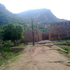
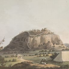
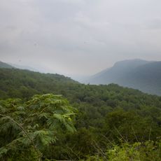
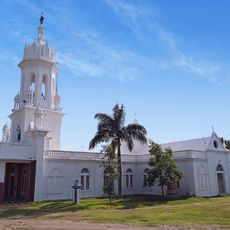
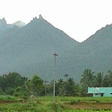
Pappireddipatti taluk is an administrative division in Dharmapuri district, Tamil Nadu, located between the Kalrayan Hills to the east and the Shevaroy Hills to the west. The region contains several revenue villages overseen by a Tahsildar responsible for tax collection and local governance.

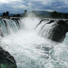
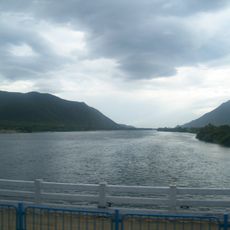
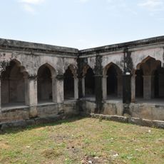
The area was established as an administrative subdivision for managing governance and tax collection in the region. The Vaniyar Dam, built across the Vaniyar river tributary of the Ponnaiyar River, was constructed as a major water management facility near the main settlement.

The population of 241,116 residents maintains a balanced gender ratio of 965 women per 1000 men according to the 2011 census data.

The Tahsildar office serves as the main administrative hub handling official matters and local services. Visitors can use the surrounding hills as natural landmarks to navigate and explore the taluk's different areas.

The groundwater levels in the region fluctuate between 4.41 and 19.07 meters during winter, shifting to 2.94 and 9.47 meters in summer periods.

The community of curious travelers

AroundUs brings together thousands of curated places, local tips, and hidden gems, enriched daily by 60,000 contributors worldwide.

Start exploring
Location
Harur division
GPS coordinates
11.91193,78.36600
Latest update
December 14, 2025 12:25
Reviews
Share your experience

No review yet

Discussions
Start a discussion...

No discussion yet

« Pappireddipatti taluk - Administrative division in Dharmapuri district, Tamil Nadu, India » is provided by Around Us (aroundus.com). Images and texts are derived from Wikimedia project under a Creative Commons license. You are allowed to copy, distribute, and modify copies of this page, under the conditions set by the license, as long as this note is clearly visible.

Discover hidden gems everywhere you go!

From secret cafés to breathtaking viewpoints, skip the crowded tourist spots and find places that match your style. Our app makes it easy with voice search, smart filtering, route optimization, and insider tips from travelers worldwide. Download now for the complete mobile experience.

Around Us App Screenshot

A unique approach to discovering new places

Le Figaro

All the places worth exploring

France Info

A tailor-made excursion in just a few clicks

20 Minutes

Around Us
Travel Guide & Maps
Download

Send to your phone

QR Code
1

Open the camera app on your mobile.

2

Point at the QR code with your camera. A notification will appear.

3

Tap the notification to open the link.