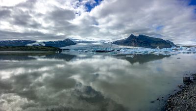
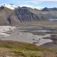
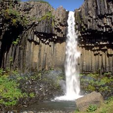
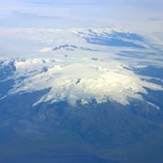
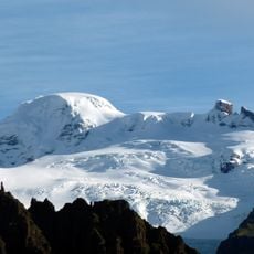
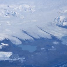
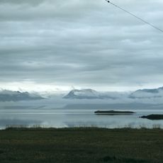
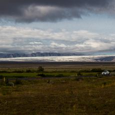
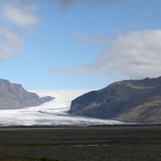
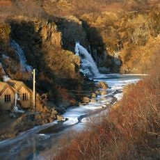
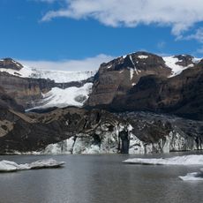
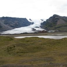
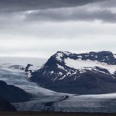
Fjallsárlón, Glacial lake in Vatnajökull National Park, Eastern Region, Iceland.
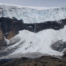
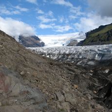
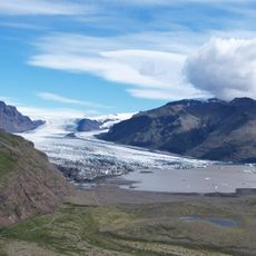
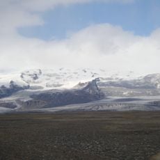
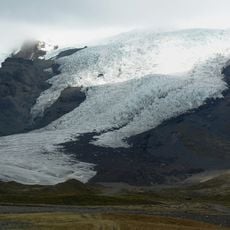
Fjallsárlón is a glacial lake covering approximately 1.5 square miles that is filled with floating icebergs that have broken off from the retreating Fjallsjökull glacier, which extends from the Öræfajökull volcano.
The lake first appeared in 1945 as the Fjallsjökull glacier began retreating from its maximum extent at the end of the 19th century, when it merged with the neighboring Breiðamerkurjökull glacier to the east.
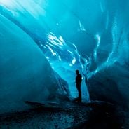
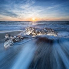
The lake has become a popular destination with over 260,000 visitors annually who take boat tours to observe the calving glacier and navigate among the icebergs in the cold waters.
Visitors should be aware that aggressive skúas nest on the ground near the lake during summer breeding season and may defend their territory by diving at people who approach too closely.
The lake contains underwater trenches that reach depths of over 656 feet (200 meters) below sea level, making it one of the deepest glacial lakes in Iceland with significant depth variations.
Location: Eastern Region
GPS coordinates: 64.01861,-16.38500
Latest update: November 28, 2025 15:21
Iceland is an island shaped by ice and fire. Glaciers cover much of the interior while geothermal areas show that something is always happening beneath the surface. The landscapes here look different from most places: black sand beaches formed by volcanic activity, fjords cutting deep into the coast, waterfalls dropping over cliffs and canyons with moss covered walls. Vatnajökull in the southeast is Europe's largest glacier, while smaller ice caps like Snæfellsjökull or Drangajökull have their own character. Reykjavik sits by the ocean and mixes city life with access to nature. The Harpa concert hall stands by the harbor, Hallgrímskirkja church rises above the rooftops, and along the shore you find the Sólfar sculpture. Lake Tjörnin lies in the center of town. Outside the city, routes lead to natural sites: the Blue Lagoon with its milky blue water, Strokkur geyser that erupts every few minutes, Gullfoss waterfall where a river plunges into a canyon. The southern coast shows different faces. Near Vík there is Reynisfjara beach with its basalt columns and black sand, and not far away the cliff at Dyrhólaey. Diamond Beach near Hornafjörður is scattered with ice chunks washed up by the sea. In the north, Lake Mývatn attracts visitors with its volcanic surroundings, while the Westfjords with the Hornstrandir reserve and the red sand of Rauðasandur beach belong to the more remote parts of the country. The Ring Road connects most of these places and circles the entire island.
Vatnajökull
47 km
Vatnajökull National Park
61.3 km
Skaftafell
28.6 km
Svartifoss
28.8 km
Öræfajökull
56.5 km
Hvannadalshnúkur
14.2 km
Breiðamerkurjökull
27.5 km
Morsárfoss
26.6 km
Diamond Beach
10.6 km
Skeiðarársandur
58.3 km
Svínafellsjökull
21.4 km
Hornafjörður
59.4 km
Skaftafellsjökull
24.4 km
Fláajökull
52.6 km
Skeiðará Bridge
30.7 km
Skeiðarárjökull
42.3 km
Kristínartindar
27 km
Hundafoss
29 km
Sandfell í Öræfum
21.6 km
Magnúsarfoss
29 km
Falljökull
19.4 km
Hofskirkja
20 km
Morsárjökull
26.7 km
Mulagljufur Canyon
4.8 km
Skalafellsjökull
37.1 km
Kvíárjökull glacier tongue
9.9 km
Heinabergsjökull
43.6 km
Brunnhólskirkja
55.3 kmReviews
Visited this place? Tap the stars to rate it and share your experience / photos with the community! Try now! You can cancel it anytime.
Discover hidden gems everywhere you go!
From secret cafés to breathtaking viewpoints, skip the crowded tourist spots and find places that match your style. Our app makes it easy with voice search, smart filtering, route optimization, and insider tips from travelers worldwide. Download now for the complete mobile experience.
A unique approach to discovering new places❞
— Le Figaro
All the places worth exploring❞
— France Info
A tailor-made excursion in just a few clicks❞
— 20 Minutes