Lake Iruka, Reservoir lake in Inuyama, Japan.
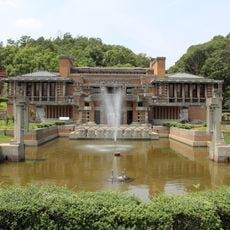
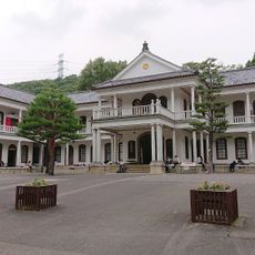
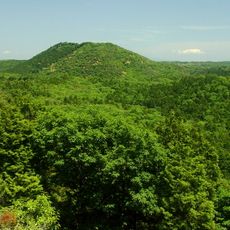
Lake Iruka is an artificial irrigation reservoir in Inuyama, Aichi Prefecture, held by a 26.9-metre-high, 120-metre-long earth dam. Its full surface covers 152.1 hectares, and it stores 18.479 million cubic metres of water for farmland in Inuyama, Komaki and Niwa District. The lake lies within Hida-Kisogawa Quasi-National Park, with Meiji Mura on its shore.
An original dam was built in 1633 but collapsed in 1868 during heavy rains, causing a major flood in the region. The current lake was rebuilt afterward and has served as a key water storage facility ever since.
The lake is named after Iruka village, which was submerged when the reservoir was created; its residents were resettled in hamlets called Iruka Shinden. The reservoir's sluice was managed by hereditary gatekeepers from Kamio village, who opened the gates with iron bars and ropes. Today, boaters and smelt anglers use the water, and the Meiji Mura museum stands on the shore.
The lake lies inside Hida-Kisogawa Quasi-National Park, ringed by Imaiyama to the north and the Owari Sanzan of Hongu-san, Owari-Fuji and Hakusan to the southwest. Roads circle the water, including the Owari Parkway and Prefectural Routes 16 and 49, and Meiji Mura museum stands on the shore. The shoreline runs about 16 km, so plan for a long loop.
The dam's 96-ken earth embankment, finished in February 1633 by the engineer Jinkurō, was built by burning oil-soaked wooden bridges loaded with branches, pine needles, earth and stone, then dropping the fill; it is still called Hyakken-tsutsumi or Kawachiya-tsutsumi. Around 490,000 cubic metres of soil went into it.
The community of curious travelers
AroundUs brings together thousands of curated places, local tips, and hidden gems, enriched daily by 93,124 contributors worldwide.