Chest opened
+${chestReward.xp} XP
Explorer
NOUVEAU ×${chestReward.collectible.quantity}
tapez pour fermer
Chest locked

Open chests in the app

Around Us is built for your phone — chests unlock when you walk, explore and capture nearby places.

Enable Location

We need your location to show you interesting places around you

Discover nearby places

Find interesting locations and hidden gems around you

Precise directions

Get accurate directions and distances to places

Your location is never shared with other users. It's only used when you tap the location button.

Pik Talgar

Log in to your account

Start exploring — it's free

Trusted by 72,882 travelers worldwide

Continue with Google
Continue with Apple
or

We will send you a code to connect

By continuing, you accept our Terms and Conditions and our Privacy Policy

Check your inbox

We've sent a pincode in your inbox. Please enter the code below.

Pik Talgar
Discussion Reviews 1 Photos
8.9k Popularity

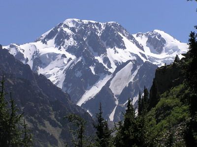
Pik Talgar, Mountain peak in Talgar District, Kazakhstan

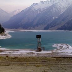
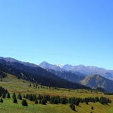
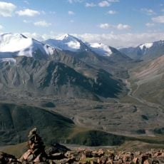
Pik Talgar is a mountain peak in the Tian Shan range standing at 4,979 meters with steep slopes and snow-covered faces on its western side. The summit displays typical alpine features and is characterized by snowfields that dominate the higher elevations.

The peak was first successfully summited in 1938 by mountaineers from Stalinsk, marking a milestone in the exploration of this Tian Shan region. This achievement established it as an important destination for alpine expeditions in Kazakhstan.

The peak takes its name from the Talgar river and the city below, making it a key geographic reference for local communities. This connection to the landscape shapes how people understand and relate to the surrounding region.

Visitors need specialized climbing gear and careful acclimatization planning to handle the significant altitude gain on this peak. Snow coverage begins between 3,700 to 3,900 meters (12,000 to 12,800 feet), shaping the nature of the ascent route.

The Korzhnevsky glacier spans 12 kilometers along the southern slopes, making it the largest glacier formation in the Trans-Ili Alatau range. This ice field shapes the appearance of the southern flank and represents a defining feature of the mountain landscape.

The community of curious travelers

AroundUs brings together thousands of curated places, local tips, and hidden gems, enriched daily by 60,000 contributors worldwide.

Start exploring
Location
Elevation above the sea
4,978.9 m
GPS coordinates
43.11784,77.34133
Latest update
December 10, 2025 15:59
Reviews
Share your experience

No review yet

Discussions
Start a discussion...

No discussion yet

« Pik Talgar - Mountain peak in Talgar District, Kazakhstan » is provided by Around Us (aroundus.com). Images and texts are derived from Wikimedia project under a Creative Commons license. You are allowed to copy, distribute, and modify copies of this page, under the conditions set by the license, as long as this note is clearly visible.

Discover hidden gems everywhere you go!

From secret cafés to breathtaking viewpoints, skip the crowded tourist spots and find places that match your style. Our app makes it easy with voice search, smart filtering, route optimization, and insider tips from travelers worldwide. Download now for the complete mobile experience.

Around Us App Screenshot

A unique approach to discovering new places

Le Figaro

All the places worth exploring

France Info

A tailor-made excursion in just a few clicks

20 Minutes

Around Us
Travel Guide & Maps
Download

Send to your phone

QR Code
1

Open the camera app on your mobile.

2

Point at the QR code with your camera. A notification will appear.

3

Tap the notification to open the link.