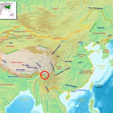
Kachin State, Administrative state in northern Myanmar
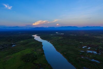
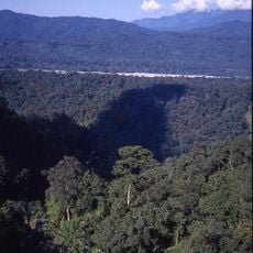
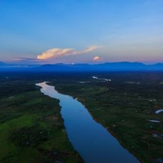
Kachin State is an administrative territory in northern Myanmar that covers mountainous terrain with dense forests and deep river valleys. The capital Myitkyina sits at the confluence of two rivers and serves as a gateway to the surrounding regions.
This territory became an established administrative unit after independence from British colonial rule in 1948. Since then, territorial conflicts and political tensions have shaped the region through decades of change.
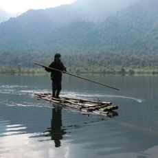
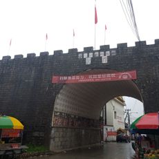
Local communities live in scattered villages and larger towns, where many people still follow farming traditions passed down through generations. Travelers visiting the markets often find handwoven textiles and carved wooden crafts made by artisans in the surrounding hills.
Visitors should check the current security situation and access permissions for different areas before traveling. The best months to visit fall during the drier season when roads and trails are easier to navigate.
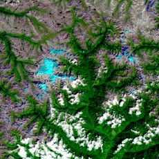
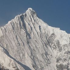
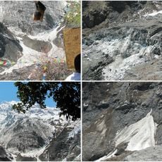
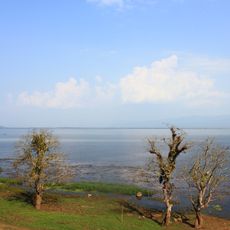
The border region with China and India includes the highest peak in Myanmar and a large natural lake that serves as a haven for migratory birds. Travelers find here one of the most remote and least visited regions in Southeast Asia.
Location: Myanmar
Inception: 1948
Capital city: Myitkyina
Elevation above the sea: 275 m
Shares border with: Arunachal Pradesh, Shan State, Yunnan, Sagaing Region, Tibet Autonomous Region
Website: https://kachinstate.gov.mm
GPS coordinates: 26.00000,97.50000
Latest update: December 13, 2025 16:39
Namdapha National Park
229.8 km
Hkakabo Razi
259.2 km
Kawagarbo
295.8 km
Three Parallel Rivers National Park
229.3 km
Kamlang Wildlife Sanctuary
213.7 km
Gamlang Razi
256.7 km
Bhismaknagar ruins
272 km
Graveyard of the National Heroes
146.2 km
Khakaborazi National Park
240.5 km
Longjiang Bridge
174.9 km
Mehao Wildlife Sanctuary
285.6 km
Fort Hertz
150.6 km
Gaoligongshan National Nature Reserve
119.4 km
Hukawng Valley Tiger Reserve
105.9 km
Mingyong Glacier
299.4 km
National GEO Park of Tengchong Volcanic and Geological
132.7 km
Sacred Heart of Jesus Church, Bahang
248.5 km
Rehai, Tengchong
150.1 km
Menghuan Pagoda
207 km
Category:Wanding Bridge
221.4 km
Indawgyi Lake Wildlife Sanctuary
151 km
Puti Temple, Mangshi
205.2 km
Bumhpa Bum
79.9 km
Hkaru Bum
143.1 km
Shweli I Dam
256.1 km
Tengchong Confucius Temple
147.4 km
Pinglu City Ruin
223.4 km
Yunyan Pagoda
152 kmVisited this place? Tap the stars to rate it and share your experience / photos with the community! Try now! You can cancel it anytime.
Discover hidden gems everywhere you go!
From secret cafés to breathtaking viewpoints, skip the crowded tourist spots and find places that match your style. Our app makes it easy with voice search, smart filtering, route optimization, and insider tips from travelers worldwide. Download now for the complete mobile experience.
A unique approach to discovering new places❞
— Le Figaro
All the places worth exploring❞
— France Info
A tailor-made excursion in just a few clicks❞
— 20 Minutes