Enable Location

We need your location to show you interesting places around you

Discover nearby places

Find interesting locations and hidden gems around you

Precise directions

Get accurate directions and distances to places

Your location is never shared with other users. It's only used when you tap the location button.

Dudipatsar Trail

Log in to your account

Start exploring — it's free

Trusted by 64,793 travelers worldwide

Continue with Google
Continue with Apple
or

We will send you a code to connect

By continuing, you accept our Terms and Conditions and our Privacy Policy

Check your inbox

We've sent a pincode in your inbox. Please enter the code below.

Dudipatsar Trail
Discussion Reviews 1 Photos
3.9k Popularity

Dudipatsar Trail, Mountain hiking trail in Mansehra District, Pakistan

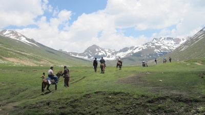
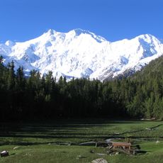
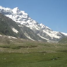
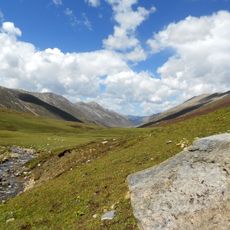
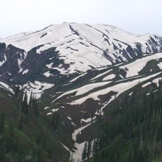
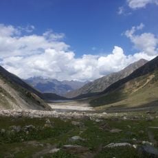
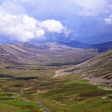
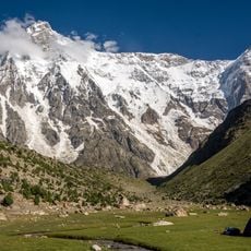
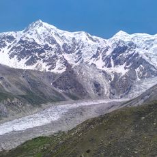
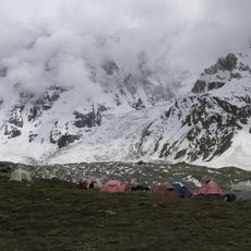
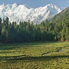
The Dudipatsar Trail is a mountain hiking route in Mansehra District that passes through alpine meadows, streams, and glaciated areas before ending at Dudipat Lake at around 3,900 meters. The path climbs from forested valleys to high alpine zones, and the landscape changes noticeably with each gain in elevation.

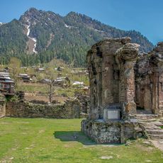
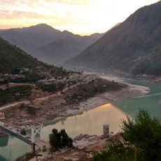
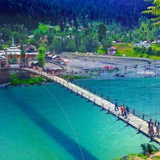
The trail follows an old route along the Poorbi Naar river, a tributary of the Kunhar, which linked mountain communities in the Kaghan Valley for many generations. This passage allowed people to travel and trade between scattered settlements that would otherwise have had little contact with each other.

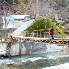
Shepherds bring their flocks to the meadows along the route each summer, and small settlements like Mulla Ki Basti come to life during the warmer months. Walking the trail means passing through this seasonal world, where the pace of life follows the rhythm of the mountains.

There are no regular buses to this remote area, so hikers need to arrange private transport from Naran to reach the trailhead. The altitude calls for careful acclimatization, and weather can shift quickly during the day, so starting early is a good idea.

Marmots live in the rocky sections of the trail and can be spotted often, especially across the open alpine meadows. The peaks surrounding the route stay snow-covered all year, so the view looking up from the lower sections feels completely different from what hikers expect at that elevation.

The community of curious travelers

AroundUs brings together thousands of curated places, local tips, and hidden gems, enriched daily by 60,000 contributors worldwide.

Start exploring
GPS coordinates
35.05220,73.93610
Latest update
March 3, 2026 14:04
Reviews
Share your experience

No review yet

Discussions
Start a discussion...

No discussion yet

« Dudipatsar Trail - Mountain hiking trail in Mansehra District, Pakistan » is provided by Around Us (aroundus.com). Images and texts are derived from Wikimedia project under a Creative Commons license. You are allowed to copy, distribute, and modify copies of this page, under the conditions set by the license, as long as this note is clearly visible.

Discover hidden gems everywhere you go!

From secret cafés to breathtaking viewpoints, skip the crowded tourist spots and find places that match your style. Our app makes it easy with voice search, smart filtering, route optimization, and insider tips from travelers worldwide. Download now for the complete mobile experience.

Around Us App Screenshot

A unique approach to discovering new places

Le Figaro

All the places worth exploring

France Info

A tailor-made excursion in just a few clicks

20 Minutes

Around Us
Travel Guide & Maps
Download

Send to your phone

QR Code
1

Open the camera app on your mobile.

2

Point at the QR code with your camera. A notification will appear.

3

Tap the notification to open the link.