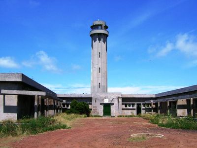
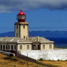
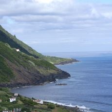
Lighthouse of Ponta dos Rosais, Maritime beacon at Ponta dos Rosais cliffs, Azores, Portugal.
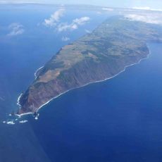
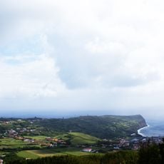
The Lighthouse of Ponta dos Rosais is a cylindrical concrete tower rising 283 meters above sea level at the northwestern tip of São Jorge Island. Supporting buildings and technical facilities surround the main structure on this exposed clifftop location.
The lighthouse was inaugurated in 1958 and represented one of the most technologically advanced navigation systems in Portugal at that time. Its construction marked a turning point in modernizing maritime facilities across the Azores.
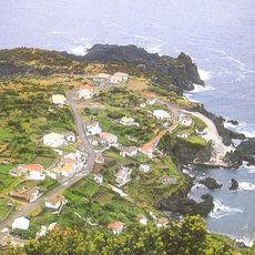
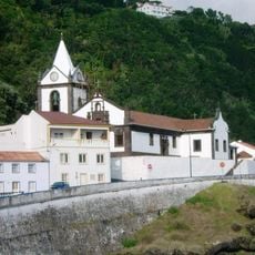
The lighthouse shapes the landscape of northwestern São Jorge and reflects the maritime heritage of the Azores. It stands as a symbol of the islands' deep connection to seafaring and ocean navigation.
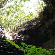
The site is difficult to reach due to its exposed clifftop location and requires sure footing and proper equipment for safety. Visitors should be prepared for changing weather conditions and maintain safe distance from the coastal edge.
The site hosts breeding colonies of roseate terns and Cory's shearwater, seabirds that animate the skies around the lighthouse. Birdwatching here is particularly rewarding because the cliffs provide natural habitats for several species.
Location: Rosais
Inception: January 1, 1958
GPS coordinates: 38.75364,-28.31156
Latest update: December 14, 2025 17:43
Mount Pico
32.6 km
Gruta das Torres
33.3 km
Landscape of the Pico Island Vineyard Culture
33.4 km
Fajã do Ouvidor
24 km
Pico da Esperança
23.6 km
Urzelina
19.1 km
Botanical Garden of Faial
36.4 km
Church of Santa Bárbara
35.7 km
Church of Santa Catarina
31 km
Ponta dos Rosais
423 m
Palacete of Pilar
35.6 km
Ribeirinha Lighthouse
30.8 km
Military Battery of Espalamaca
34.5 km
Calheta
29.6 km
Colégio dos Jesuítas da Horta e sua igreja (Santíssimo Salvador, hoje igreja matriz da Horta)
36.5 km
Cultura da Vinha-Zona Norte
25.6 km
Hermitage of São Vicente
24 km
Ermitage de Notre-Dame de Livramento
11.6 km
Fajã das Pontas
29.8 km
Miradouro da Fajã dos Cubres
30.5 km
Convento de São Francisco
12.2 km
Church of Santo António
24.4 km
Horta Breakwater Light
36.4 km
Paços do Concelho da Madalena do Pico
30.8 km
Madalena Pier Head Light
30.9 km
Câmara Municipal da Horta
36.5 km
Área de Paisagem Protegida da Cultura da Vinha - Zona Norte
25.7 km
Solar dos Noronhas, logradouros, capela e construções anexas (granel, eira e cisterna)
32 kmVisited this place? Tap the stars to rate it and share your experience / photos with the community! Try now! You can cancel it anytime.
Discover hidden gems everywhere you go!
From secret cafés to breathtaking viewpoints, skip the crowded tourist spots and find places that match your style. Our app makes it easy with voice search, smart filtering, route optimization, and insider tips from travelers worldwide. Download now for the complete mobile experience.
A unique approach to discovering new places❞
— Le Figaro
All the places worth exploring❞
— France Info
A tailor-made excursion in just a few clicks❞
— 20 Minutes