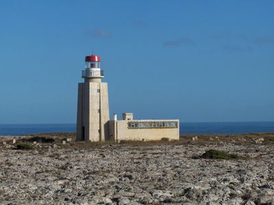
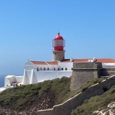
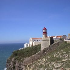
Ponta de Sagres Lighthouse, Maritime lighthouse in Sagres, Portugal.
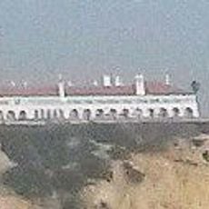
Ponta de Sagres Lighthouse is a white masonry tower with a rectangular form and an attached storage room at its base. The structure houses a lens system and has guided ships across the Atlantic for decades.
An earlier lighthouse from 1894 with a petroleum lamp once stood here before being replaced by the current structure. The new building was erected in the 1960s and has operated as a navigation aid since then.
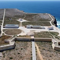
The lighthouse marks a key navigation point on Portugal's southwestern coast and shapes the look of the Fortaleza site. Visitors see a working system that has guided Atlantic shipping for decades.
The site is reached from the Fortaleza and sits at Portugal's southwestern tip. The light operates automatically and remains visible regardless of weather conditions.
The system has operated on full automation since 1983, controlled remotely from Cape St. Vincent without needing staff on site. This remote operation allows efficient navigation over vast distances.
Location: Escalos de Cima e Lousa
Inception: January 1, 1960
GPS coordinates: 36.99457,-8.94924
Latest update: December 13, 2025 17:02
Fortaleza de Sagres
704 m
E9 European long distance path
5.3 km
Cabo de São Vicente Lighthouse
5.2 km
Praia do Beliche
3.7 km
Fort of Santo António de Belixe
4.7 km
Conjunto de menires de Milrei e do Padrão
9.3 km
Fortaleza de São Vicente
5.2 km
Praia do Martinhal
3.4 km
Zavial Battery
8.6 km
Menir de Aspradantes
11.4 km
Igreja de Nossa Senhora da Graça (Sagres)
713 m
Praia da Ingrina
8.5 km
Torre de Aspa
10.1 km
Igreja matriz de Vila do Bispo
10.4 km
Forte de Nossa Senhora da Guia
2.5 km
Pousada de São Vicente
1.9 km
Praia do Tonel
1.3 km
Igreja da Raposeira
11.2 km
Câmara Municipal de Vila do Bispo
10.3 km
Posto da Guarda Fiscal, GF, de Torre de Aspa
11.2 km
Conjunto de menires de Vila do Bispo (Pedra Escorregadia; Casa do Francês; Amantes I; Amantes II; Cerro do Camacho)
8.2 km
Hotel da Baleeira
2.4 km
Posto da Guarda Fiscal, GF, de Zavial
8.5 km
Menires do Cerro do Camacho
8.2 km
Estátua do Infante D. Henrique
1.6 km
Praia da Baleeira (lapyahan, lat 37,01, long -8,93)
2.5 km
Praia da Mareta
1.5 km
Praia do Tonel (lapyahan sa Distrito de Faro)
1.3 kmVisited this place? Tap the stars to rate it and share your experience / photos with the community! Try now! You can cancel it anytime.
Discover hidden gems everywhere you go!
From secret cafés to breathtaking viewpoints, skip the crowded tourist spots and find places that match your style. Our app makes it easy with voice search, smart filtering, route optimization, and insider tips from travelers worldwide. Download now for the complete mobile experience.
A unique approach to discovering new places❞
— Le Figaro
All the places worth exploring❞
— France Info
A tailor-made excursion in just a few clicks❞
— 20 Minutes