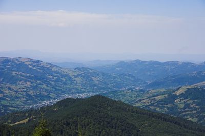
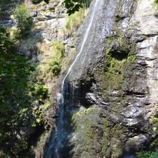
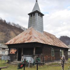
Poienile de sub Munte, village in Maramureș County, Romania
Location: Poienile de sub Munte
Elevation above the sea: 548 m
GPS coordinates: 47.81667,24.43333
Latest update: May 8, 2025 11:32
Bârsana Monastery
25.7 km
Pip Ivan
14.3 km
Maramureş Mountains Natural Park
10.5 km
Yalynskii Waterfall
19.9 km
イザの青い泉の洞窟
26 km
Hora Chyvchyn
21.4 km
Stóg
19.5 km
Vârful Farcău - Lacul Vinderelu - Vârful Mihăilecu
9 km
Saint Nicholas' wooden church in Bogdan Vodă, Maramureș
18.7 km
Farcău
11.7 km
Marmaros protected massif
16.3 km
Wooden church in Rozavlea
18 km
Archangels' wooden church in Borșa de Jos
23.9 km
Downhill wooden church of the Nativity of Mary in Ieud, Maramureș
21.8 km
Ukrainian wooden church of the Transfiguration in Poienile de sub Munte, Maramureș
525 m
Hora Petros
17.7 km
Berlebashka
17.6 km
Neniska Velyka
16.6 km
Roman Catholic church of John and Anna in Vișeu de Sus
12.2 km
Wooden church in Ruscova-Oblaz
8.2 km
Church of the Nativity of the Theotokos, Dilove
23.4 km
Szent Miklós-fatemplom (Felsőszelistye, Buleni)
19.6 km
Neniska Mała
16.4 km
Тис ягідний
18.1 km
Dovhyi Potik Natural Monument
18.1 km
Casa Martirilor de la Moisei
22 km
Веймутова сосна
21.4 km
Redyskul
24.3 kmReviews
Visited this place? Tap the stars to rate it and share your experience / photos with the community! Try now! You can cancel it anytime.
Discover hidden gems everywhere you go!
From secret cafés to breathtaking viewpoints, skip the crowded tourist spots and find places that match your style. Our app makes it easy with voice search, smart filtering, route optimization, and insider tips from travelers worldwide. Download now for the complete mobile experience.
A unique approach to discovering new places❞
— Le Figaro
All the places worth exploring❞
— France Info
A tailor-made excursion in just a few clicks❞
— 20 Minutes