Lomonosovsky District

Log in to your account

AroundUs is a community-driven map of interesting places, built by curious explorers like you. It grows with every review, story, and photo you share.
Connect to save your favorite spots, contribute locations, and create personalized routes.
By continuing, you accept our Terms and Conditions and our Privacy Policy

Lomonosovsky District

Add to collection
Map
Suggest a change
Share

Lomonosovsky District, Municipal district in Leningrad Oblast, Russia.

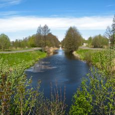
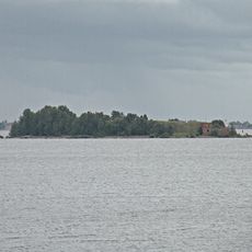
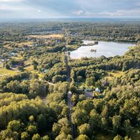
Lomonosovsky District is a municipal area in Leningrad Oblast situated between Saint Petersburg and the Gulf of Finland. The region contains agricultural and forested zones, small settlements, and is linked to the nearby city through road and railway networks.

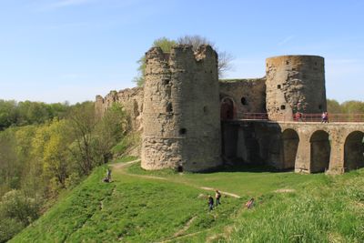
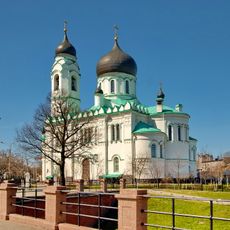
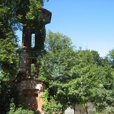
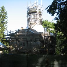
The territory was established as an administrative district in 1927, but the region's past extends much further back to Koporye Fortress from 1240. This medieval stronghold experienced centuries of conflict between Russia, Sweden, and other regional powers.

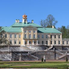
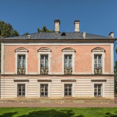
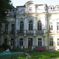
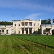
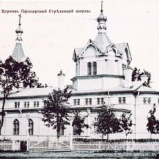
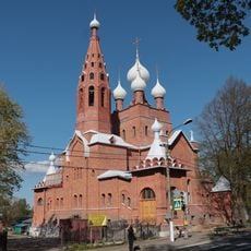
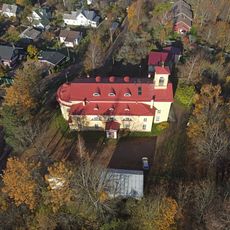
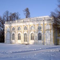
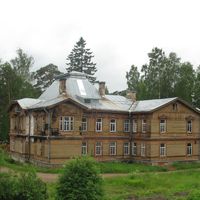
The district preserves several country estates such as Ropsha and Gostilitsy that reflect the aristocratic heritage of the region. These manor houses show how the wealthy elite lived during the Russian imperial period.

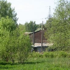
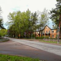
The area has a well-developed road network and train connections that make traveling to and from Saint Petersburg easier. Visitors should note that many locations in the district are sparsely populated, so it makes sense to plan ahead when exploring more remote areas.

The town of Lomonosov serves as the administrative center of the district but is under Saint Petersburg's authority rather than the district itself. This unusual arrangement reflects how some cities in Russia have special administrative status separate from their surrounding regions.

Location: Leningrad Oblast

Inception: August 1, 1927

Capital city: Lomonosov

Shares border with: Petrodvortsovy District, Gatchinsky District, Volosovsky District, Kingiseppsky District, Sosnovy Bor, Krasnoselsky District, Saint Petersburg

Website: http://lomonosovlo.ru

GPS coordinates: 59.91667,29.76667

Latest update: December 7, 2025 10:03

Photos
Around this place
Show the full map
Oranienbaum ensemble with palace
Russian Federation

Oranienbaum ensemble with palace

873 m
Giant's Head, Sergievka
Russian Federation

Giant's Head, Sergievka

4.8 km
Sergievka
Russian Federation

Sergievka

4.8 km
Chinese Palace of Russia
Russian Federation

Chinese Palace of Russia

1.5 km
Grand Menshikov Palace in Oranienbaum ‎
Russian Federation

Grand Menshikov Palace in Oranienbaum ‎

736 m
The Peterstadt fortress in Oranienbaum
Russian Federation

The Peterstadt fortress in Oranienbaum

842 m
Palace of Peter III in Oranienbaum
Russian Federation

Palace of Peter III in Oranienbaum

843 m
Private Dacha
Russian Federation

Private Dacha

5.3 km
Palace of Maximilian, Duke of Leuchtenberg (Sergievka)
Russian Federation

Palace of Maximilian, Duke of Leuchtenberg (Sergievka)

4.9 km
Michael Archangel Cathedral
Russian Federation

Michael Archangel Cathedral

94 m
Usadba Mordvinovyh
Russian Federation

Usadba Mordvinovyh

4.1 km
Spiridon Trimiphuntskiy church
Russian Federation

Spiridon Trimiphuntskiy church

363 m
Saint Seraphim of Sarov church in Peterhof
Russian Federation

Saint Seraphim of Sarov church in Peterhof

5.9 km
Holy Trinity church
Russian Federation

Holy Trinity church

5.3 km
Saint John Lutheran church (Lomonosov)
Russian Federation

Saint John Lutheran church (Lomonosov)

2.9 km
'Kamennoe zalo' pavilion
Russian Federation

'Kamennoe zalo' pavilion

1 km
Martyshkino Memorial
Russian Federation

Martyshkino Memorial

3.8 km
South Shore of Neva Gulf
Russian Federation

South Shore of Neva Gulf

5.1 km
Sea channel in Lomonosov
Russian Federation

Sea channel in Lomonosov

1.2 km
Petrovsky Bridge in Oranienbaum Park
Russian Federation

Petrovsky Bridge in Oranienbaum Park

835 m
Eleninskaya Street, 26 - Volkov mansion
Russian Federation

Eleninskaya Street, 26 - Volkov mansion

443 m
Shvedsky bridge
Russian Federation

Shvedsky bridge

88 m
Kronstadt alignment mark
Russian Federation

Kronstadt alignment mark

6.1 km
Southern battery No 1
Russian Federation

Southern battery No 1

5 km
Zubov Estate
Russian Federation

Zubov Estate

2.8 km
Upper Sea Channel range light
Russian Federation

Upper Sea Channel range light

5.8 km
Southern battery No 2 (Dzichkanetz)
Russian Federation

Southern battery No 2 (Dzichkanetz)

5.7 km
Maximov's Dacha
Russian Federation

Maximov's Dacha

1.9 km
Show the full map
Reviews

Visited this place? Tap the stars to rate it and share your experience / photos with the community! Try now! You can cancel it anytime.

« Lomonosovsky District - Municipal district in Leningrad Oblast, Russia » is provided by Around Us (aroundus.com). Images and texts are derived from Wikimedia project under a Creative Commons license. You are allowed to copy, distribute, and modify copies of this page, under the conditions set by the license, as long as this note is clearly visible.

Discover hidden gems everywhere you go!

From secret cafés to breathtaking viewpoints, skip the crowded tourist spots and find places that match your style. Our app makes it easy with voice search, smart filtering, route optimization, and insider tips from travelers worldwide. Download now for the complete mobile experience.

Around Us App Screenshot

A unique approach to discovering new places

Le Figaro

All the places worth exploring

France Info

A tailor-made excursion in just a few clicks

20 Minutes