Enable Location

We need your location to show you interesting places around you

Discover nearby places

Find interesting locations and hidden gems around you

Precise directions

Get accurate directions and distances to places

Your location is never shared with other users. It's only used when you tap the location button.

Turukhansk

Log in to your account

Start exploring — it's free

Trusted by 63,231 travelers worldwide

Continue with Google
Continue with Apple
or

We will send you a code to connect

By continuing, you accept our Terms and Conditions and our Privacy Policy

Check your inbox

We've sent a pincode in your inbox. Please enter the code below.

Turukhansk
Discussion Reviews 2 Photos
42.9k Popularity

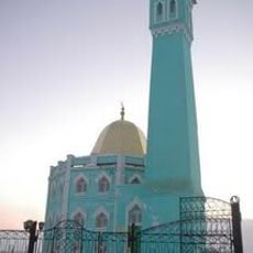
Turukhansk, Rural settlement in Krasnoyarsk Krai, Russia

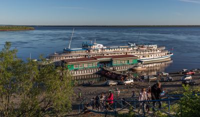
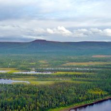
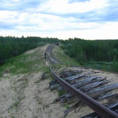
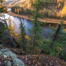
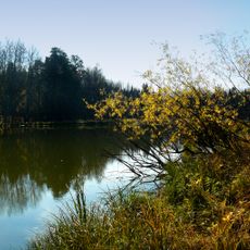
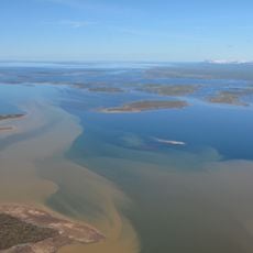
Turukhansk is a village where the Yenisey and Nizhnyaya Tunguska Rivers meet, about 1,474 kilometers north of Krasnoyarsk in northern Siberia. It functions as the administrative center of Turukhansky District and has an airport that connects the area to the rest of the region.

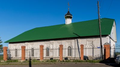
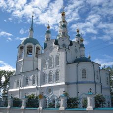
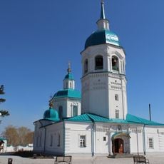
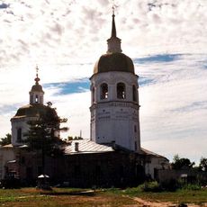
It was founded in 1607 as a winter camp and gained importance after fires destroyed Mangazeya, leading to the construction of a timber fort with cannons in 1677. This fort helped secure the region for trade and gradually drew merchants and settlers to the area.

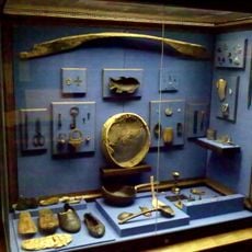
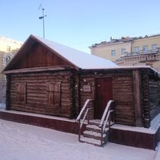
The Museum of Taiga Traditions holds regional objects and tells the story of how local ethnic groups like the Ket people lived in this remote area. You can see how communities adapted to life in northern Siberia through the artifacts on display.

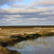
The village is difficult to reach during winter months and relies mainly on air travel for transportation. Visitors should prepare for very cold conditions and limited supplies available in the settlement.

During the 1700s, this place became one of Siberia's largest trading centers with major regional fairs that drew merchants from far away. This legacy as an important trade hub remains part of the settlement's identity today, even though modern times have changed its role.

The community of curious travelers

AroundUs brings together thousands of curated places, local tips, and hidden gems, enriched daily by 60,000 contributors worldwide.

Start exploring
Location
Turukhansky Selsoviet
Inception
1660
Elevation above the sea
7 m
GPS coordinates
65.79306,87.96222
Latest update
December 14, 2025 21:12
Around this place
Putorana Plateau
Russian Federation

Putorana Plateau

416.7 km
Salekhard–Igarka Railway
Russian Federation

Salekhard–Igarka Railway

7.9 km
Mangazeya
Russian Federation

Mangazeya

274.7 km
Putorana Nature Reserve
Russian Federation

Putorana Nature Reserve

451.2 km
Ob–Yenisei Canal
Russian Federation

Ob–Yenisei Canal

734.6 km
Lake Lama
Russian Federation

Lake Lama

420.3 km
Новопортовский мерзлотник
Russian Federation

Новопортовский мерзлотник

693 km
Nord Kamal Mosque
Russian Federation

Nord Kamal Mosque

395.1 km
Zapovednik Gydansky
Russian Federation

Zapovednik Gydansky

851.7 km
Central Siberia Nature Reserve
Russian Federation

Central Siberia Nature Reserve

439.1 km
Upper Taz Nature Reserve
Russian Federation

Upper Taz Nature Reserve

315.4 km
Krasnye Kamny
Russian Federation

Krasnye Kamny

411.2 km
First house Norilsk
Russian Federation

First house Norilsk

395.6 km
Russian Federation

Музей Сталина (Курейка)

86.1 km
Permafrost Museum
Russian Federation

Permafrost Museum

195.5 km
Turukhansk Holy Trinity Monastery
Russian Federation

Turukhansk Holy Trinity Monastery

683 m
Dormition of the Theotokos Cathedral
Russian Federation

Dormition of the Theotokos Cathedral

845.3 km
Monastyrskoye Lake
Russian Federation

Monastyrskoye Lake

849.6 km
Transfiguration monastery, Yeniseysk
Russian Federation

Transfiguration monastery, Yeniseysk

845.5 km
Great Kureika waterfall
Russian Federation

Great Kureika waterfall

391.5 km
Zotino Tall Tower Observation Facility
Russian Federation

Zotino Tall Tower Observation Facility

560.3 km
Khantayka Reservoir
Russian Federation

Khantayka Reservoir

255.3 km
Putoransky Nature Reserve
Russian Federation

Putoransky Nature Reserve

448.3 km
Church of the Exaltation of the Holy Cross in Lesosibirsk
Russian Federation

Church of the Exaltation of the Holy Cross in Lesosibirsk

873.9 km
Боганида (эвла)
Russian Federation

Боганида (эвла)

718.1 km
Category:Church of the Holy Mandylion in Kargasok
Russian Federation

Category:Church of the Holy Mandylion in Kargasok

832.6 km
Yeniseysk historic center
Russian Federation

Yeniseysk historic center

826.8 km
Мозаичное панно «Сургутская Мадонна» (Сургут)
Russian Federation

Мозаичное панно «Сургутская Мадонна» (Сургут)

871.9 km
Show the full map
Reviews
Share your experience

No review yet

Discussions
Start a discussion...

No discussion yet

« Turukhansk - Rural settlement in Krasnoyarsk Krai, Russia » is provided by Around Us (aroundus.com). Images and texts are derived from Wikimedia project under a Creative Commons license. You are allowed to copy, distribute, and modify copies of this page, under the conditions set by the license, as long as this note is clearly visible.

Discover hidden gems everywhere you go!

From secret cafés to breathtaking viewpoints, skip the crowded tourist spots and find places that match your style. Our app makes it easy with voice search, smart filtering, route optimization, and insider tips from travelers worldwide. Download now for the complete mobile experience.

Around Us App Screenshot

A unique approach to discovering new places

Le Figaro

All the places worth exploring

France Info

A tailor-made excursion in just a few clicks

20 Minutes

Around Us
Travel Guide & Maps
Download

Send to your phone

QR Code
1

Open the camera app on your mobile.

2

Point at the QR code with your camera. A notification will appear.

3

Tap the notification to open the link.