Enable Location

We need your location to show you interesting places around you

Discover nearby places

Find interesting locations and hidden gems around you

Precise directions

Get accurate directions and distances to places

Your location is never shared with other users. It's only used when you tap the location button.

Khantayka Reservoir

Log in to your account

Start exploring — it's free

Trusted by 62,355 travelers worldwide

Continue with Google
Continue with Apple
or

We will send you a code to connect

By continuing, you accept our Terms and Conditions and our Privacy Policy

Check your inbox

We've sent a pincode in your inbox. Please enter the code below.

Khantayka Reservoir

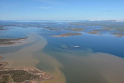
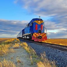
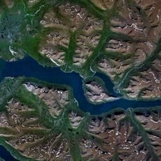
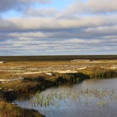
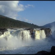
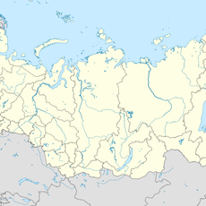
Khantayka Reservoir, reservoir in Krasnoyarsk Krai, Russia

Khantayka Reservoir is a large body of water in Krasnoyarsk Krai, Russia, created by a dam that holds back the Khantayka River. The water reaches depths of around 56 meters (184 feet) and covers a substantial area, supporting local fish populations and natural ecosystems.

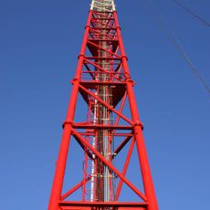
The reservoir was completed in 1970 as part of a Soviet-era effort to harness water resources for regional development. Its construction helped manage river flow and prevent flooding in downstream villages.

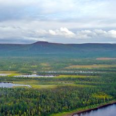
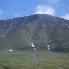
The name Khantayka connects to local river systems and the indigenous history of the region. Residents view this water body as central to their way of life, using it for fishing and spending time along its banks.

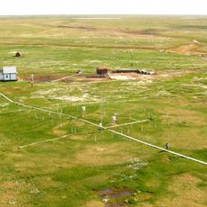
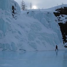
Access to the reservoir is limited since the area is quite remote with few roads leading to it. The best time to visit is during the brief summer when snow melts and the landscape becomes more accessible.

This is the northernmost reservoir of its kind in Siberia, situated in an extremely remote area where human settlement is almost nonexistent. Its existence shows how people have adapted to the Siberian landscape and harnessed water resources for economic purposes.

The community of curious travelers

AroundUs brings together thousands of curated places, local tips, and hidden gems, enriched daily by 60,000 contributors worldwide.

Start exploring
Location
Inception
1970
GPS coordinates
68.08556,87.77333
Latest update
February 9, 2026 08:20
Around this place
Putorana Plateau
Russian Federation

Putorana Plateau

235.8 km
Sabetta
Russian Federation

Sabetta

698.1 km
Salekhard–Igarka Railway
Russian Federation

Salekhard–Igarka Railway

249.2 km
Mangazeya
Russian Federation

Mangazeya

282.6 km
Taymyr Nature Reserve
Russian Federation

Taymyr Nature Reserve

729.6 km
Great Arctic State Nature Reserve
Russian Federation

Great Arctic State Nature Reserve

841.6 km
Obskaya–Bovanenkovo Line
Russian Federation

Obskaya–Bovanenkovo Line

792.1 km
Putorana Nature Reserve
Russian Federation

Putorana Nature Reserve

300.3 km
Lake Lama
Russian Federation

Lake Lama

178.7 km
Новопортовский мерзлотник
Russian Federation

Новопортовский мерзлотник

623.2 km
Nord Kamal Mosque
Russian Federation

Nord Kamal Mosque

140.8 km
Zapovednik Gydansky
Russian Federation

Zapovednik Gydansky

629.6 km
Central Siberia Nature Reserve
Russian Federation

Central Siberia Nature Reserve

694.4 km
Upper Taz Nature Reserve
Russian Federation

Upper Taz Nature Reserve

537.2 km
Krasnye Kamny
Russian Federation

Krasnye Kamny

158.3 km
First house Norilsk
Russian Federation

First house Norilsk

141.4 km
Russian Federation

Музей Сталина (Курейка)

180.7 km
Permafrost Museum
Russian Federation

Permafrost Museum

84.7 km
Turukhansk Holy Trinity Monastery
Russian Federation

Turukhansk Holy Trinity Monastery

255.6 km
Great Kureika waterfall
Russian Federation

Great Kureika waterfall

270.1 km
Харнаурды-Кеу
Russian Federation

Харнаурды-Кеу

912.1 km
Zotino Tall Tower Observation Facility
Russian Federation

Zotino Tall Tower Observation Facility

814.6 km
Popow-Station
Russian Federation

Popow-Station

868.8 km
Putoransky Nature Reserve
Russian Federation

Putoransky Nature Reserve

280.7 km
Боганида (эвла)
Russian Federation

Боганида (эвла)

507.7 km
Polar circle monument
Russian Federation

Polar circle monument

918.9 km
Здание начальной школы 501-й стройки (Салехард)
Russian Federation

Здание начальной школы 501-й стройки (Салехард)

918.9 km
Фрагмент застройки (2 объекта) (Салехард)
Russian Federation

Фрагмент застройки (2 объекта) (Салехард)

918.9 km
Show the full map
« Khantayka Reservoir - reservoir in Krasnoyarsk Krai, Russia » is provided by Around Us (aroundus.com). Images and texts are derived from Wikimedia project under a Creative Commons license. You are allowed to copy, distribute, and modify copies of this page, under the conditions set by the license, as long as this note is clearly visible.

Discover hidden gems everywhere you go!

From secret cafés to breathtaking viewpoints, skip the crowded tourist spots and find places that match your style. Our app makes it easy with voice search, smart filtering, route optimization, and insider tips from travelers worldwide. Download now for the complete mobile experience.

Around Us App Screenshot

A unique approach to discovering new places

Le Figaro

All the places worth exploring

France Info

A tailor-made excursion in just a few clicks

20 Minutes

Around Us
Travel Guide & Maps
Download

Send to your phone

QR Code
1

Open the camera app on your mobile.

2

Point at the QR code with your camera. A notification will appear.

3

Tap the notification to open the link.