Enable Location

We need your location to show you interesting places around you

Discover nearby places

Find interesting locations and hidden gems around you

Precise directions

Get accurate directions and distances to places

Your location is never shared with other users. It's only used when you tap the location button.

Lake Lama

Log in to your account

Start exploring — it's free

Trusted by 61,875 travelers worldwide

Continue with Google
Continue with Apple
or

We will send you a code to connect

By continuing, you accept our Terms and Conditions and our Privacy Policy

Check your inbox

We've sent a pincode in your inbox. Please enter the code below.

Lake Lama

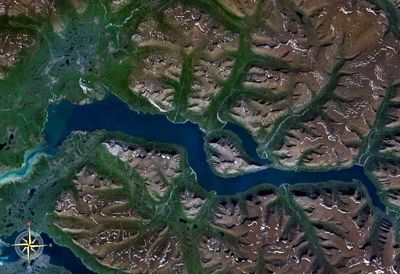
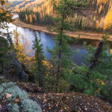
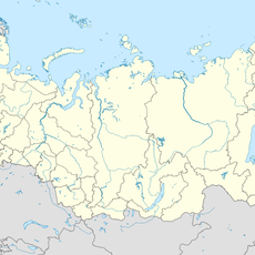
Lake Lama, Glacial lake in Taymyrsky Dolgano-Nenetsky District, Russia.

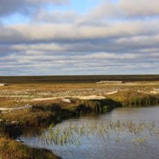
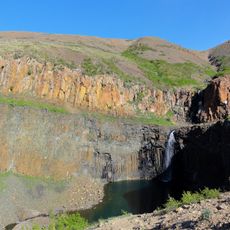
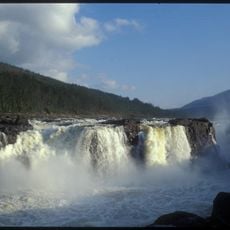
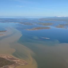
Lake Lama extends roughly 80 kilometers in length and reaches depths of up to 600 meters, making it one of the largest water bodies in northern Siberia. The water connects with several rivers and forms a complex network of bays and islands.

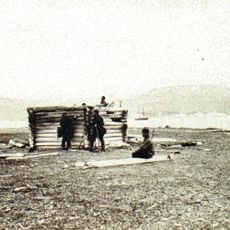
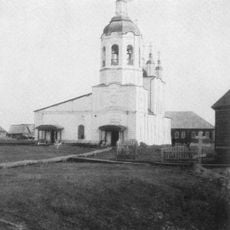
Russian scientists conducted the first comprehensive survey of the lake in the 1920s and documented its geographical features. These early expeditions laid the foundation for understanding this remote region of Siberia.

The name comes from the Tungusic word 'laamu', meaning sea or ocean, reflecting how indigenous peoples perceived this vast water body. This naming tradition shows the deep connection between the lake and the region's traditional communities.

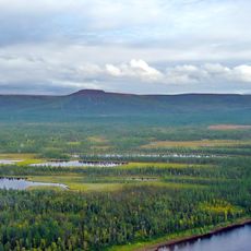
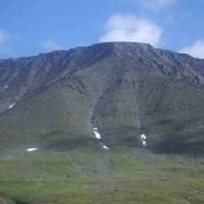
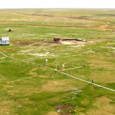
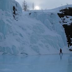
The area is remote and typically visited by experienced expedition teams who must prepare for the harsh tundra conditions. The best time to travel is during the short summer when the water is ice-free and daylight extends for many hours.

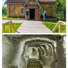
Near the lake, archaeologists found traces of ancient metalworking sites showing that people processed metal thousands of years ago. These discoveries suggest that this remote region has a longer history of human presence than often assumed.

The community of curious travelers

AroundUs brings together thousands of curated places, local tips, and hidden gems, enriched daily by 60,000 contributors worldwide.

Start exploring
Location
Taymyrsky Dolgano-Nenetsky District
GPS coordinates
69.49701,89.88808
Latest update
December 7, 2025 20:41
Around this place
Putorana Plateau
Russian Federation

Putorana Plateau

134.6 km
Sabetta
Russian Federation

Sabetta

690.2 km
Salekhard–Igarka Railway
Russian Federation

Salekhard–Igarka Railway

413.2 km
Mangazeya
Russian Federation

Mangazeya

444.6 km
Taymyr Nature Reserve
Russian Federation

Taymyr Nature Reserve

550.9 km
Great Arctic State Nature Reserve
Russian Federation

Great Arctic State Nature Reserve

674.2 km
Obskaya–Bovanenkovo Line
Russian Federation

Obskaya–Bovanenkovo Line

812 km
Putorana Nature Reserve
Russian Federation

Putorana Nature Reserve

206.5 km
Het Behouden Huys
Russian Federation

Het Behouden Huys

1022.1 km
Новопортовский мерзлотник
Russian Federation

Новопортовский мерзлотник

716.2 km
Nord Kamal Mosque
Russian Federation

Nord Kamal Mosque

68.3 km
Zapovednik Gydansky
Russian Federation

Zapovednik Gydansky

574.8 km
Central Siberia Nature Reserve
Russian Federation

Central Siberia Nature Reserve

854.6 km
Upper Taz Nature Reserve
Russian Federation

Upper Taz Nature Reserve

714.8 km
Krasnye Kamny
Russian Federation

Krasnye Kamny

53 km
First house Norilsk
Russian Federation

First house Norilsk

67.8 km
Russian Federation

Музей Сталина (Курейка)

355 km
Permafrost Museum
Russian Federation

Permafrost Museum

262.7 km
Turukhansk Holy Trinity Monastery
Russian Federation

Turukhansk Holy Trinity Monastery

420.4 km
Great Kureika waterfall
Russian Federation

Great Kureika waterfall

220.3 km
Харнаурды-Кеу
Russian Federation

Харнаурды-Кеу

990 km
Zotino Tall Tower Observation Facility
Russian Federation

Zotino Tall Tower Observation Facility

968.6 km
Khantayka Reservoir
Russian Federation

Khantayka Reservoir

178.7 km
Popow-Station
Russian Federation

Popow-Station

817 km
Putoransky Nature Reserve
Russian Federation

Putoransky Nature Reserve

175.5 km
Боганида (эвла)
Russian Federation

Боганида (эвла)

335.5 km
Polar circle monument
Russian Federation

Polar circle monument

1015.6 km
Здание начальной школы 501-й стройки (Салехард)
Russian Federation

Здание начальной школы 501-й стройки (Салехард)

1016 km
Show the full map
« Lake Lama - Glacial lake in Taymyrsky Dolgano-Nenetsky District, Russia » is provided by Around Us (aroundus.com). Images and texts are derived from Wikimedia project under a Creative Commons license. You are allowed to copy, distribute, and modify copies of this page, under the conditions set by the license, as long as this note is clearly visible.

Discover hidden gems everywhere you go!

From secret cafés to breathtaking viewpoints, skip the crowded tourist spots and find places that match your style. Our app makes it easy with voice search, smart filtering, route optimization, and insider tips from travelers worldwide. Download now for the complete mobile experience.

Around Us App Screenshot

A unique approach to discovering new places

Le Figaro

All the places worth exploring

France Info

A tailor-made excursion in just a few clicks

20 Minutes

Around Us
Travel Guide & Maps
Download

Send to your phone

QR Code
1

Open the camera app on your mobile.

2

Point at the QR code with your camera. A notification will appear.

3

Tap the notification to open the link.