Upper Taz Nature Reserve

Log in to your account

AroundUs is a community-driven map of interesting places, built by curious explorers like you. It grows with every review, story, and photo you share.
Connect to save your favorite spots, contribute locations, and create personalized routes.
Continue with Google
Continue with Apple
Continue with X
Continue with Facebook
Continue with email
By continuing, you accept our Terms and Conditions and our Privacy Policy
Create an account

Upper Taz Nature Reserve

Add to collection
Map
Suggest a change
Share

Upper Taz Nature Reserve, Nature reserve in Yamalo-Nenets Autonomous Okrug, Russia.
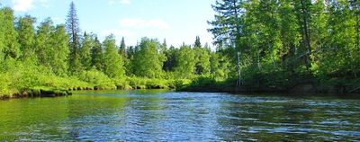
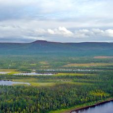
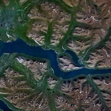
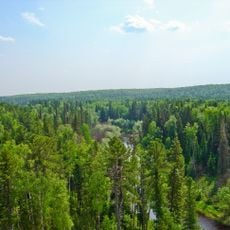
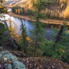
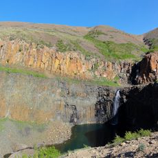
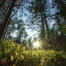
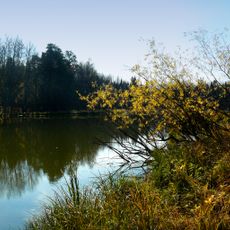
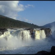
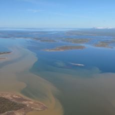
The Upper Taz Nature Reserve is a vast protected area in Arctic Russia that contains open tundra, mixed forest-tundra zones, and northern taiga spread across its landscape. Rivers wind through the terrain, creating networks of waterways alongside expanses of marshland and forested patches.

The reserve was established by the Russian government in December 1986 to protect the ecological balance and natural resources of western Siberia. This decision marked a commitment to preserving the region's wilderness and limiting extractive activities.

Indigenous Nenets people have maintained their traditional way of life here for generations, herding reindeer and fishing through the seasons. Their practices shape how the land is used and understood by those who travel through it.

Entering the reserve requires special permits, and access is limited to designated areas with authorized guides to minimize impact on wildlife. Planning a visit means arranging permissions well in advance and respecting all access restrictions.

The reserve operates under the strictest IUCN protection level, allowing natural processes to unfold without human intervention in one of the Arctic's most remote areas. Few places on Earth maintain such complete protection from industrial and human activity.

Location: Yamalo-Nenets Autonomous Okrug

Inception: December 24, 1986

Website: http://верхне-тазовский-заповедник.рус

GPS coordinates: 63.50401,84.05774

Latest update: December 9, 2025 18:48

Photos
Around this place
Putorana Plateau
Russian Federation

Putorana Plateau

729.9 km
Salekhard–Igarka Railway
Russian Federation

Salekhard–Igarka Railway

323.3 km
Mangazeya
Russian Federation

Mangazeya

364.5 km
Ob–Yenisei Canal
Russian Federation

Ob–Yenisei Canal

535.9 km
Yugra Bridge
Russian Federation

Yugra Bridge

616.2 km
Lake Lama
Russian Federation

Lake Lama

714.8 km
Новопортовский мерзлотник
Russian Federation

Новопортовский мерзлотник

691.5 km
Nord Kamal Mosque
Russian Federation

Nord Kamal Mosque

675.1 km
Yugansky Nature Reserve
Russian Federation

Yugansky Nature Reserve

656.9 km
Central Siberia Nature Reserve
Russian Federation

Central Siberia Nature Reserve

281.2 km
Krasnye Kamny
Russian Federation

Krasnye Kamny

693.9 km
First house Norilsk
Russian Federation

First house Norilsk

675.7 km
Barsova Mountain
Russian Federation

Barsova Mountain

613.4 km
Russian Federation

Музей Сталина (Курейка)

361.1 km
Permafrost Museum
Russian Federation

Permafrost Museum

456.4 km
Turukhansk Holy Trinity Monastery
Russian Federation

Turukhansk Holy Trinity Monastery

315.6 km
Dormition of the Theotokos Cathedral
Russian Federation

Dormition of the Theotokos Cathedral

711.4 km
Monastyrskoye Lake
Russian Federation

Monastyrskoye Lake

709.8 km
Transfiguration monastery, Yeniseysk
Russian Federation

Transfiguration monastery, Yeniseysk

711.7 km
Great Kureika waterfall
Russian Federation

Great Kureika waterfall

706.5 km
Zotino Tall Tower Observation Facility
Russian Federation

Zotino Tall Tower Observation Facility

407.8 km
Khantayka Reservoir
Russian Federation

Khantayka Reservoir

537.2 km
Дом Г.С. Клепикова (Сургут)
Russian Federation

Дом Г.С. Клепикова (Сургут)

604.3 km
Category:Church of the Holy Mandylion in Kargasok
Russian Federation

Category:Church of the Holy Mandylion in Kargasok

523 km
Дом, в котором с 1957 по 1961 гг. жил советский и российский геолог, первооткрыватель нефти в Сибири Ф.К. Салманов (Сургут)
Russian Federation

Дом, в котором с 1957 по 1961 гг. жил советский и российский геолог, первооткрыватель нефти в Сибири Ф.К. Салманов (Сургут)

600.6 km
Yeniseysk historic center
Russian Federation

Yeniseysk historic center

695.6 km
Церковь целителя Пантелеймона (Тундрино)
Russian Federation

Церковь целителя Пантелеймона (Тундрино)

668.2 km
Мозаичное панно «Сургутская Мадонна» (Сургут)
Russian Federation

Мозаичное панно «Сургутская Мадонна» (Сургут)

598.4 km
Show the full map
Reviews

Visited this place? Tap the stars to rate it and share your experience / photos with the community! Try now! You can cancel it anytime.

« Upper Taz Nature Reserve - Nature reserve in Yamalo-Nenets Autonomous Okrug, Russia » is provided by Around Us (aroundus.com). Images and texts are derived from Wikimedia project under a Creative Commons license. You are allowed to copy, distribute, and modify copies of this page, under the conditions set by the license, as long as this note is clearly visible.

Discover hidden gems everywhere you go!

From secret cafés to breathtaking viewpoints, skip the crowded tourist spots and find places that match your style. Our app makes it easy with voice search, smart filtering, route optimization, and insider tips from travelers worldwide. Download now for the complete mobile experience.

Around Us App Screenshot

A unique approach to discovering new places

Le Figaro

All the places worth exploring

France Info

A tailor-made excursion in just a few clicks

20 Minutes