Lake Ladoga, Freshwater lake in northwestern Russia
Lake Ladoga lies in northwestern Russia across Leningrad Oblast and Karelia, covering 17,891 km² without its roughly 660 islands. It runs 219 km from south to north, reaching 230 m deep in the northwest and only 20–70 m in the south. Its water drains to the Gulf of Finland through the single outflow, the Neva.
Viking traders used the body as part of a route between Scandinavia and Byzantium from the 8th century onward, founding settlements on the southern shore. During World War II, the frozen surface served as a supply route to besieged Leningrad, saving thousands of lives.
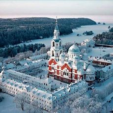
The name Ladoga first referred to a river flowing into the lower Volkhov, from a Finnic name meaning "river of the lowlands"; Norse sagas and Hanseatic treaties call the lake Aldeigja or Aldoga, and Scandinavians reached it in the early 750s, before the Slavs. The lake holds around 660 islands, including the Valaam archipelago, Kilpola and Konevets in the northwest.
The lake is navigable and forms part of the Volga–Baltic Waterway; the Ladoga Canal bypasses it in the south, linking the Neva to the Svir. The Neva, its only outflow, drains it into the Gulf of Finland. Most islands, including Valaam, Kilpola and Konevets, lie in the northwest.
Some of the islands hold abandoned villages where wooden houses still stand, left by residents after the war. Seals live in the northern bays, a rare freshwater population that can sometimes be seen sunbathing on rocks.
The community of curious travelers
AroundUs brings together thousands of curated places, local tips, and hidden gems, enriched daily by 92,163 contributors worldwide.