Enable Location

We need your location to show you interesting places around you

Discover nearby places

Find interesting locations and hidden gems around you

Precise directions

Get accurate directions and distances to places

Your location is never shared with other users. It's only used when you tap the location button.

Zyuratkul National Park

Log in to your account

Start exploring — it's free

Trusted by 62,955 travelers worldwide

Continue with Google
Continue with Apple
or

We will send you a code to connect

By continuing, you accept our Terms and Conditions and our Privacy Policy

Check your inbox

We've sent a pincode in your inbox. Please enter the code below.

Zyuratkul National Park
Discussion Reviews 1 Photos
30.2k Popularity

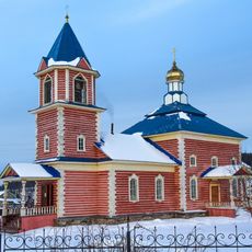
Zyuratkul National Park, National park in Chelyabinsk Oblast, Russia

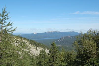
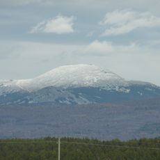
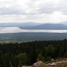
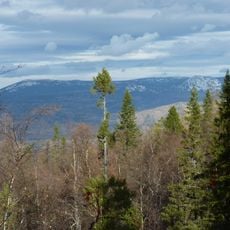
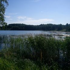
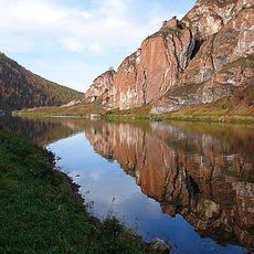
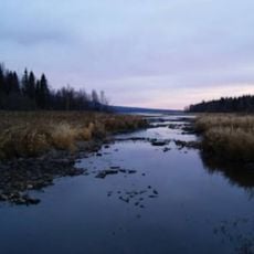
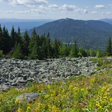
Zyuratkul National Park is a protected area in Chelyabinsk Oblast containing mountains, forests and a large mountain lake in the southern Ural range. The territory extends across forested slopes and open summits covered with grasses and low shrubs.

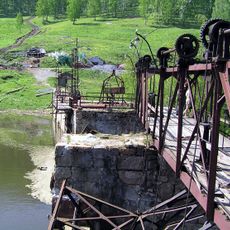
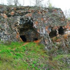
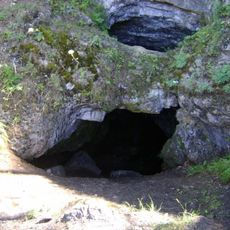
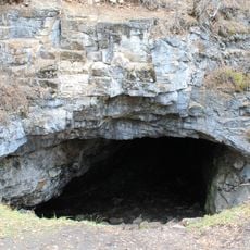
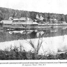
The Russian government created this protected territory in 1993 to conserve the ecosystems and geological formations of the southern Urals. Archaeologists have uncovered traces of human settlement here dating back several thousand years.

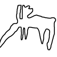
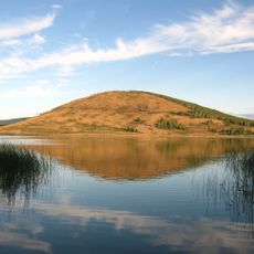
The name comes from Bashkir language and translates as 'heart lake', reflecting how local communities view this body of water at the center of the territory. Visitors today can follow trails that pass stone formations and rock carvings left by people who lived here thousands of years ago.

Entry points to the park are located near the villages of Zuratkul and Tyulyuk, where visitors can gather information about hiking routes. Weather conditions can change quickly, so carrying warm clothing and rain protection is advisable.

The lake sits at 724 meters (2375 feet) above sea level and ranks among the highest large water bodies in the Ural range. On clear days, surrounding mountain peaks reflect in the water surface, creating symmetrical images along the shoreline.

The community of curious travelers

AroundUs brings together thousands of curated places, local tips, and hidden gems, enriched daily by 60,000 contributors worldwide.

Start exploring
Inception
1993
GPS coordinates
54.84890,58.94060
Latest update
December 20, 2025 02:33
Around this place
Iremel
Russian Federation

Iremel

33.1 km
Porogi hydroelectric power plant
Russian Federation

Porogi hydroelectric power plant

49.8 km
Zyuratkul
Russian Federation

Zyuratkul

18.2 km
Russian geoglyph
Russian Federation

Russian geoglyph

19.2 km
Idrisovskaya Cave
Russian Federation

Idrisovskaya Cave

54.9 km
Laklinskaya Cave
Russian Federation

Laklinskaya Cave

47 km
Zigalga National Park
Russian Federation

Zigalga National Park

39.2 km
Башня-колокольня Иоанна Златоуста
Russian Federation

Башня-колокольня Иоанна Златоуста

56.4 km
Aushkul Lake
Russian Federation

Aushkul Lake

51.2 km
Kurgazak Cave
Russian Federation

Kurgazak Cave

35 km
Saint Seraphim of Sarov Cathedral, Zlatoust
Russian Federation

Saint Seraphim of Sarov Cathedral, Zlatoust

57.7 km
Karagaykul Lake
Russian Federation

Karagaykul Lake

46.8 km
Tyulyuk
Russian Federation

Tyulyuk

27.8 km
Stone Gate, Bashkortostan
Russian Federation

Stone Gate, Bashkortostan

54 km
Bol'shoy Kyl
Russian Federation

Bol'shoy Kyl

18 km
Златоустовский Воскресенский монастырь
Russian Federation

Златоустовский Воскресенский монастырь

44.2 km
Dva Brata
Russian Federation

Dva Brata

39 km
Museum of Khabir Galimov
Russian Federation

Museum of Khabir Galimov

55.9 km
Machine builders' palace of culture "Victory"
Russian Federation

Machine builders' palace of culture "Victory"

57.3 km
Церковь Введения во храм Пресвятой Богородицы (Тюлюк)
Russian Federation

Церковь Введения во храм Пресвятой Богородицы (Тюлюк)

28.6 km
Дом Белосельских-Белозерских (Катав-Ивановск)
Russian Federation

Дом Белосельских-Белозерских (Катав-Ивановск)

48 km
Церковь Иоанна Предтечи (Катав-Ивановск)
Russian Federation

Церковь Иоанна Предтечи (Катав-Ивановск)

48 km
Дом купцов Патриных (Усть-Катав)
Russian Federation

Дом купцов Патриных (Усть-Катав)

50.3 km
Дворец культуры вагоностроителей им. Т.Я. Белоконева (Усть-Катав)
Russian Federation

Дворец культуры вагоностроителей им. Т.Я. Белоконева (Усть-Катав)

49.9 km
Брянский мост (Усть-Катав)
Russian Federation

Брянский мост (Усть-Катав)

49.8 km
Училище высшее начальное (Сатка)
Russian Federation

Училище высшее начальное (Сатка)

22.1 km
Церковь Рождества Христова (Юрюзань)
Russian Federation

Церковь Рождества Христова (Юрюзань)

32.2 km
Serebryakov house (Yuryuzan)
Russian Federation

Serebryakov house (Yuryuzan)

33.6 km
Show the full map
Reviews
Share your experience

No review yet

Discussions
Start a discussion...

No discussion yet

« Zyuratkul National Park - National park in Chelyabinsk Oblast, Russia » is provided by Around Us (aroundus.com). Images and texts are derived from Wikimedia project under a Creative Commons license. You are allowed to copy, distribute, and modify copies of this page, under the conditions set by the license, as long as this note is clearly visible.

Discover hidden gems everywhere you go!

From secret cafés to breathtaking viewpoints, skip the crowded tourist spots and find places that match your style. Our app makes it easy with voice search, smart filtering, route optimization, and insider tips from travelers worldwide. Download now for the complete mobile experience.

Around Us App Screenshot

A unique approach to discovering new places

Le Figaro

All the places worth exploring

France Info

A tailor-made excursion in just a few clicks

20 Minutes

Around Us
Travel Guide & Maps
Download

Send to your phone

QR Code
1

Open the camera app on your mobile.

2

Point at the QR code with your camera. A notification will appear.

3

Tap the notification to open the link.