Chest opened
+${chestReward.xp} XP
Explorer
NOUVEAU ×${chestReward.collectible.quantity}
tapez pour fermer
Chest locked

Open chests in the app

Around Us is built for your phone — chests unlock when you walk, explore and capture nearby places.

Enable Location

We need your location to show you interesting places around you

Discover nearby places

Find interesting locations and hidden gems around you

Precise directions

Get accurate directions and distances to places

Your location is never shared with other users. It's only used when you tap the location button.

Irkut

Log in to your account

Start exploring — it's free

Trusted by 72,874 travelers worldwide

Continue with Google
Continue with Apple
or

We will send you a code to connect

By continuing, you accept our Terms and Conditions and our Privacy Policy

Check your inbox

We've sent a pincode in your inbox. Please enter the code below.

Irkut
Discussion Reviews 1 Photos
14.5k Popularity

Irkut, River system in Eastern Sayan Mountains, Russia.

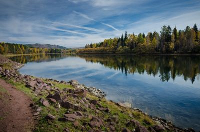
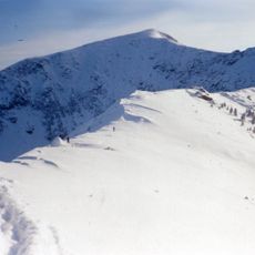
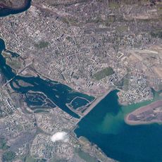
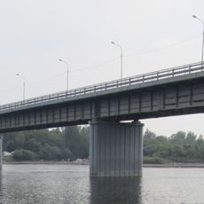
The Irkut is a river system in the Eastern Sayan Mountains that stretches about 488 kilometers through Buryatia and Irkutsk Oblast. It originates from Lake Ilchir near Munku-Sardyk peak and flows through terrain that transitions from mountains to plains.

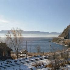
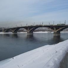
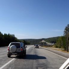
The river has served as a major transportation route since the 17th century, linking settlements across southeastern Siberia. Its waterways were crucial for connecting distant regions and shaped how the area developed.

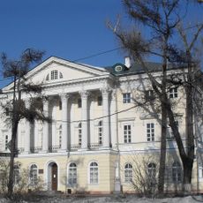
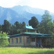
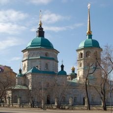
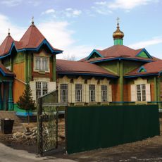
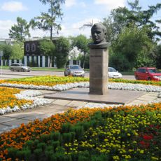
The Irkut has long been central to Buryat settlements and remains woven into their daily routines and local customs. Communities along its banks maintain deep connections to the waterway that shape how they live and work.

The waterway freezes from late October through early May, which affects local activities and travel depending on the season. Summer months offer better conditions for water-based exploration and access to surrounding areas.

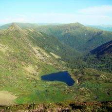
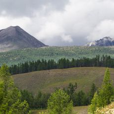
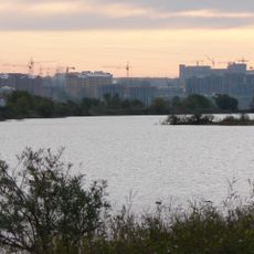
The river marks the natural boundary where the Eastern Sayan Mountains meet the Siberian plains, creating a meeting point of strikingly different landscapes. Visitors crossing this zone notice visible shifts in the land, plant life, and wildlife on either side.

The community of curious travelers

AroundUs brings together thousands of curated places, local tips, and hidden gems, enriched daily by 60,000 contributors worldwide.

Start exploring
Location
Location
GPS coordinates
51.81737,103.33972
Latest update
December 7, 2025 20:21
Around this place
Circum-Baikal Railway
Russian Federation

Circum-Baikal Railway

28.1 km
Chersky Peak
Russian Federation

Chersky Peak

39 km
Monument of Alexander III
Russian Federation

Monument of Alexander III

82 km
Irkutsk Reservoir
Russian Federation

Irkutsk Reservoir

81.9 km
Serdtse Lake
Russian Federation

Serdtse Lake

39.6 km
Tunka valley
Russian Federation

Tunka valley

67.9 km
Trud Stadium
Russian Federation

Trud Stadium

82.3 km
Glazkovsky Bridge, Irkutsk
Russian Federation

Glazkovsky Bridge, Irkutsk

82.1 km
White House, Irkutsk
Russian Federation

White House, Irkutsk

82 km
Badary RTF-32
Russian Federation

Badary RTF-32

76.3 km
Academgorodok in Irkutsk
Russian Federation

Academgorodok in Irkutsk

79.8 km
Immaculate Heart of Mary Cathedral
Russian Federation

Immaculate Heart of Mary Cathedral

80 km
Olkhinskoye plateau
Russian Federation

Olkhinskoye plateau

57 km
Radioastrophysical Observatory Badary
Russian Federation

Radioastrophysical Observatory Badary

77.4 km
Botanic Garden of the Irkutsk State University
Russian Federation

Botanic Garden of the Irkutsk State University

79.5 km
Khoymorsky datsan
Russian Federation

Khoymorsky datsan

63.4 km
Holy Trinity Church
Russian Federation

Holy Trinity Church

82.3 km
Siberian Solar Radio Telescope
Russian Federation

Siberian Solar Radio Telescope

77.4 km
Экспериментарий
Russian Federation

Экспериментарий

79.9 km
Church of Saint Nicholas in Slyudyanka
Russian Federation

Church of Saint Nicholas in Slyudyanka

31.9 km
Nikolo-Innokentyevskaya Church, Irkutsk
Russian Federation

Nikolo-Innokentyevskaya Church, Irkutsk

81.4 km
Church of Saint Gregory of Neocaesarea
Russian Federation

Church of Saint Gregory of Neocaesarea

82.3 km
Russian Federation

Якимовка

65.6 km
Temple of Saints Peter and Paul
Russian Federation

Temple of Saints Peter and Paul

66.7 km
Stadium Stroitel, Shelekhov
Russian Federation

Stadium Stroitel, Shelekhov

68.2 km
Irkutny Bridge (Bypass of Irkutsk)
Russian Federation

Irkutny Bridge (Bypass of Irkutsk)

64.4 km
Yuriy Gagarin haykali (Irkutsk)
Russian Federation

Yuriy Gagarin haykali (Irkutsk)

82.1 km
Памятник воинам-землякам, погибшим в годы Великой Отечественной войны (Аршан)
Russian Federation

Памятник воинам-землякам, погибшим в годы Великой Отечественной войны (Аршан)

63.4 km
Show the full map
Reviews
Share your experience

No review yet

Discussions
Start a discussion...

No discussion yet

« Irkut - River system in Eastern Sayan Mountains, Russia » is provided by Around Us (aroundus.com). Images and texts are derived from Wikimedia project under a Creative Commons license. You are allowed to copy, distribute, and modify copies of this page, under the conditions set by the license, as long as this note is clearly visible.

Discover hidden gems everywhere you go!

From secret cafés to breathtaking viewpoints, skip the crowded tourist spots and find places that match your style. Our app makes it easy with voice search, smart filtering, route optimization, and insider tips from travelers worldwide. Download now for the complete mobile experience.

Around Us App Screenshot

A unique approach to discovering new places

Le Figaro

All the places worth exploring

France Info

A tailor-made excursion in just a few clicks

20 Minutes

Around Us
Travel Guide & Maps
Download

Send to your phone

QR Code
1

Open the camera app on your mobile.

2

Point at the QR code with your camera. A notification will appear.

3

Tap the notification to open the link.