Enable Location

We need your location to show you interesting places around you

Discover nearby places

Find interesting locations and hidden gems around you

Precise directions

Get accurate directions and distances to places

Your location is never shared with other users. It's only used when you tap the location button.

Gunib

Log in to your account

Start exploring — it's free

Trusted by 64,828 travelers worldwide

Continue with Google
Continue with Apple
or

We will send you a code to connect

By continuing, you accept our Terms and Conditions and our Privacy Policy

Check your inbox

We've sent a pincode in your inbox. Please enter the code below.

Discussion Reviews 1 Photos
22.4k Popularity

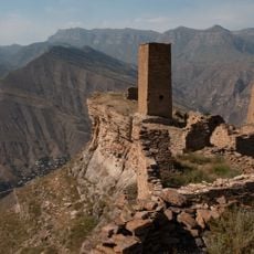
Gunib, village in Russia

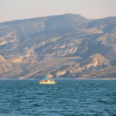
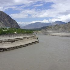
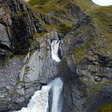
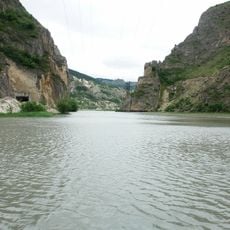
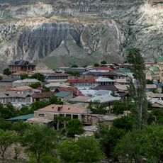
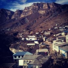
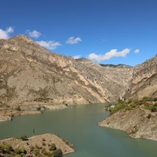
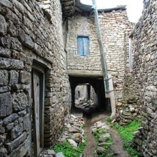
Gunib is a village set on a highland plateau in Dagestan, Russia, surrounded on most sides by steep cliffs and rocky mountain walls. The plateau rises sharply above the surrounding valleys, giving the settlement a naturally enclosed position that shapes how it looks and feels from every angle.

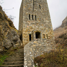
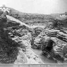
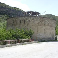
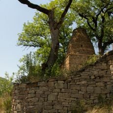
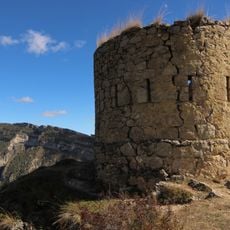
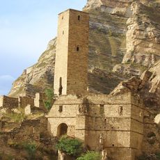
In 1859, Imam Shamil, the leader of the Caucasian resistance against Russian expansion, surrendered at Gunib after decades of conflict, bringing the long Caucasian War to a close. The site became a place of memory for both Russian and Dagestani history from that moment on.

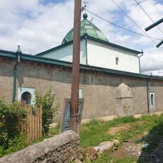
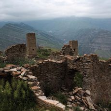
The village sits on a flat plateau edged by steep cliffs, and local life revolves around this geography in ways that are easy to observe during a walk through the area. Residents keep small gardens and orchards typical of highland Dagestani communities.

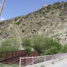
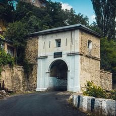
The road leading to the village winds through mountain passes that can become impassable in bad weather, so checking conditions before setting out is a good idea. Once on the plateau, paths are uneven and sometimes steep, so sturdy footwear makes the visit much easier.

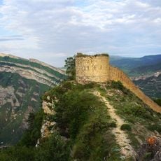
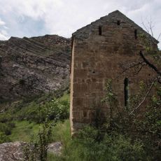
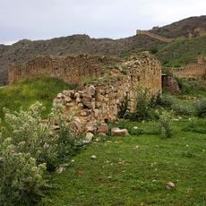
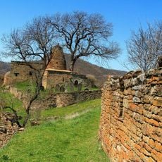
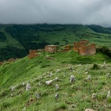
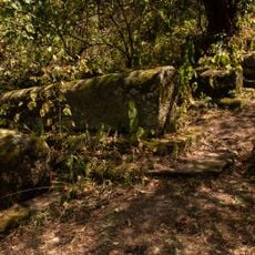
After the surrender in 1859, Russian engineers built a fortress on the plateau, and parts of those old walls are still visible today as you walk around the site. The fortress was meant to permanently hold a position that had proven almost impossible to take by force.

The community of curious travelers

AroundUs brings together thousands of curated places, local tips, and hidden gems, enriched daily by 60,000 contributors worldwide.

Start exploring
Location
Inception
12 century
Elevation above the sea
1,234 m
GPS coordinates
42.38667,46.96167
Latest update
March 3, 2026 08:22
Around this place
Gunib Fortress
Russian Federation

Gunib Fortress

714 m
Datuna Church
Russian Federation

Datuna Church

29.5 km
Chirkey Reservoir
Russian Federation

Chirkey Reservoir

64.9 km
Gimry tower
Russian Federation

Gimry tower

40.8 km
Irganai Reservoir
Russian Federation

Irganai Reservoir

32.1 km
Khunzakh Fortress
Russian Federation

Khunzakh Fortress

27.3 km
Кумухская джума-мечеть
Russian Federation

Кумухская джума-мечеть

27.3 km
Preobragenskaya Fortres
Russian Federation

Preobragenskaya Fortres

65.5 km
Vodopad Chyrkhalyu
Russian Federation

Vodopad Chyrkhalyu

43.4 km
Евгеньевское укрепление
Russian Federation

Евгеньевское укрепление

63.2 km
Gergebil Reservoir
Russian Federation

Gergebil Reservoir

8.2 km
Джума-мечеть (Кумух)
Russian Federation

Джума-мечеть (Кумух)

27.2 km
Крепостная стена (Гуниб)
Russian Federation

Крепостная стена (Гуниб)

691 m
Мечеть (Салта)
Russian Federation

Мечеть (Салта)

8.9 km
Мавзолей (Кала-Корейш)
Russian Federation

Мавзолей (Кала-Корейш)

65.5 km
Архитектурный комплекс села Амузги (Амузги)
Russian Federation

Архитектурный комплекс села Амузги (Амузги)

63.2 km
Селение Нижний Батлух (Нижний Батлух)
Russian Federation

Селение Нижний Батлух (Нижний Батлух)

37.7 km
Кладбище уцмиев (Кала-Корейш)
Russian Federation

Кладбище уцмиев (Кала-Корейш)

65.5 km
Водохранилище (Гуниб)
Russian Federation

Водохранилище (Гуниб)

4.1 km
Башня юго-западная (Нижнее Инхело)
Russian Federation

Башня юго-западная (Нижнее Инхело)

65.5 km
Селение Корода (архитектурный комплекс) (Корода)
Russian Federation

Селение Корода (архитектурный комплекс) (Корода)

11.7 km
Джума-мечеть (Кала-Корейш)
Russian Federation

Джума-мечеть (Кала-Корейш)

65.5 km
Арабское кладбище (Кара-корейш)
Russian Federation

Арабское кладбище (Кара-корейш)

65.7 km
Оборонительная сторожевая башня (Гуниб)
Russian Federation

Оборонительная сторожевая башня (Гуниб)

882 m
Верхняя боевая башня (Кахиб)
Russian Federation

Верхняя боевая башня (Кахиб)

30 km
Три Гоорские башни (Гоор)
Russian Federation

Три Гоорские башни (Гоор)

32.9 km
Селение «Гоор» (Гоор)
Russian Federation

Селение «Гоор» (Гоор)

32.8 km
Нижние ворота крепости (Гуниб)
Russian Federation

Нижние ворота крепости (Гуниб)

110 m
Show the full map
Reviews
Share your experience

No review yet

Discussions
Start a discussion...

No discussion yet

« Gunib - village in Russia » is provided by Around Us (aroundus.com). Images and texts are derived from Wikimedia project under a Creative Commons license. You are allowed to copy, distribute, and modify copies of this page, under the conditions set by the license, as long as this note is clearly visible.

Discover hidden gems everywhere you go!

From secret cafés to breathtaking viewpoints, skip the crowded tourist spots and find places that match your style. Our app makes it easy with voice search, smart filtering, route optimization, and insider tips from travelers worldwide. Download now for the complete mobile experience.

Around Us App Screenshot

A unique approach to discovering new places

Le Figaro

All the places worth exploring

France Info

A tailor-made excursion in just a few clicks

20 Minutes

Around Us
Travel Guide & Maps
Download

Send to your phone

QR Code
1

Open the camera app on your mobile.

2

Point at the QR code with your camera. A notification will appear.

3

Tap the notification to open the link.