Chest opened
+${chestReward.xp} XP
Explorer
NOUVEAU ×${chestReward.collectible.quantity}
tapez pour fermer
Chest locked

Open chests in the app

Around Us is built for your phone — chests unlock when you walk, explore and capture nearby places.

Enable Location

We need your location to show you interesting places around you

Discover nearby places

Find interesting locations and hidden gems around you

Precise directions

Get accurate directions and distances to places

Your location is never shared with other users. It's only used when you tap the location button.

Neglinnaya

Log in to your account

Start exploring — it's free

Trusted by 72,887 travelers worldwide

Continue with Google
Continue with Apple
or

We will send you a code to connect

By continuing, you accept our Terms and Conditions and our Privacy Policy

Check your inbox

We've sent a pincode in your inbox. Please enter the code below.

Neglinnaya
Discussion Reviews 1 Photos
38.8k Popularity

Neglinnaya, Subterranean river beneath central Moscow, Russia

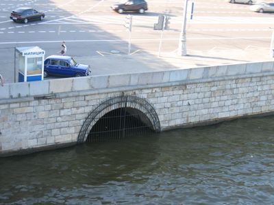
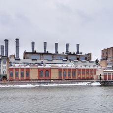
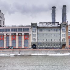
Neglinnaya is a hidden river flowing beneath Moscow's streets from the northern districts down to the Moskva River. The water travels through concrete tunnels that were constructed during the 1970s and 1980s as the city expanded over the original channel.

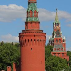
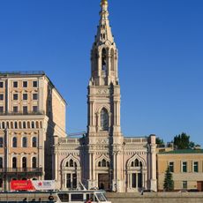
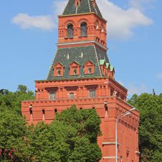
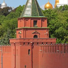
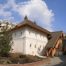
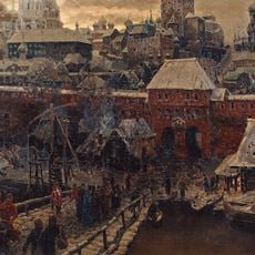
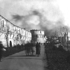
When the Moscow Kremlin was built in 1495, the river served as a natural barrier along its western fortress walls. This strategic water defense remained important until urban growth eventually forced the river underground.

The name of the waterway appears in two forms among Moscow residents, known as both Neglinnaya and Neglinka, showing how it remains part of the city's sense of place. This dual naming reflects how the hidden water shapes urban identity even though it flows out of sight.

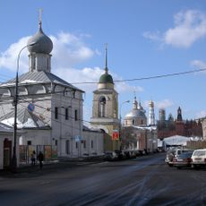
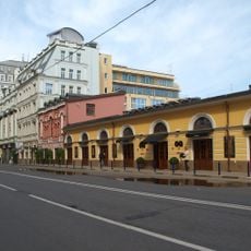
The river flows through sealed tunnels with no public access inside, though maintenance points along Tsvetnoy Boulevard mark its path above ground. Visitors can walk along the surface and discover where the underground system runs from various vantage points.

Early attempts to manage the waterway involved creating a series of connected ponds scattered across the city that served as water reserves. These ponds also provided water for firefighting before the system was eventually moved entirely underground.

The community of curious travelers

AroundUs brings together thousands of curated places, local tips, and hidden gems, enriched daily by 60,000 contributors worldwide.

Start exploring
Location
GPS coordinates
55.74972,37.62639
Latest update
December 17, 2025 09:28
Around this place
Zaryadye Park
Russian Federation

Zaryadye Park

217 m
Bolshoy Moskvoretsky Bridge
Russian Federation

Bolshoy Moskvoretsky Bridge

137 m
Eighth Sister
Russian Federation

Eighth Sister

243 m
House of the Boyars Romanov
Russian Federation

House of the Boyars Romanov

364 m
Beklemishevskaya Tower
Russian Federation

Beklemishevskaya Tower

197 m
The Old English Court
Russian Federation

The Old English Court

296 m
Zaryadye Concert Hall
Russian Federation

Zaryadye Concert Hall

364 m
Middle Trade Rows
Russian Federation

Middle Trade Rows

347 m
Saint Sophia Church, Moscow
Russian Federation

Saint Sophia Church, Moscow

364 m
Church of Anna's Conceiving in Ugol
Russian Federation

Church of Anna's Conceiving in Ugol

289 m
Church of Saint Barbara, Moscow
Russian Federation

Church of Saint Barbara, Moscow

285 m
Konstantino-Yeleninskaya Tower
Russian Federation

Konstantino-Yeleninskaya Tower

300 m
Kathedraal van de Moeder Gods van het Teken
Russian Federation

Kathedraal van de Moeder Gods van het Teken

364 m
Petrovskaya Tower
Russian Federation

Petrovskaya Tower

274 m
Church of the Theotokos of the Sign
Russian Federation

Church of the Theotokos of the Sign

333 m
Church of Saint Maximus the Confessor in Varvarka
Russian Federation

Church of Saint Maximus the Confessor in Varvarka

309 m
Church of Saint George in Endove
Russian Federation

Church of Saint George in Endove

250 m
Музей «Английское подворье»
Russian Federation

Музей «Английское подворье»

295 m
Братский корпус Знаменского монастыря
Russian Federation

Братский корпус Знаменского монастыря

366 m
Москворецкие ворота
Russian Federation

Москворецкие ворота

148 m
Николомокринская башня
Russian Federation

Николомокринская башня

37 m
Раушская набережная 10 c1
Russian Federation

Раушская набережная 10 c1

301 m
Улица Балчуг 5
Russian Federation

Улица Балчуг 5

276 m
Belltower of the church of Saint George in Endove
Russian Federation

Belltower of the church of Saint George in Endove

234 m
Колокольня (Тверской)
Russian Federation

Колокольня (Тверской)

322 m
Church of St George in Endove, main building
Russian Federation

Church of St George in Endove, main building

257 m
Раушская набережная 10 c2
Russian Federation

Раушская набережная 10 c2

353 m
Софийская набережная 34 c1
Russian Federation

Софийская набережная 34 c1

294 m
Show the full map
Reviews
Share your experience

No review yet

Discussions
Start a discussion...

No discussion yet

« Neglinnaya - Subterranean river beneath central Moscow, Russia » is provided by Around Us (aroundus.com). Images and texts are derived from Wikimedia project under a Creative Commons license. You are allowed to copy, distribute, and modify copies of this page, under the conditions set by the license, as long as this note is clearly visible.

Discover hidden gems everywhere you go!

From secret cafés to breathtaking viewpoints, skip the crowded tourist spots and find places that match your style. Our app makes it easy with voice search, smart filtering, route optimization, and insider tips from travelers worldwide. Download now for the complete mobile experience.

Around Us App Screenshot

A unique approach to discovering new places

Le Figaro

All the places worth exploring

France Info

A tailor-made excursion in just a few clicks

20 Minutes

Around Us
Travel Guide & Maps
Download

Send to your phone

QR Code
1

Open the camera app on your mobile.

2

Point at the QR code with your camera. A notification will appear.

3

Tap the notification to open the link.