Chest opened
+${chestReward.xp} XP
Explorer
NOUVEAU ×${chestReward.collectible.quantity}
tapez pour fermer
Chest locked

Open chests in the app

Around Us is built for your phone — chests unlock when you walk, explore and capture nearby places.

Enable Location

We need your location to show you interesting places around you

Discover nearby places

Find interesting locations and hidden gems around you

Precise directions

Get accurate directions and distances to places

Your location is never shared with other users. It's only used when you tap the location button.

Log in to your account

Start exploring — it's free

Trusted by 72,966 travelers worldwide

Continue with Google
Continue with Apple
or

We will send you a code to connect

By continuing, you accept our Terms and Conditions and our Privacy Policy

Check your inbox

We've sent a pincode in your inbox. Please enter the code below.

Discussion Reviews Photo
16k Popularity

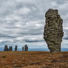
Pechora–Kama Canal, proposed canal

The Pechora-Kama Canal is a proposed Soviet engineering project designed to redirect water from northern Russian rivers toward southern regions and Central Asia. The plan involved creating a waterway to connect the Pechora River basin with the Kama River, fundamentally altering water flow patterns across a vast territory.

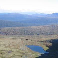
The project emerged in the 1970s as part of an ambitious Soviet effort to redirect Siberian rivers to support agriculture and water supply in Central Asia and southern regions. Soviet planners explored nuclear explosions as a construction method, notably detonating three nuclear devices in 1971 west of the Urals to create what became known as Nuclear Lake as a step toward the larger canal scheme.

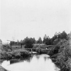
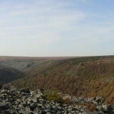
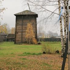
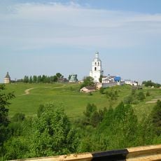
The area where the canal would have been constructed remains largely undeveloped and remote, making it difficult to access for regular visitors. Those interested in learning about the project would be better served by visiting nearby towns or regional museums that document this engineering history.

The project led to the 1971 detonation of three nuclear devices west of the Urals, creating what is now known as Nuclear Lake and leaving physical traces of this unusual Soviet engineering approach. This application of nuclear explosives for civilian construction was unprecedented at the time and was later abandoned due to safety and environmental concerns.

The community of curious travelers

AroundUs brings together thousands of curated places, local tips, and hidden gems, enriched daily by 60,000 contributors worldwide.

Start exploring
GPS coordinates
61.30583,56.59861
Latest update
February 19, 2026 23:00
Around this place
Manpupuner rock formations
Russian Federation

Manpupuner rock formations

177.2 km
North Urals
Russian Federation

North Urals

169.3 km
Otorten
Russian Federation

Otorten

158.6 km
Pechora-Ilych Nature Reserve
Russian Federation

Pechora-Ilych Nature Reserve

21.9 km
Yugyd Va National Park
Russian Federation

Yugyd Va National Park

372.1 km
Vishera Nature Reserve
Russian Federation

Vishera Nature Reserve

140.9 km
Vetlan Rock
Russian Federation

Vetlan Rock

96 km
Polyudov Kamen
Russian Federation

Polyudov Kamen

94.3 km
Northern Catherine Canal
Russian Federation

Northern Catherine Canal

85.3 km
Kvarkush
Russian Federation

Kvarkush

168.8 km
Synagogue in Yekaterinburg
Russian Federation

Synagogue in Yekaterinburg

78.6 km
Zhigalan Waterfalls
Russian Federation

Zhigalan Waterfalls

172.7 km
Ust-Borovaya Saltworks
Russian Federation

Ust-Borovaya Saltworks

177.6 km
Trinity-Stefanovsky monastery
Russian Federation

Trinity-Stefanovsky monastery

171.3 km
Cherdyn museum
Russian Federation

Cherdyn museum

100.9 km
John the Theologian monastery
Russian Federation

John the Theologian monastery

100.1 km
Lake Nyukhti
Russian Federation

Lake Nyukhti

130.2 km
Saint Nicholas Church, Nyrob
Russian Federation

Saint Nicholas Church, Nyrob

64 km
Church of the Dormition
Russian Federation

Church of the Dormition

100.9 km
Varysh Rock on the Beryozovaya River
Russian Federation

Varysh Rock on the Beryozovaya River

86.4 km
Puramunitur
Russian Federation

Puramunitur

152.2 km
Церковь Иконы Смоленской Божией Матери
Russian Federation

Церковь Иконы Смоленской Божией Матери

129.5 km
Гостиница (Ульяново)
Russian Federation

Гостиница (Ульяново)

171.3 km
Надвратная церковь архистратига Михаила (Ульяново)
Russian Federation

Надвратная церковь архистратига Михаила (Ульяново)

171.3 km
Северный братский корпус (Ульяново)
Russian Federation

Северный братский корпус (Ульяново)

171.2 km
Церковь во имя Успения Божией Матери (Ульяново)
Russian Federation

Церковь во имя Успения Божией Матери (Ульяново)

171.5 km
Юго-восточная угловая башня (Ульяново)
Russian Federation

Юго-восточная угловая башня (Ульяново)

171.1 km
Церковь-колокольня (Ульяново)
Russian Federation

Церковь-колокольня (Ульяново)

171.3 km
Show the full map
Reviews
Share your experience

No review yet

Discussions
Start a discussion...

No discussion yet

« Pechora–Kama Canal - proposed canal » is provided by Around Us (aroundus.com). Images and texts are derived from Wikimedia project under a Creative Commons license. You are allowed to copy, distribute, and modify copies of this page, under the conditions set by the license, as long as this note is clearly visible.

Discover hidden gems everywhere you go!

From secret cafés to breathtaking viewpoints, skip the crowded tourist spots and find places that match your style. Our app makes it easy with voice search, smart filtering, route optimization, and insider tips from travelers worldwide. Download now for the complete mobile experience.

Around Us App Screenshot

A unique approach to discovering new places

Le Figaro

All the places worth exploring

France Info

A tailor-made excursion in just a few clicks

20 Minutes

Around Us
Travel Guide & Maps
Download

Send to your phone

QR Code
1

Open the camera app on your mobile.

2

Point at the QR code with your camera. A notification will appear.

3

Tap the notification to open the link.