Chest opened
+${chestReward.xp} XP
Explorer
NOUVEAU ×${chestReward.collectible.quantity}
tapez pour fermer
Chest locked

Open chests in the app

Around Us is built for your phone — chests unlock when you walk, explore and capture nearby places.

Enable Location

We need your location to show you interesting places around you

Discover nearby places

Find interesting locations and hidden gems around you

Precise directions

Get accurate directions and distances to places

Your location is never shared with other users. It's only used when you tap the location button.

Log in to your account

Start exploring — it's free

Trusted by 72,961 travelers worldwide

Continue with Google
Continue with Apple
or

We will send you a code to connect

By continuing, you accept our Terms and Conditions and our Privacy Policy

Check your inbox

We've sent a pincode in your inbox. Please enter the code below.

Хор-Бутырина
Discussion Reviews Photo
1.4k Popularity

Хор-Бутырина, Rural settlement in Zalarinsky District, Russia.

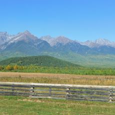
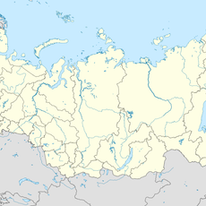
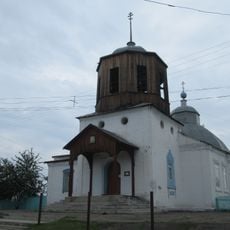
Khor-Butyrina is a small rural settlement located in the Zalarinsky District of Irkutsk Oblast in Siberia. The community is organized around a single main street that serves as the center of daily life.

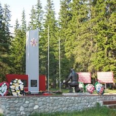
The settlement emerged as part of the Cheremshanskoye municipal formation that organized territorial divisions in Zalarinsky District. Its growth reflects the pattern of rural development typical of Siberian regions during the 20th century.

The residents of Khor-Butyrina maintain traditional rural practices while adapting to modern municipal administration systems within the Irkutsk region.

The settlement is a remote rural location that operates with basic services typical of Siberian villages. Visitors should expect limited commercial facilities and plan accordingly for the local climate conditions.

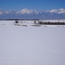
The location experiences extreme seasonal temperature variations where winters can be brutally cold and shape daily life in significant ways. This harsh climate has directly influenced how residents construct buildings and organize their routines year-round.

The community of curious travelers

AroundUs brings together thousands of curated places, local tips, and hidden gems, enriched daily by 60,000 contributors worldwide.

Start exploring
Location
Черемшанское муниципальное образование
GPS coordinates
53.34222,101.52833
Latest update
December 14, 2025 16:40
Around this place
Sayan Mountains
Russian Federation

Sayan Mountains

190.2 km
Monkh Saridag
Mongolia

Monkh Saridag

191.4 km
Venus figurines of Mal'ta
Russian Federation

Venus figurines of Mal'ta

144.5 km
Alexandrovsky Central
Russian Federation

Alexandrovsky Central

165.6 km
Tunkinsky National Park
Russian Federation

Tunkinsky National Park

189.2 km
Church of the Theotokos of Kazan
Russian Federation

Church of the Theotokos of Kazan

163.1 km
Badary RTF-32
Russian Federation

Badary RTF-32

181.4 km
Sayan Solar Observatory
Russian Federation

Sayan Solar Observatory

195.9 km
Radioastrophysical Observatory Badary
Russian Federation

Radioastrophysical Observatory Badary

182.3 km
Jermak
Russian Federation

Jermak

181 km
Khoymorsky datsan
Russian Federation

Khoymorsky datsan

170.8 km
Siberian Solar Radio Telescope
Russian Federation

Siberian Solar Radio Telescope

182.3 km
Holy Trinity church in Angarsk
Russian Federation

Holy Trinity church in Angarsk

181.4 km
Russian Federation

Бурински Дача

90.9 km
Baga-Zjombolok
Russian Federation

Baga-Zjombolok

135.4 km
Russian Federation

Якимовка

169.6 km
Большелихачевски
Russian Federation

Большелихачевски

91.7 km
Irkutny Bridge (Bypass of Irkutsk)
Russian Federation

Irkutny Bridge (Bypass of Irkutsk)

206.2 km
Большерастягаевски
Russian Federation

Большерастягаевски

79 km
Памятник политкаторжанам в Ангарске
Russian Federation

Памятник политкаторжанам в Ангарске

182.9 km
Верхнеокинский
Russian Federation

Верхнеокинский

19.6 km
Борови
Russian Federation

Борови

76.9 km
Бахвалово
Russian Federation

Бахвалово

17.7 km
Вантеевская
Russian Federation

Вантеевская

168.8 km
Участок Благодатний
Russian Federation

Участок Благодатний

34 km
Верхний
Russian Federation

Верхний

31.1 km
Памятник воинам-землякам, погибшим в годы Великой Отечественной войны (Аршан)
Russian Federation

Памятник воинам-землякам, погибшим в годы Великой Отечественной войны (Аршан)

170.1 km
Покровская церковь (Тунка)
Russian Federation

Покровская церковь (Тунка)

190.5 km
Show the full map
Reviews
Share your experience

No review yet

Discussions
Start a discussion...

No discussion yet

« Хор-Бутырина - Rural settlement in Zalarinsky District, Russia » is provided by Around Us (aroundus.com). Images and texts are derived from Wikimedia project under a Creative Commons license. You are allowed to copy, distribute, and modify copies of this page, under the conditions set by the license, as long as this note is clearly visible.

Discover hidden gems everywhere you go!

From secret cafés to breathtaking viewpoints, skip the crowded tourist spots and find places that match your style. Our app makes it easy with voice search, smart filtering, route optimization, and insider tips from travelers worldwide. Download now for the complete mobile experience.

Around Us App Screenshot

A unique approach to discovering new places

Le Figaro

All the places worth exploring

France Info

A tailor-made excursion in just a few clicks

20 Minutes

Around Us
Travel Guide & Maps
Download

Send to your phone

QR Code
1

Open the camera app on your mobile.

2

Point at the QR code with your camera. A notification will appear.

3

Tap the notification to open the link.