Enable Location

We need your location to show you interesting places around you

Discover nearby places

Find interesting locations and hidden gems around you

Precise directions

Get accurate directions and distances to places

Your location is never shared with other users. It's only used when you tap the location button.

Tunkinsky National Park

Log in to your account

Start exploring — it's free

Trusted by 66,147 travelers worldwide

Continue with Google
Continue with Apple
or

We will send you a code to connect

By continuing, you accept our Terms and Conditions and our Privacy Policy

Check your inbox

We've sent a pincode in your inbox. Please enter the code below.

Tunkinsky National Park
Discussion Reviews 1 Photos
7.1k Popularity

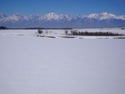
Tunkinsky National Park, National park in south central Siberia, Russia.

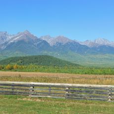
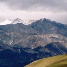
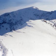
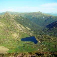
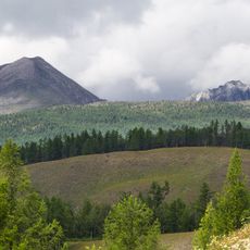
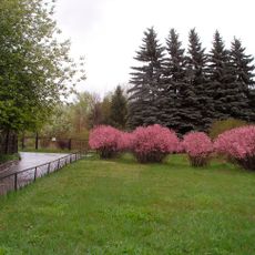
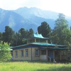
Tunkinsky National Park is a protected area in the Republic of Buryatia, southern Siberia, running along the Tunka Valley and bordered by the ridges of the Eastern Sayan mountains. The terrain shifts from forested lower slopes to open alpine meadows and rocky peaks, with thermal springs found at various points across the valley floor.

The park was established in 1991, near the end of the Soviet era, as part of a broader push to protect natural areas across Russia. The Tunka Valley had long served as a route between Buryatia and Mongolia, shaping the region's settlement patterns over many centuries.

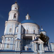
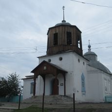
The Buryat people who live in the valley still follow Buddhist and shamanist traditions, and small temples or prayer flags can be spotted near certain springs and mountain paths. These sacred spots are woven into everyday life and are easy to notice while walking through the area.

The town of Arshan sits at the park entrance and is a good starting point, offering places to stay and eat before heading into the valley or up the mountain trails. Weather in the mountains can shift quickly, so warm layers and sturdy footwear are worth bringing regardless of the season.

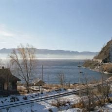
Although the park sits in one of the coldest parts of Russia, some of the thermal springs there reach temperatures above 158 degrees Fahrenheit (70 degrees Celsius). This heat comes from geological activity along fault lines connected to the same rift system that formed Lake Baikal nearby.

The community of curious travelers

AroundUs brings together thousands of curated places, local tips, and hidden gems, enriched daily by 60,000 contributors worldwide.

Start exploring
Location
Inception
June 27, 1991
GPS coordinates
51.68333,102.13333
Latest update
March 3, 2026 10:10
Around this place
Sayan Mountains
Russian Federation

Sayan Mountains

105.9 km
Circum-Baikal Railway
Russian Federation

Circum-Baikal Railway

109.7 km
Monkh Saridag
Mongolia

Monkh Saridag

106.1 km
Venus figurines of Mal'ta
Russian Federation

Venus figurines of Mal'ta

159 km
Chersky Peak
Russian Federation

Chersky Peak

104.9 km
Serdtse Lake
Russian Federation

Serdtse Lake

105 km
Church of the Theotokos of Kazan
Russian Federation

Church of the Theotokos of Kazan

156.1 km
Tunka valley
Russian Federation

Tunka valley

32.6 km
Badary RTF-32
Russian Federation

Badary RTF-32

11.9 km
Academgorodok in Irkutsk
Russian Federation

Academgorodok in Irkutsk

159.6 km
Sayan Solar Observatory
Russian Federation

Sayan Solar Observatory

84.1 km
Immaculate Heart of Mary Cathedral
Russian Federation

Immaculate Heart of Mary Cathedral

159.3 km
Olkhinskoye plateau
Russian Federation

Olkhinskoye plateau

141.2 km
Radioastrophysical Observatory Badary
Russian Federation

Radioastrophysical Observatory Badary

10.3 km
Botanic Garden of the Irkutsk State University
Russian Federation

Botanic Garden of the Irkutsk State University

158.7 km
Jermak
Russian Federation

Jermak

148.4 km
Khoymorsky datsan
Russian Federation

Khoymorsky datsan

32.3 km
Siberian Solar Radio Telescope
Russian Federation

Siberian Solar Radio Telescope

10.3 km
Holy Trinity church in Angarsk
Russian Federation

Holy Trinity church in Angarsk

151.5 km
Church of Saint Nicholas in Slyudyanka
Russian Federation

Church of Saint Nicholas in Slyudyanka

110 km
Russian Federation

Якимовка

123.2 km
Temple of Saints Peter and Paul
Russian Federation

Temple of Saints Peter and Paul

145.5 km
Stadium Stroitel, Shelekhov
Russian Federation

Stadium Stroitel, Shelekhov

147.1 km
Irkutny Bridge (Bypass of Irkutsk)
Russian Federation

Irkutny Bridge (Bypass of Irkutsk)

141.3 km
Памятник политкаторжанам в Ангарске
Russian Federation

Памятник политкаторжанам в Ангарске

154.6 km
Памятник воинам-землякам, погибшим в годы Великой Отечественной войны (Аршан)
Russian Federation

Памятник воинам-землякам, погибшим в годы Великой Отечественной войны (Аршан)

33 km
Dvorets Kultury Neftekhimik
Russian Federation

Dvorets Kultury Neftekhimik

153.5 km
Покровская церковь (Тунка)
Russian Federation

Покровская церковь (Тунка)

28.8 km
Show the full map
Reviews
Share your experience

No review yet

Discussions
Start a discussion...

No discussion yet

« Tunkinsky National Park - National park in south central Siberia, Russia » is provided by Around Us (aroundus.com). Images and texts are derived from Wikimedia project under a Creative Commons license. You are allowed to copy, distribute, and modify copies of this page, under the conditions set by the license, as long as this note is clearly visible.

Discover hidden gems everywhere you go!

From secret cafés to breathtaking viewpoints, skip the crowded tourist spots and find places that match your style. Our app makes it easy with voice search, smart filtering, route optimization, and insider tips from travelers worldwide. Download now for the complete mobile experience.

Around Us App Screenshot

A unique approach to discovering new places

Le Figaro

All the places worth exploring

France Info

A tailor-made excursion in just a few clicks

20 Minutes

Around Us
Travel Guide & Maps
Download

Send to your phone

QR Code
1

Open the camera app on your mobile.

2

Point at the QR code with your camera. A notification will appear.

3

Tap the notification to open the link.