Enable Location

We need your location to show you interesting places around you

Discover nearby places

Find interesting locations and hidden gems around you

Precise directions

Get accurate directions and distances to places

Your location is never shared with other users. It's only used when you tap the location button.

Monkh Saridag

Log in to your account

Start exploring — it's free

Trusted by 62,373 travelers worldwide

Continue with Google
Continue with Apple
or

We will send you a code to connect

By continuing, you accept our Terms and Conditions and our Privacy Policy

Check your inbox

We've sent a pincode in your inbox. Please enter the code below.

Monkh Saridag

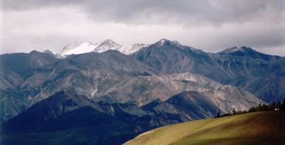
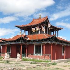
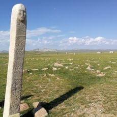
Monkh Saridag, Mountain summit in Khankh, Mongolia.

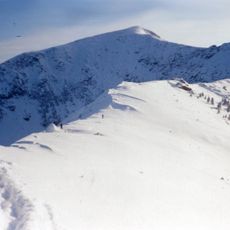
Monkh Saridag is a mountain summit in the Vostochny Sayan range, positioned at the international border where Mongolia and Russia meet. At approximately 3,500 meters (11,480 feet), the peak stands as a distinctive landmark in this remote, high-altitude region.

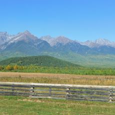
For centuries, the mountain served as a natural dividing line in this frontier region between different territories. Its prominence made it an important reference point for establishing and maintaining boundary definitions.

People from both countries today gather here for climbing expeditions and shared outdoor activities that cross the international border. The mountain serves as a meeting point where locals and visitors experience nature together regardless of nationality.

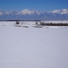
Visitors should plan to climb with local guides who know the conditions and mountain routes in this remote area. The best time to attempt the summit is during warmer months when access routes are more manageable.

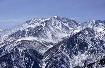
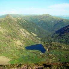
The mountain slopes display different vegetation zones on the northern and southern faces, reflecting distinct climate patterns. These contrasting plant life zones are visible to anyone climbing or observing the peak.

The community of curious travelers

AroundUs brings together thousands of curated places, local tips, and hidden gems, enriched daily by 60,000 contributors worldwide.

Start exploring
Location
Elevation above the sea
3,492 m
Part of
Vostochny Sayan
GPS coordinates
51.71883,100.59706
Latest update
December 7, 2025 10:04
Around this place
Sayan Mountains
Russian Federation

Sayan Mountains

1.3 km
Circum-Baikal Railway
Russian Federation

Circum-Baikal Railway

215.4 km
Venus figurines of Mal'ta
Russian Federation

Venus figurines of Mal'ta

234.4 km
Chersky Peak
Russian Federation

Chersky Peak

210.6 km
Serdtse Lake
Russian Federation

Serdtse Lake

210.6 km
Tunkinsky National Park
Russian Federation

Tunkinsky National Park

106.1 km
Church of the Theotokos of Kazan
Russian Federation

Church of the Theotokos of Kazan

238.9 km
Badary RTF-32
Russian Federation

Badary RTF-32

113 km
Sayan Solar Observatory
Russian Federation

Sayan Solar Observatory

24.7 km
Radioastrophysical Observatory Badary
Russian Federation

Radioastrophysical Observatory Badary

111.9 km
Jermak
Russian Federation

Jermak

238.4 km
Khoymorsky datsan
Russian Federation

Khoymorsky datsan

127.8 km
Siberian Solar Radio Telescope
Russian Federation

Siberian Solar Radio Telescope

111.9 km
Holy Trinity church in Angarsk
Russian Federation

Holy Trinity church in Angarsk

241.2 km
Church of Saint Nicholas in Slyudyanka
Russian Federation

Church of Saint Nicholas in Slyudyanka

216 km
Baga-Zjombolok
Russian Federation

Baga-Zjombolok

130.2 km
Danzandarjaa Monastery
Mongolia

Danzandarjaa Monastery

233.7 km
Russian Federation

Якимовка

213.1 km
Irkutny Bridge (Bypass of Irkutsk)
Russian Federation

Irkutny Bridge (Bypass of Irkutsk)

239.5 km
Верхнеокинский
Russian Federation

Верхнеокинский

200.4 km
Бахвалово
Russian Federation

Бахвалово

190.8 km
Участок Благодатний
Russian Federation

Участок Благодатний

219.2 km
Верхний
Russian Federation

Верхний

214 km
Памятник воинам-землякам, погибшим в годы Великой Отечественной войны (Аршан)
Russian Federation

Памятник воинам-землякам, погибшим в годы Великой Отечественной войны (Аршан)

128.1 km
Покровская церковь (Тунка)
Russian Federation

Покровская церковь (Тунка)

134 km
Dvorets Kultury Neftekhimik
Russian Federation

Dvorets Kultury Neftekhimik

242.9 km
Irkutsk historical center
Russian Federation

Irkutsk historical center

169.2 km
Uushigiin Uver
Mongolia

Uushigiin Uver

234.4 km
Show the full map
« Monkh Saridag - Mountain summit in Khankh, Mongolia » is provided by Around Us (aroundus.com). Images and texts are derived from Wikimedia project under a Creative Commons license. You are allowed to copy, distribute, and modify copies of this page, under the conditions set by the license, as long as this note is clearly visible.

Discover hidden gems everywhere you go!

From secret cafés to breathtaking viewpoints, skip the crowded tourist spots and find places that match your style. Our app makes it easy with voice search, smart filtering, route optimization, and insider tips from travelers worldwide. Download now for the complete mobile experience.

Around Us App Screenshot

A unique approach to discovering new places

Le Figaro

All the places worth exploring

France Info

A tailor-made excursion in just a few clicks

20 Minutes

Around Us
Travel Guide & Maps
Download

Send to your phone

QR Code
1

Open the camera app on your mobile.

2

Point at the QR code with your camera. A notification will appear.

3

Tap the notification to open the link.