Wadi Hanifa, Wadi in Riyadh Province, Saudi Arabia
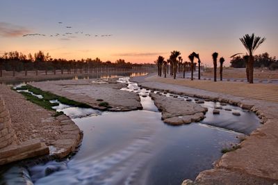
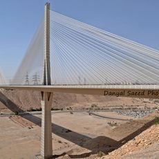
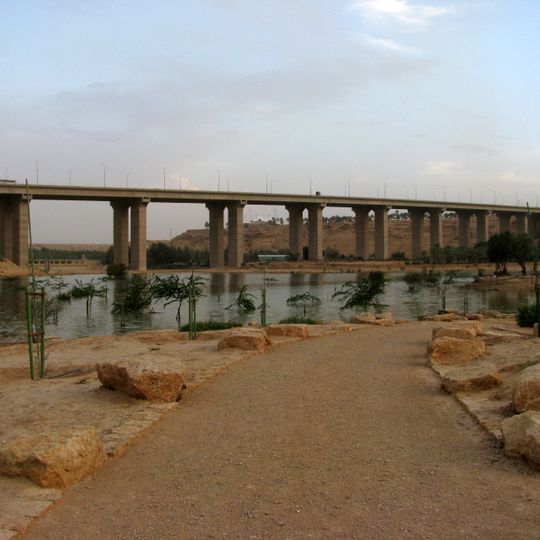
Wadi Hanifa is a seasonal river valley running about 120 km from northwest to southeast through Riyadh Province and the city of Riyadh. Its channel descends from the Al-Haisiya heights to Al-Hayer and drains roughly 4,000 square kilometres through more than 40 tributaries. The bed lies 10 to 100 m below its edges and is 100 to 1,000 m wide; a long concrete bridge on slab piers crosses the green water, with bare rocky ground and a sandy path beside it.
Wadi Hanifa was called al-Irdh in ancient times, as recorded by Yaqut al-Hamawi and al-Hamdani; the name Hanifa comes from the Banu Hanifa tribe that settled there before Islam. The first and second Saudi states built their capitals on its banks, at Diriyah and then Riyadh. In 1408 AH the Royal Commission for Riyadh City declared the valley a protected environmental and development zone, and in 1423 AH it adopted a comprehensive development plan.
The name comes from the Banu Hanifa, the main Arab tribe in the area at the time of the Islamic conquest of Arabia; before that the valley was called al-Irdh. The capitals of the first and second Saudi states, Diriyah and then Riyadh, were built on its banks. Six open parks along the valley are planted with tamarisk, acacia and Vachellia tortilis.
The valley is easy to reach from Riyadh by car, with several entry points along its length. Visitors can park near the main recreational areas and walk along the paved paths that follow the water channel.
The valley's water is cleaned by a bio-treatment plant built on a weir system, which aerates the flow to raise its oxygen level and remove pollution. Six open parks line the banks, planted with tamarisk, acacia and Vachellia tortilis.
The community of curious travelers
AroundUs brings together thousands of curated places, local tips, and hidden gems, enriched daily by 94,705 contributors worldwide.