Wielicka Próba

Log in to your account

AroundUs is a community-driven map of interesting places, built by curious explorers like you. It grows with every review, story, and photo you share.
Connect to save your favorite spots, contribute locations, and create personalized routes.
Continue with Google
Continue with Apple
Continue with X
Continue with Facebook
Continue with email
By continuing, you accept our Terms and Conditions and our Privacy Policy
Create an account

Wielicka Próba

Add to collection
Map
Suggest a change
Share

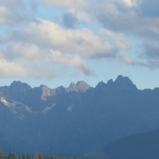
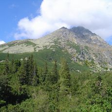
Wielicka Próba, Mountain trail segment in High Tatras, Slovakia.

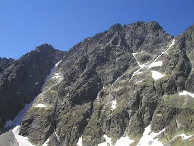
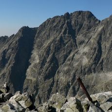
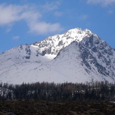
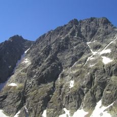
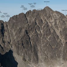
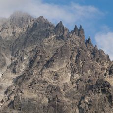
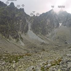
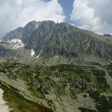
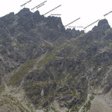
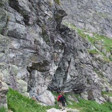
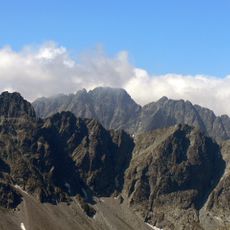
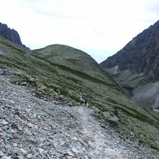
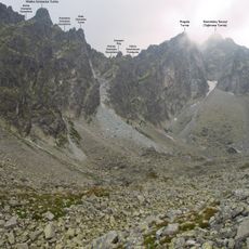
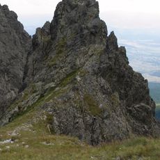
Wielicka Próba is a steep rock passage in the High Tatras at roughly 1980 meters elevation that climbers use to reach Gerlachspitze summit. The section requires technical rock scrambling across exposed terrain with metal handholds and clamps for grip and balance.

The route was first documented on August 31, 1874, when climbers Mór Déchy and Anton Döller completed the ascent with their group. This passage became an established climbing route in the Slovak Tatras from that time onward.

The trail marks a traditional mountaineering passage in the Slovak Tatras, requiring skilled navigation and adherence to local climbing regulations.

Access to this section requires a certified mountain guide, as independent climbing is not permitted without special authorization and mountaineering club membership. Check current conditions and forecasts ahead of time, as weather can shift rapidly at this elevation.

The only climbing aids remaining on this passage are metal clamps and pegs, following the mysterious disappearance of support chains in 2004. This unexplained event still shapes climbers' experience of the route today.

Location: Poprad District

Elevation above the sea: 1,980 m

GPS coordinates: 49.16030,20.14610

Latest update: December 14, 2025 13:06

Photos
Reviews

Visited this place? Tap the stars to rate it and share your experience / photos with the community! Try now! You can cancel it anytime.

« Wielicka Próba - Mountain trail segment in High Tatras, Slovakia » is provided by Around Us (aroundus.com). Images and texts are derived from Wikimedia project under a Creative Commons license. You are allowed to copy, distribute, and modify copies of this page, under the conditions set by the license, as long as this note is clearly visible.

Discover hidden gems everywhere you go!

From secret cafés to breathtaking viewpoints, skip the crowded tourist spots and find places that match your style. Our app makes it easy with voice search, smart filtering, route optimization, and insider tips from travelers worldwide. Download now for the complete mobile experience.

Around Us App Screenshot

A unique approach to discovering new places

Le Figaro

All the places worth exploring

France Info

A tailor-made excursion in just a few clicks

20 Minutes