Batyżowiecka Próba

Log in to your account

AroundUs is a community-driven map of interesting places, built by curious explorers like you. It grows with every review, story, and photo you share.
Connect to save your favorite spots, contribute locations, and create personalized routes.
Continue with Google
Continue with Apple
Continue with X
Continue with Facebook
Continue with email
By continuing, you accept our Terms and Conditions and our Privacy Policy
Create an account

Batyżowiecka Próba

Add to collection
Map
Suggest a change
Share

Batyżowiecka Próba, Mountain hiking trail in High Tatras, Slovakia.

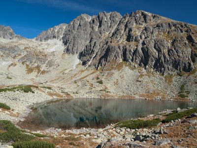
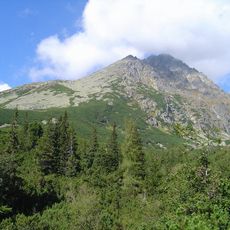
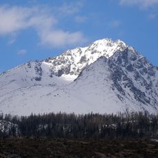
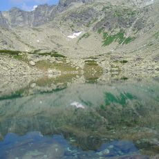
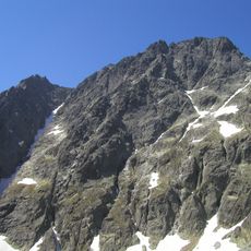
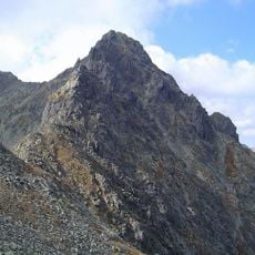
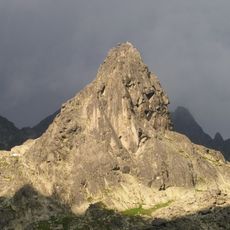
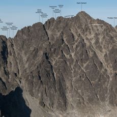
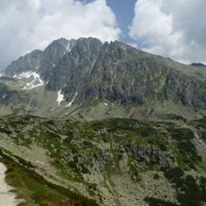
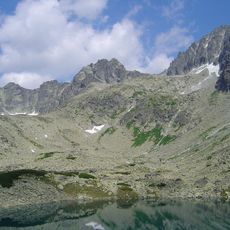
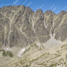
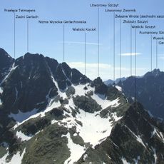
Batyżowiecka Próba is a mountain hiking trail in the High Tatras that runs from Vysne Hagy to Gerlach peak over roughly 13 kilometers. The route follows steep rocky sections with exposed climbing and descent segments.

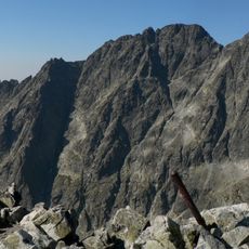
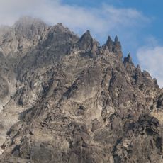
The route was first traveled in 1875 by mountain guides Ján Pastrnák and Ján Ruman Driečny junior, who established it as a climbing path. In 1880, metal brackets and chains were installed along the route to improve safety for climbers.

The name Próba means test in Slovak, referring to a climbing assessment that mountaineers had to pass before attempting the summit. This naming tradition reflects how challenging routes were used to mark progress in mountaineering skill.

The route takes a full day to complete and requires solid physical fitness; hikers should come with good shoes and proper equipment. Weather conditions can change quickly in the mountains, so starting early and checking forecasts beforehand is important.

The route is known for its metal fixtures that were installed in the 1880s to help climbers grip the rock. These early safety improvements show how mountaineers of that era worked to make challenging passages more manageable.

GPS coordinates: 49.16030,20.13140

Latest update: December 14, 2025 11:25

Photos
Reviews

Visited this place? Tap the stars to rate it and share your experience / photos with the community! Try now! You can cancel it anytime.

« Batyżowiecka Próba - Mountain hiking trail in High Tatras, Slovakia » is provided by Around Us (aroundus.com). Images and texts are derived from Wikimedia project under a Creative Commons license. You are allowed to copy, distribute, and modify copies of this page, under the conditions set by the license, as long as this note is clearly visible.

Discover hidden gems everywhere you go!

From secret cafés to breathtaking viewpoints, skip the crowded tourist spots and find places that match your style. Our app makes it easy with voice search, smart filtering, route optimization, and insider tips from travelers worldwide. Download now for the complete mobile experience.

Around Us App Screenshot

A unique approach to discovering new places

Le Figaro

All the places worth exploring

France Info

A tailor-made excursion in just a few clicks

20 Minutes