Enable Location

We need your location to show you interesting places around you

Discover nearby places

Find interesting locations and hidden gems around you

Precise directions

Get accurate directions and distances to places

Your location is never shared with other users. It's only used when you tap the location button.

Zadný Gerlach

Log in to your account

Start exploring — it's free

Trusted by 62,074 travelers worldwide

Continue with Google
Continue with Apple
or

We will send you a code to connect

By continuing, you accept our Terms and Conditions and our Privacy Policy

Check your inbox

We've sent a pincode in your inbox. Please enter the code below.

Zadný Gerlach

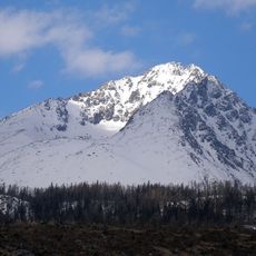
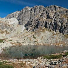
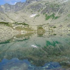
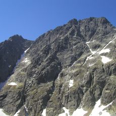
Zadný Gerlach, Granite summit in High Tatras, Slovakia.

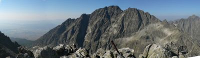
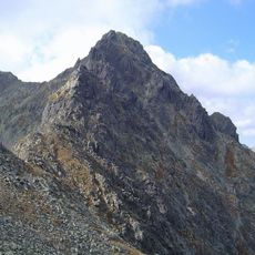
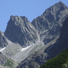
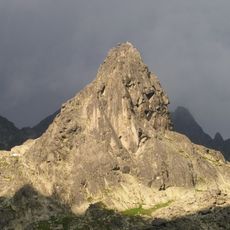
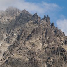
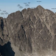
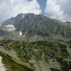
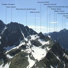
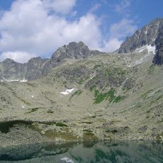
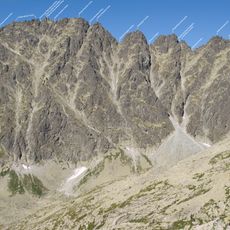
Zadný Gerlach is a granite summit in the High Tatras rising to about 2600 meters, featuring three distinct peaks that form a triangular outline along the main ridge. The mountain displays the exposed rocky formations typical of this alpine zone.

The first documented ascent took place in 1895 when mountaineer Janusz Chmielowski and guide Jedrzej Wala reached the summit. The peak later lost its designation as Poland's highest mountain following border changes in the region.

For centuries, this peak served as a boundary marker between Poland and Hungary, shaping how local communities understood their territories and borders. The mountain remains part of their shared heritage and collective memory.

Access requires authorization from TANAP authorities, and climbers can only use designated routes between mid-July and late October. This restriction exists because the peak sits within a protected national park zone.

A Soviet military aircraft crashed near the peak in 1944, leaving an unexpected mark on the mountain's story. A memorial plate at a nearby symbolic cemetery honors those who died in the incident.

The community of curious travelers

AroundUs brings together thousands of curated places, local tips, and hidden gems, enriched daily by 60,000 contributors worldwide.

Start exploring
Location
Elevation above the sea
2,616 m
Made from material
granite
Part of
Vysoké Tatry
GPS coordinates
49.16623,20.13148
Latest update
December 11, 2025 18:10
« Zadný Gerlach - Granite summit in High Tatras, Slovakia » is provided by Around Us (aroundus.com). Images and texts are derived from Wikimedia project under a Creative Commons license. You are allowed to copy, distribute, and modify copies of this page, under the conditions set by the license, as long as this note is clearly visible.

Discover hidden gems everywhere you go!

From secret cafés to breathtaking viewpoints, skip the crowded tourist spots and find places that match your style. Our app makes it easy with voice search, smart filtering, route optimization, and insider tips from travelers worldwide. Download now for the complete mobile experience.

Around Us App Screenshot

A unique approach to discovering new places

Le Figaro

All the places worth exploring

France Info

A tailor-made excursion in just a few clicks

20 Minutes

Around Us
Travel Guide & Maps
Download

Send to your phone

QR Code
1

Open the camera app on your mobile.

2

Point at the QR code with your camera. A notification will appear.

3

Tap the notification to open the link.