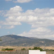
Djebel Serj, Mountain range and nature reserve in central Tunisia.
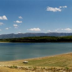
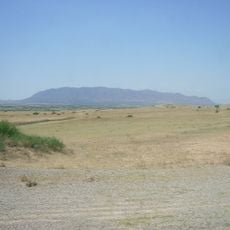
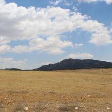
Djebel Serj is a limestone mountain range in central Tunisia with peaks reaching about 1357 meters high, spanning roughly 20 kilometers. The northern slopes contain wadis that channel water to a dam system supplying the surrounding area.
The mountain was designated as a protected area in 2010, safeguarding about 17.2 square kilometers between Siliana and Kairouan governorates. This protected status recognized the ecological importance of the mountain to the region.
The mountain takes its name from its shape, which resembles a traditional saddle and reflects the Arabic word 'serj'. This naming reveals how local people perceive and describe the landscape in their daily lives.
The mountain is most accessible during cooler months when heat is less intense and hiking becomes easier. Visitors should bring plenty of water and wear sturdy footwear to navigate safely on the uneven limestone slopes.
The mountain contains several cave systems, including Ain Dhab cave, which holds significance for speleological research in North Africa. These underground chambers attract researchers studying the geological history and ecosystem of the region.
Location: Kairouan Governorate
Location: Siliana Governorate
Elevation above the sea: 1,357 m
Made from material: limestone
GPS coordinates: 35.93670,9.54972
Latest update: December 12, 2025 12:06
Siliana
17.7 km
Mactaris
32.3 km
Arch of Trajan
32.2 km
Djebel Bargou
14.7 km
Jebel Serj National Park
0 m
Djebel Ousselat
23.5 km
Abthugni
51.2 km
Assuras
48.6 km
El Haouareb Dam
44.5 km
Large southern thermae
32.2 km
Aggar
43.9 km
Stade Hamda-Laouani
54.9 km
Dolmens of Eles
40.8 km
Jebel Zaghdoud National Park
21.3 km
Chusira
21.5 km
Sers church
50 km
Saint Anne Church (Gaafour)
47.7 km
Église du Mont-Carmel du djebel Trozza
44 km
Bridge over the Oued Cherchira
42.2 km
El Aroussa church
50.2 km
Kesra Traditional Heritage Museum
21.4 km
Ancient Roman temples in Oum El Abouab
32.6 km
Maktar amphitheatre
32.3 km
Byzantine fortress of Ksar Lemsa
16.9 km
Pyramidal mausoleum of Maktar
32.7 km
Bab El Ain
32.3 km
Mégalithes
32.4 km
Aqueduc qui amenait les eaux de la source de Souk el Djemaa
33.1 kmVisited this place? Tap the stars to rate it and share your experience / photos with the community! Try now! You can cancel it anytime.
Discover hidden gems everywhere you go!
From secret cafés to breathtaking viewpoints, skip the crowded tourist spots and find places that match your style. Our app makes it easy with voice search, smart filtering, route optimization, and insider tips from travelers worldwide. Download now for the complete mobile experience.
A unique approach to discovering new places❞
— Le Figaro
All the places worth exploring❞
— France Info
A tailor-made excursion in just a few clicks❞
— 20 Minutes