Donets-Donbas Canal, Water canal in Donetsk Oblast, Ukraine.
The Donets-Donbas Canal runs 133.4 km from the Siverskyi Donets near Raigorodok to the Verkhnekalmius reservoir south of Yasynuvata. Only 107 km is an open trapezoidal channel (bottom 2–4 m, surface 30–40 m, depth 6–30 m); the remaining 26.4 km crosses rivers, railways and ravines in pipes over 2 m in diameter. Four pumping stations lift water about 200 m onto the Donets Ridge.
The canal was built in the 1950s to supply water to the rapidly growing industrial region of Donbas during Soviet development. This project was a major infrastructure undertaking designed to support the region's expanding factories and urban centers.
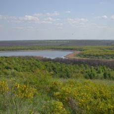
The canal's name links the Siverskyi Donets river, its source, with the Donbas industrial region it supplies. Its route ends at the Verkhno-Kalmius reservoir near the source of the Kalmius river. Five reserve reservoirs along the course — Karlivske, Volyntsivske, Artemivske, Horlivske and Verkhno-Kalmiuske — hold 64 million m³ for emergencies.
The canal runs 133.4 km from near Raihorodok to the Verkhnokalmius reservoir south of Yasynuvata; only 107 km is an open trapezoidal channel, the rest crosses rivers and ravines in pipes. Four pumping stations lift the water about 200 m onto the Donets Ridge, and five reserve reservoirs (Karlivske, Volyntsivske, Artemivske, Horlivske, Verkhno-Kalmiuske) hold 64 million m³. The current is about 0.8 m/s.
Only 107 km of the 133.4 km route is an open trapezoidal channel; the remaining 26.4 km runs through pipe bridges (ducers) of 2–3 pipes over 2 m in diameter crossing two rivers, a railway line and deep ravines. Four pumping stations lift water about 200 m onto the Donets Ridge, and five reserve reservoirs hold 64 million m³.
The community of curious travelers
AroundUs brings together thousands of curated places, local tips, and hidden gems, enriched daily by 93,480 contributors worldwide.