Enable Location

We need your location to show you interesting places around you

Discover nearby places

Find interesting locations and hidden gems around you

Precise directions

Get accurate directions and distances to places

Your location is never shared with other users. It's only used when you tap the location button.

Renville County

Log in to your account

Start exploring — it's free

Trusted by 61,367 travelers worldwide

Continue with Google
Continue with Apple
or

We will send you a code to connect

By continuing, you accept our Terms and Conditions and our Privacy Policy

Check your inbox

We've sent a pincode in your inbox. Please enter the code below.

Renville County, County administrative division in Southern Minnesota, United States

Description

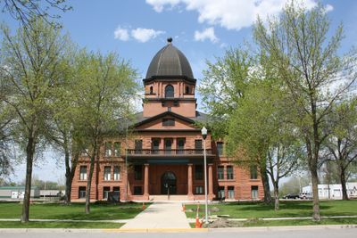
Renville County is an administrative division in southern Minnesota with 27 townships and 10 cities, with Olivia serving as the county seat. Five elected commissioners represent different districts and oversee county services and management.

History

The Minnesota Legislature created this county in 1855, but it was not formally organized until 1866, following the Dakota conflict. This delayed organization reflected broader changes happening across the state at that time.

Culture

The county is named after Joseph Renville, a fur trader who brought new farming methods to the region and worked as a translator between communities. His influence shaped how the area developed and how different groups lived together.

Practical

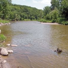
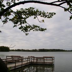
The area is known for lakes, rivers, and farmland that are easily accessible from Olivia, the main town. Visitors can find recreational areas and outdoor spaces suited for different activities throughout the county.

Did you know?

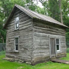
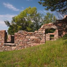
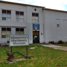
The area has deep roots in farming that remain visible in the landscape and daily life today. This agricultural heritage is woven into how locals use and value the land.

Location
Inception
February 20, 1855
Capital city
Olivia
Shares border with
Kandiyohi County, Chippewa County, Redwood County, Meeker County, McLeod County, Sibley County, Nicollet County, Brown County, Yellow Medicine County
GPS coordinates
44.72000,-94.96000
Latest update
December 7, 2025 20:25

AroundUs brings together thousands of curated places, local tips, and hidden gems, enriched daily by 60,000 contributors worldwide. Discover all places nearby (Minnesota).

Around this place
Hermann Heights Monument
United States of America

Hermann Heights Monument

60.1 km
Fort Ridgely
United States of America

Fort Ridgely

35 km
Flandrau State Park
United States of America

Flandrau State Park

61.6 km
Fort Ridgely State Park
United States of America

Fort Ridgely State Park

35.2 km
Upper Sioux Agency State Park
United States of America

Upper Sioux Agency State Park

39.3 km
Andrew John Volstead House
United States of America

Andrew John Volstead House

46.9 km
Greenleaf Lake State Recreation Area
United States of America

Greenleaf Lake State Recreation Area

51 km
Renville County Courthouse and Jail
United States of America

Renville County Courthouse and Jail

6.5 km
Redwood County Poor Farm
United States of America

Redwood County Poor Farm

23.9 km
Endreson Cabin
United States of America

Endreson Cabin

52.9 km
Sacred Heart Public School
United States of America

Sacred Heart Public School

31.7 km
Merton S. Goodnow House
United States of America

Merton S. Goodnow House

50.2 km
Gibbon Village Hall
United States of America

Gibbon Village Hall

40.1 km
Harry Merrill House
United States of America

Harry Merrill House

50.2 km
Wanda Gág House
United States of America

Wanda Gág House

59.8 km
New Ulm Oil Company Service Station
United States of America

New Ulm Oil Company Service Station

59.6 km
Milroy State Bank Building
United States of America

Milroy State Bank Building

57.8 km
Brightwood Beach Cottage
United States of America

Brightwood Beach Cottage

53.6 km
St. Cornelia's Episcopal Church
United States of America

St. Cornelia's Episcopal Church

20.9 km
Fagen Fighters WWII Museum
United States of America

Fagen Fighters WWII Museum

47.4 km
Flandrau State Park CCC/WPA/Rustic Style Historic Resources
United States of America

Flandrau State Park CCC/WPA/Rustic Style Historic Resources

61.5 km
Fort Ridgely State Park CCC/Rustic Style Historic Resources
United States of America

Fort Ridgely State Park CCC/Rustic Style Historic Resources

34.4 km
Joseph Brown House Ruins
United States of America

Joseph Brown House Ruins

28.8 km
Wheel and Cog
United States of America

Wheel and Cog

49.1 km
Harkin Store
United States of America

Harkin Store

46.8 km
Fort Ridgely
United States of America

Fort Ridgely

35.5 km
Old Main, Dr. Martin Luther College
United States of America

Old Main, Dr. Martin Luther College

60.3 km
Minnesota Machinery Museum
United States of America

Minnesota Machinery Museum

52.3 km
Show the full map
« Renville County - County administrative division in Southern Minnesota, United States » is provided by Around Us (aroundus.com). Images and texts are derived from Wikimedia project under a Creative Commons license. You are allowed to copy, distribute, and modify copies of this page, under the conditions set by the license, as long as this note is clearly visible.

Discover hidden gems everywhere you go!

From secret cafés to breathtaking viewpoints, skip the crowded tourist spots and find places that match your style. Our app makes it easy with voice search, smart filtering, route optimization, and insider tips from travelers worldwide. Download now for the complete mobile experience.

Around Us App Screenshot

A unique approach to discovering new places

Le Figaro

All the places worth exploring

France Info

A tailor-made excursion in just a few clicks

20 Minutes

Around Us
Travel Guide & Maps
Download

Send to your phone

QR Code
1

Open the camera app on your mobile.

2

Point at the QR code with your camera. A notification will appear.

3

Tap the notification to open the link.