Fort Fisher

Log in to your account

AroundUs is a community-driven map of interesting places, built by curious explorers like you. It grows with every review, story, and photo you share.
Connect to save your favorite spots, contribute locations, and create personalized routes.
Continue with Google
Continue with Apple
Continue with X
Continue with Facebook
Continue with email
By continuing, you accept our Terms and Conditions and our Privacy Policy
Create an account
Add to collection
Map
Suggest a change
Share

Fort Fisher, Civil War fort near Wilmington, United States

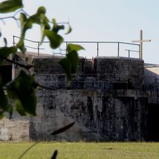
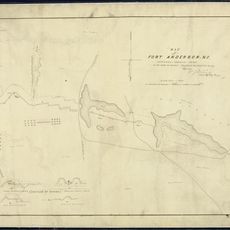
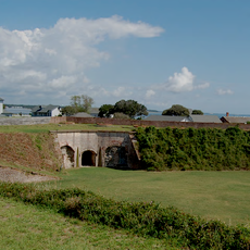
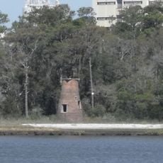
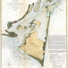
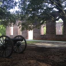
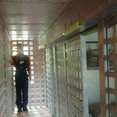
Fort Fisher is a series of earthwork defenses along the Cape Fear River and the Atlantic coastline that protected the harbor of Wilmington during the 1860s. The fortification forms an L-shaped defensive line with underground chambers, gun positions, and sheltered spaces for ammunition and troops.

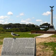
The fortification was built in the early 1860s and captured in January 1865 after a massive naval bombardment. Its loss closed the final Confederate supply route by sea.

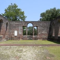
The site includes a museum displaying Civil War artifacts, military equipment, and detailed exhibits about the daily operations of Confederate soldiers at the fort.

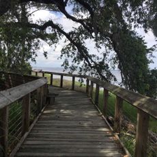
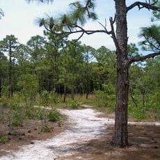
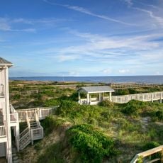
The site is open Tuesday through Saturday from 9 AM to 5 PM with no admission charge, and visitors can walk along the preserved earthworks, explore underground rooms, and view restored gun positions. A museum displays military equipment and daily life items from the Civil War period.

The fortification is named after Colonel Charles Fisher, who died at the Battle of First Manassas in July 1861. His death gave the still-under-construction defense its final name.

Location: Wilmington

Inception: 1861

Website: https://historicsites.nc.gov/all-sites/fort-fisher

GPS coordinates: 33.97170,-77.91940

Latest update: December 17, 2025 10:25

Photos
Around this place
Orton Plantation
United States of America

Orton Plantation

10.2 km
Bald Head Light
United States of America

Bald Head Light

13.2 km
Brunswick Town
United States of America

Brunswick Town

8 km
Oak Island Light
United States of America

Oak Island Light

13.8 km
North Carolina Baptist Assembly
United States of America

North Carolina Baptist Assembly

12.8 km
Fort Johnston
United States of America

Fort Johnston

10.8 km
Fort Anderson
United States of America

Fort Anderson

8 km
Carolina Beach State Park
United States of America

Carolina Beach State Park

8.8 km
Fort Caswell Historic District
United States of America

Fort Caswell Historic District

13.5 km
Fort Fisher State Recreation Area
United States of America

Fort Fisher State Recreation Area

2.2 km
St. Philip's Church, Brunswick Town
United States of America

St. Philip's Church, Brunswick Town

8.1 km
Cape Fear Light
United States of America

Cape Fear Light

13.8 km
Price Creek Light
United States of America

Price Creek Light

7.6 km
Tregembo Animal Park
United States of America

Tregembo Animal Park

17.3 km
G. V. Barbee Bridge
United States of America

G. V. Barbee Bridge

15.2 km
Corncake Inlet, North Carolina
United States of America

Corncake Inlet, North Carolina

6.3 km
Brunswick Town Historic District
United States of America

Brunswick Town Historic District

8 km
Swain's Cut Bridge
United States of America

Swain's Cut Bridge

22.7 km
Brunswick County Courthouse
United States of America

Brunswick County Courthouse

10.8 km
Joy Lee Apartment Building and Annex
United States of America

Joy Lee Apartment Building and Annex

7.7 km
Hatch Auditorium
United States of America

Hatch Auditorium

12.7 km
Southport Historic District
United States of America

Southport Historic District

11 km
Bald Head Creek Boathouse
United States of America

Bald Head Creek Boathouse

13.8 km
Brunswick Town/Fort Anderson State Historic Site
United States of America

Brunswick Town/Fort Anderson State Historic Site

8 km
Old Brunswick County Jail
United States of America

Old Brunswick County Jail

10.6 km
Fort Fisher State Historic Site
United States of America

Fort Fisher State Historic Site

226 m
Caswell Beach
United States of America

Caswell Beach

14.8 km
Masonboro Island Reserve
United States of America

Masonboro Island Reserve

17.9 km
Show the full map
Reviews

Visited this place? Tap the stars to rate it and share your experience / photos with the community! Try now! You can cancel it anytime.

« Fort Fisher - Civil War fort near Wilmington, United States » is provided by Around Us (aroundus.com). Images and texts are derived from Wikimedia project under a Creative Commons license. You are allowed to copy, distribute, and modify copies of this page, under the conditions set by the license, as long as this note is clearly visible.

Discover hidden gems everywhere you go!

From secret cafés to breathtaking viewpoints, skip the crowded tourist spots and find places that match your style. Our app makes it easy with voice search, smart filtering, route optimization, and insider tips from travelers worldwide. Download now for the complete mobile experience.

Around Us App Screenshot

A unique approach to discovering new places

Le Figaro

All the places worth exploring

France Info

A tailor-made excursion in just a few clicks

20 Minutes