Enable Location

We need your location to show you interesting places around you

Discover nearby places

Find interesting locations and hidden gems around you

Precise directions

Get accurate directions and distances to places

Your location is never shared with other users. It's only used when you tap the location button.

Carolina Beach State Park

Log in to your account

Start exploring — it's free

Trusted by 64,552 travelers worldwide

Continue with Google
Continue with Apple
or

We will send you a code to connect

By continuing, you accept our Terms and Conditions and our Privacy Policy

Check your inbox

We've sent a pincode in your inbox. Please enter the code below.

Carolina Beach State Park
Discussion Reviews 1 Photos
5.5k Popularity

Carolina Beach State Park, State park in Carolina Beach, North Carolina.

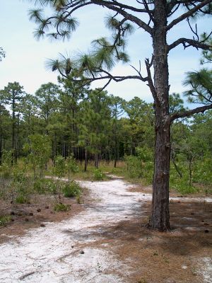
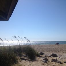
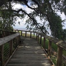
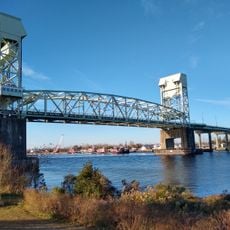
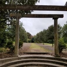
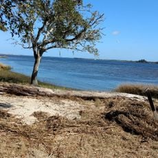
Carolina Beach State Park is a protected area in North Carolina, located where the Cape Fear River meets the Intracoastal Waterway, with maritime forests, hiking trails, and a marina. The land covers a mix of sandy soil, wetlands, and wooded sections that reach down to the water's edge.

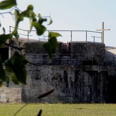
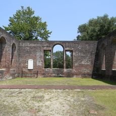
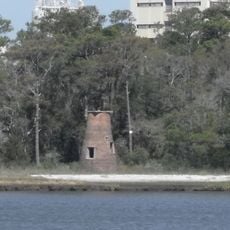
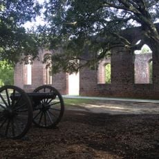
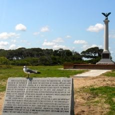
The area was once home to the Cape Fear Indians, who lived there until around 1725 and left behind pottery fragments and oyster shell mounds. During the Civil War, Confederate forces used the site as a defensive position near Fort Fisher.

The park is one of the few places in the world where Venus flytraps grow in the wild, and visitors can spot them up close along the trails. The plants thrive in the wet, nutrient-poor soils found here, making this area a draw for anyone interested in unusual plant life.

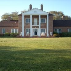
The park has trails for different fitness levels, camping areas, and fishing spots at the marina, so it works well for a half-day or full-day visit. The visitor center near the entrance is a good first stop to get a map and plan which areas to explore.

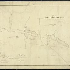
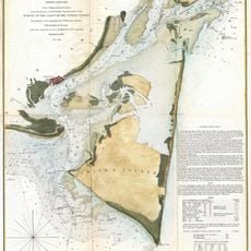
The Sugarloaf dune inside the park appeared on navigation charts as early as 1738, serving as a landmark for sailors long before the land became a protected area. It is still visible today and can be reached on foot along one of the trails.

The community of curious travelers

AroundUs brings together thousands of curated places, local tips, and hidden gems, enriched daily by 60,000 contributors worldwide.

Start exploring
Location
Inception
1969
GPS coordinates
34.05000,-77.91000
Latest update
March 3, 2026 10:08
Around this place
Fort Fisher
United States of America

Fort Fisher

8.8 km
Orton Plantation
United States of America

Orton Plantation

3.6 km
Brunswick Town
United States of America

Brunswick Town

3.6 km
Cape Fear Memorial Bridge
United States of America

Cape Fear Memorial Bridge

20.2 km
North Carolina Baptist Assembly
United States of America

North Carolina Baptist Assembly

20.3 km
Fort Johnston
United States of America

Fort Johnston

17.7 km
Fort Anderson
United States of America

Fort Anderson

3.5 km
Fort Fisher State Recreation Area
United States of America

Fort Fisher State Recreation Area

10.8 km
St. Mary Catholic Church
United States of America

St. Mary Catholic Church

20.5 km
St. Philip's Church, Brunswick Town
United States of America

St. Philip's Church, Brunswick Town

3.5 km
Price Creek Light
United States of America

Price Creek Light

14.7 km
Airlie Gardens
United States of America

Airlie Gardens

19.9 km
Cameron Art Museum
United States of America

Cameron Art Museum

14.9 km
Sunset Park Historic District
United States of America

Sunset Park Historic District

17.4 km
Corncake Inlet, North Carolina
United States of America

Corncake Inlet, North Carolina

14.9 km
Brunswick Town Historic District
United States of America

Brunswick Town Historic District

3.4 km
Brunswick County Courthouse
United States of America

Brunswick County Courthouse

17.7 km
Joy Lee Apartment Building and Annex
United States of America

Joy Lee Apartment Building and Annex

2.2 km
Mount Lebanon Chapel and Cemetery
United States of America

Mount Lebanon Chapel and Cemetery

19.8 km
Bradley-Latimer Summer House
United States of America

Bradley-Latimer Summer House

19.8 km
Hatch Auditorium
United States of America

Hatch Auditorium

20.2 km
Southport Historic District
United States of America

Southport Historic District

17.8 km
Gabriel's Landing
United States of America

Gabriel's Landing

19.9 km
Delgrado School
United States of America

Delgrado School

20 km
Brunswick Town/Fort Anderson State Historic Site
United States of America

Brunswick Town/Fort Anderson State Historic Site

3.5 km
Westbrook–Ardmore Historic District
United States of America

Westbrook–Ardmore Historic District

20.3 km
Old Brunswick County Jail
United States of America

Old Brunswick County Jail

17.4 km
Fort Fisher State Historic Site
United States of America

Fort Fisher State Historic Site

8.9 km
Show the full map
Reviews
Share your experience

No review yet

Discussions
Start a discussion...

No discussion yet

« Carolina Beach State Park - State park in Carolina Beach, North Carolina » is provided by Around Us (aroundus.com). Images and texts are derived from Wikimedia project under a Creative Commons license. You are allowed to copy, distribute, and modify copies of this page, under the conditions set by the license, as long as this note is clearly visible.

Discover hidden gems everywhere you go!

From secret cafés to breathtaking viewpoints, skip the crowded tourist spots and find places that match your style. Our app makes it easy with voice search, smart filtering, route optimization, and insider tips from travelers worldwide. Download now for the complete mobile experience.

Around Us App Screenshot

A unique approach to discovering new places

Le Figaro

All the places worth exploring

France Info

A tailor-made excursion in just a few clicks

20 Minutes

Around Us
Travel Guide & Maps
Download

Send to your phone

QR Code
1

Open the camera app on your mobile.

2

Point at the QR code with your camera. A notification will appear.

3

Tap the notification to open the link.