Corncake Inlet, North Carolina

Log in to your account

AroundUs is a community-driven map of interesting places, built by curious explorers like you. It grows with every review, story, and photo you share.
Connect to save your favorite spots, contribute locations, and create personalized routes.
Continue with Google
Continue with Apple
Continue with X
Continue with Facebook
Continue with email
By continuing, you accept our Terms and Conditions and our Privacy Policy
Create an account

Corncake Inlet, North Carolina

Add to collection
Map
Suggest a change
Share

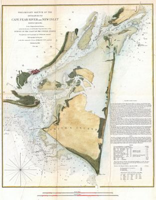
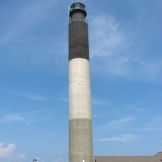
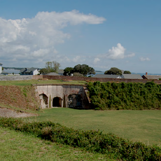
Corncake Inlet, North Carolina, Historical inlet in Brunswick County, North Carolina.

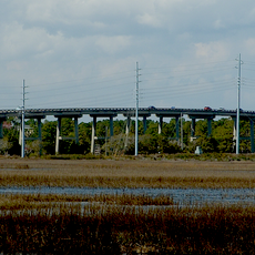
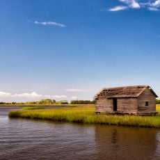
Corncake Inlet is a natural waterway in Brunswick County that channels water from the Cape Fear region toward the Atlantic Ocean. This narrow passage cuts through coastal terrain and forms a distinct separation between land masses in the area.

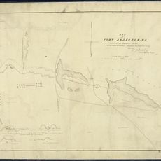
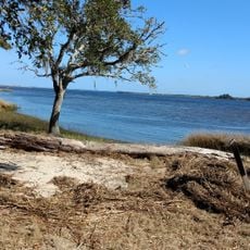
The inlet appeared in records starting in the 1930s as an active waterway serving the coastal region. Major hurricanes in the 1990s reshaped its structure and ultimately transformed it into a closed channel.

Native American tribes utilized this waterway for fishing activities and transportation routes before European settlers arrived in the region.

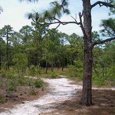
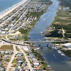
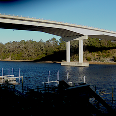
The location sits near several coastal towns and can be accessed from nearby communities. Keep in mind that water conditions here are shallow and changeable, reflecting its current status as a sediment-filled channel.

The water here filled with sand and vanished suddenly in the late 1990s rather than closing gradually over decades. A single tropical storm accelerated this process dramatically, revealing how quickly coastal features can disappear.

GPS coordinates: 33.91906,-77.94443

Latest update: December 14, 2025 14:45

Photos
Around this place
Fort Fisher
United States of America

Fort Fisher

6.3 km
Orton Plantation
United States of America

Orton Plantation

15.8 km
Bald Head Light
United States of America

Bald Head Light

7.2 km
Brunswick Town
United States of America

Brunswick Town

13.4 km
Oak Island Light
United States of America

Oak Island Light

8.9 km
North Carolina Baptist Assembly
United States of America

North Carolina Baptist Assembly

7.6 km
Fort Johnston
United States of America

Fort Johnston

6.8 km
Fort Anderson
United States of America

Fort Anderson

13.5 km
Carolina Beach State Park
United States of America

Carolina Beach State Park

14.9 km
Fort Caswell Historic District
United States of America

Fort Caswell Historic District

8.3 km
Fort Fisher State Recreation Area
United States of America

Fort Fisher State Recreation Area

4.1 km
St. Philip's Church, Brunswick Town
United States of America

St. Philip's Church, Brunswick Town

13.6 km
Cape Fear Light
United States of America

Cape Fear Light

8.9 km
Price Creek Light
United States of America

Price Creek Light

4.6 km
Holden Beach Bridge
United States of America

Holden Beach Bridge

29.8 km
Cameron Art Museum
United States of America

Cameron Art Museum

29.6 km
G. V. Barbee Bridge
United States of America

G. V. Barbee Bridge

11.8 km
New Hope Presbyterian Church
United States of America

New Hope Presbyterian Church

29 km
Brunswick Town Historic District
United States of America

Brunswick Town Historic District

13.6 km
Swain's Cut Bridge
United States of America

Swain's Cut Bridge

19.9 km
Brunswick County Courthouse
United States of America

Brunswick County Courthouse

6.8 km
Joy Lee Apartment Building and Annex
United States of America

Joy Lee Apartment Building and Annex

14 km
Hatch Auditorium
United States of America

Hatch Auditorium

7.4 km
Southport Historic District
United States of America

Southport Historic District

7 km
Bald Head Creek Boathouse
United States of America

Bald Head Creek Boathouse

7.5 km
Brunswick Town/Fort Anderson State Historic Site
United States of America

Brunswick Town/Fort Anderson State Historic Site

13.5 km
Old Brunswick County Jail
United States of America

Old Brunswick County Jail

6.6 km
Fort Fisher State Historic Site
United States of America

Fort Fisher State Historic Site

6.2 km
Show the full map
Reviews

Visited this place? Tap the stars to rate it and share your experience / photos with the community! Try now! You can cancel it anytime.

« Corncake Inlet, North Carolina - Historical inlet in Brunswick County, North Carolina » is provided by Around Us (aroundus.com). Images and texts are derived from Wikimedia project under a Creative Commons license. You are allowed to copy, distribute, and modify copies of this page, under the conditions set by the license, as long as this note is clearly visible.

Discover hidden gems everywhere you go!

From secret cafés to breathtaking viewpoints, skip the crowded tourist spots and find places that match your style. Our app makes it easy with voice search, smart filtering, route optimization, and insider tips from travelers worldwide. Download now for the complete mobile experience.

Around Us App Screenshot

A unique approach to discovering new places

Le Figaro

All the places worth exploring

France Info

A tailor-made excursion in just a few clicks

20 Minutes