Enable Location

We need your location to show you interesting places around you

Discover nearby places

Find interesting locations and hidden gems around you

Precise directions

Get accurate directions and distances to places

Your location is never shared with other users. It's only used when you tap the location button.

Cape Fear Light

Log in to your account

Start exploring — it's free

Trusted by 64,548 travelers worldwide

Continue with Google
Continue with Apple
or

We will send you a code to connect

By continuing, you accept our Terms and Conditions and our Privacy Policy

Check your inbox

We've sent a pincode in your inbox. Please enter the code below.

Discussion Reviews 1 Photos
4.1k Popularity

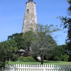
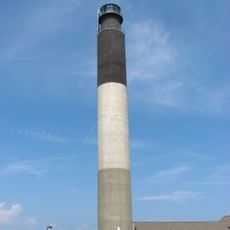
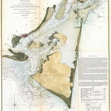
Cape Fear Light, Historic lighthouse on Bald Head Island, United States

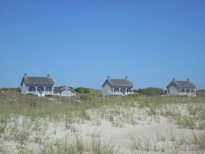
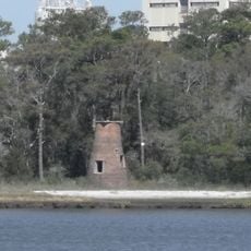
Cape Fear Light is a lighthouse on Bald Head Island, North Carolina, painted with black and white spiral bands that make it easy to spot from a distance. The site also includes three keepers' houses and a storage building, all part of the same historic complex.

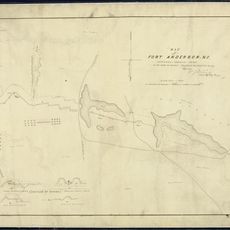
The tower was built in 1903 to replace an earlier lighthouse that had proven inadequate for guiding ships through the treacherous shoals off the North Carolina coast. It operated for about 55 years before being decommissioned in 1958, when modern navigation technology made it less necessary.

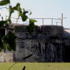
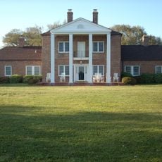
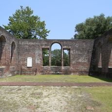
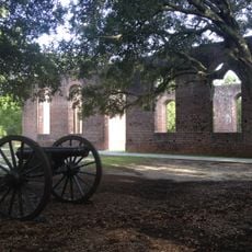
The keepers' houses that still stand near the tower give a sense of what daily life looked like for the families who lived here year-round. The site is woven into the identity of Bald Head Island, where it remains one of the few visible traces of the island's working past.

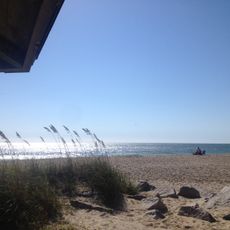
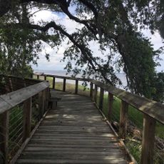
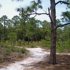
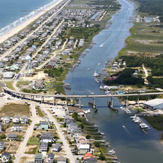
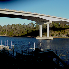
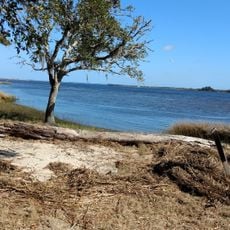
Bald Head Island is only reachable by ferry, so planning the crossing is a key part of the visit. Once on the island, no cars are allowed, so expect to walk or rent a golf cart to reach the lighthouse from the dock.

After the lighthouse was shut down, its French-made Fresnel lens was taken apart and sold piece by piece to an antique dealer, which is a rare fate for a navigation instrument of that kind. The lens was never reassembled, so no complete version of it exists today.

The community of curious travelers

AroundUs brings together thousands of curated places, local tips, and hidden gems, enriched daily by 60,000 contributors worldwide.

Start exploring
Location
Inception
1903
GPS coordinates
33.89270,-78.03480
Latest update
March 3, 2026 10:05
Around this place
Fort Fisher
United States of America

Fort Fisher

13.8 km
Orton Plantation
United States of America

Orton Plantation

20.4 km
Bald Head Light
United States of America

Bald Head Light

3.8 km
Brunswick Town
United States of America

Brunswick Town

18.3 km
Oak Island Light
United States of America

Oak Island Light

29 m
North Carolina Baptist Assembly
United States of America

North Carolina Baptist Assembly

1.3 km
Fort Johnston
United States of America

Fort Johnston

3.3 km
Fort Anderson
United States of America

Fort Anderson

18.3 km
Carolina Beach State Park
United States of America

Carolina Beach State Park

21 km
Fort Caswell Historic District
United States of America

Fort Caswell Historic District

648 m
Fort Fisher State Recreation Area
United States of America

Fort Fisher State Recreation Area

11.9 km
St. Philip's Church, Brunswick Town
United States of America

St. Philip's Church, Brunswick Town

18.4 km
Price Creek Light
United States of America

Price Creek Light

6.4 km
Holden Beach Bridge
United States of America

Holden Beach Bridge

21.7 km
Cameron Art Museum
United States of America

Cameron Art Museum

34.3 km
G. V. Barbee Bridge
United States of America

G. V. Barbee Bridge

4.8 km
New Hope Presbyterian Church
United States of America

New Hope Presbyterian Church

28.2 km
Corncake Inlet, North Carolina
United States of America

Corncake Inlet, North Carolina

8.9 km
Brunswick Town Historic District
United States of America

Brunswick Town Historic District

18.5 km
Swain's Cut Bridge
United States of America

Swain's Cut Bridge

12.1 km
Brunswick County Courthouse
United States of America

Brunswick County Courthouse

3.3 km
Joy Lee Apartment Building and Annex
United States of America

Joy Lee Apartment Building and Annex

20.8 km
Southport Historic District
United States of America

Southport Historic District

3.2 km
Hatch Auditorium
United States of America

Hatch Auditorium

1.5 km
Bald Head Creek Boathouse
United States of America

Bald Head Creek Boathouse

5.7 km
Brunswick Town/Fort Anderson State Historic Site
United States of America

Brunswick Town/Fort Anderson State Historic Site

18.4 km
Old Brunswick County Jail
United States of America

Old Brunswick County Jail

3.6 km
Fort Fisher State Historic Site
United States of America

Fort Fisher State Historic Site

13.8 km
Show the full map
Reviews
Share your experience

No review yet

Discussions
Start a discussion...

No discussion yet

« Cape Fear Light - Historic lighthouse on Bald Head Island, United States » is provided by Around Us (aroundus.com). Images and texts are derived from Wikimedia project under a Creative Commons license. You are allowed to copy, distribute, and modify copies of this page, under the conditions set by the license, as long as this note is clearly visible.

Discover hidden gems everywhere you go!

From secret cafés to breathtaking viewpoints, skip the crowded tourist spots and find places that match your style. Our app makes it easy with voice search, smart filtering, route optimization, and insider tips from travelers worldwide. Download now for the complete mobile experience.

Around Us App Screenshot

A unique approach to discovering new places

Le Figaro

All the places worth exploring

France Info

A tailor-made excursion in just a few clicks

20 Minutes

Around Us
Travel Guide & Maps
Download

Send to your phone

QR Code
1

Open the camera app on your mobile.

2

Point at the QR code with your camera. A notification will appear.

3

Tap the notification to open the link.