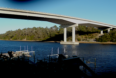
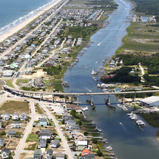
Swain's Cut Bridge, Road bridge over Intracoastal Waterway in Oak Island, North Carolina, United States
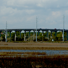
Swain's Cut Bridge is a four-lane concrete structure that spans the Atlantic Intracoastal Waterway in Oak Island, North Carolina. The bridge rises approximately 65 feet above the water and extends roughly 980 feet to connect the island with the mainland.
The bridge was constructed by the North Carolina Department of Transportation and opened to public use in 2010. It was built as part of the island's efforts to improve infrastructure and provide better connections to the mainland.
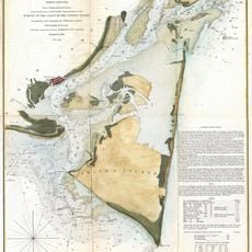
The bridge takes its name from the Swain family, who owned land in the area when the Intracoastal Waterway was developed in the 1930s. Today, the structure stands as a reminder of the families whose property shaped the island's development.
As a second crossing to the island, this bridge provides an important route for daily traffic and storm evacuation routes. The wide four-lane roadway allows for reasonably smooth traffic flow, particularly during off-peak hours.
The bridge serves as a critical evacuation route during hurricanes, making it an essential safety feature beyond everyday traffic. Its elevated roadway was specifically designed to remain passable even under extreme weather conditions.
The community of curious travelers
AroundUs brings together thousands of curated places, local tips, and hidden gems, enriched daily by 60,000 contributors worldwide.